Thanks for the update Stitcher. That's a pity, although it was expected I suppose. Didn't look like there was too much left of it after the fire. Viv.
-
Welcome to this forum . We are a worldwide group with a common interest in Birmingham and its history. While here, please follow a few simple rules. We ask that you respect other members, thank those who have helped you and please keep your contributions on-topic with the thread.
We do hope you enjoy your visit. BHF Admin Team
You are using an out of date browser. It may not display this or other websites correctly.
You should upgrade or use an alternative browser.
You should upgrade or use an alternative browser.
S
Stitcher
Guest

The Emily Arms, Dimoke Street.
The Great Western Yardley road has reopened, The outside has been spruced up a bit, not sure about the inside though.
thats good news rob..makes a change from hearing about our pubs closing down
lyn
S
Stitcher
Guest

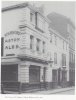
Is this The Dog and Partridge that was in Selly Oak.
Selly Oak boy.
knowlegable brummie
View attachment 120661
Is this The Dog and Partridge that was in Selly Oak.
It certainly is . Errrr I meant certainly WAS.
S
Stitcher
Guest

Barr_Beacon
The Prodigal Brummie

The Emily Arms was situated on Emily Street (corner of Emily St and Dymoke St). The original Victorian pub was demolished and replaced with a new pub of the same name. Later known as The Hideout, it is now in use as an Islamic centre.
Dennis Williams
Gone but not forgotten
Here are a few TAVERN oldies from the 1700s , and if you like I can spill what bit is recorded about some of them.....or are they too old to bother? Of course if anyone else has anything, especially any drawings or old prints of any them, it would be interesting....?

Dennis Williams
Gone but not forgotten

Barr_Beacon
The Prodigal Brummie
Thanks so much for that Phil. In the photograph I found of The Hideout, the observer is looking 'up hill' where as the view of The Emily Arms is looking 'down hill'. The photograph explains this much better...


Superb old picture. Hope you guys and girls don't mind me asking here, does anyone who used the Victoria pub in Bordesley Green remember Lena and her daughter Caroline who ran it ? What has become of Lena does anyone know?View attachment 118584
In 1899 the Ring-o Bells was in Church Road Yardley and the Licensee was a Benjamin Spittle.
S
Stitcher
Guest

Is this The Norton on Kingsbury/Tyburn Road where Alde is now?
looks like it to me mort....frothy will be able to say for certain
lyn
S
Stitcher
Guest

S
Stitcher
Guest

The Tyburn House.
oldMohawk
gone but not forgotten
I had posted a photo of the Birmingham Arms, Bradford Street, in the thread quoted below and it probably deserves a place in this thread. Moat Row on the right, Sherlock Street East on the left.

linked forum pic only visible if logged in
The Birmingham Arms in Bradford Street date 1968
linked forum pic only visible if logged in
Last edited:
S
Stitcher
Guest

I was going to post a postcard with exactly the some picture as this but it is in a sorry state so I posted this one instead.
Pedrocut
Master Barmmie
View attachment 121365
I was going to post a postcard with exactly the some picture as this but it is in a sorry state so I posted this one instead.
Maybe the remains of a toll gate, bottom right?
Radiorails
master brummie
Or a hand pump?

Looks like a gate on hinges to me opening onto the road. So as Pedro suggests, possibly something connected to a toll gate. Great photo. Lovely rural scene.
Viv.
Viv.
Pedrocut
Master Barmmie

View attachment 121365
I was going to post a postcard with exactly the some picture as this but it is in a sorry state so I posted this one instead.
The caption says Heath Road, but should be Washwood Heath Road.
Really speaking it should say the corner of Bromford Lane and Washwood Heath Road?
1916 published map
Pedrocut
Master Barmmie
Picture from 2005, the pub must have been rebuilt since the 1905 photo.
https://freepages.family.rootsweb.ancestry.com/~stanier/images/views/FoxandGoose2005.jpg
https://freepages.family.rootsweb.ancestry.com/~stanier/images/views/FoxandGoose2005.jpg
What's 'M P' to the left of the F&G pub on Pedro's map ? Does it give us any clues in relation to the gate ? Viv.


Radiorails
master brummie
How far away from the F & G Ward End were the lands mentioned near the toll gates at Castle Bromwich?