-
Welcome to this forum . We are a worldwide group with a common interest in Birmingham and its history. While here, please follow a few simple rules. We ask that you respect other members, thank those who have helped you and please keep your contributions on-topic with the thread.
We do hope you enjoy your visit. BHF Admin Team
You are using an out of date browser. It may not display this or other websites correctly.
You should upgrade or use an alternative browser.
You should upgrade or use an alternative browser.
OLD AND NEW PHOTOGRAPHS
- Thread starter Astoness
- Start date
SteveBhx
master brummie
Rather dark and dingy picture - two storey building with a single storey extension, wrapped around the corner here. couple of nice vans and a winters day as there are no leaves. Some quiet distinctive building to get your bearings from.
EDIT From Mike Jee I can see on the fascia "& Butlers". Must be an M&B pub
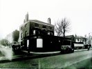
EDIT From Mike Jee I can see on the fascia "& Butlers". Must be an M&B pub

Last edited:
SteveBhx
master brummie
On the corner of Guilford Street and.... classic white / cream tiled Ansells pub. Painted signs on the walls and a nice angled corner line of windows with angled window tops too. Nice street lamp, and the street going away from you.
EDIT: From Mike Jee : junction Gerrard St, so must be Weymouth Arms
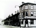
EDIT: From Mike Jee : junction Gerrard St, so must be Weymouth Arms

Last edited:
SteveBhx
master brummie
another property for you to work out where it is. Corner pub but with no visible name of brewer. Motorbike and sidecar to the left . Rather distictive pub, stone/ tile downstairs and red brick up, narrow sash windows and a pediment around the roof, and a coupole of grand chimney stacks. Further up the road are a few buildings with bay windows upstairs. another nice street lamp and are we on a bridge up the road?


I can see on the fascia "& Butlers". Must be an M&B pubRather dark and dingy picture - two storey building with a single storey extension, wrapped around the corner here. couple of nice vans and a winters day as there are no leaves. Some quiet distinctive building to get your bearings from.
View attachment 184416
SteveBhx
master brummie
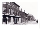
Last one for the moment, a few shops and pub on the left , one a record shop and then a line of house , they have an interesting layout, ground floor has a small window and a front door first floor is one large window and top floor is two small small windows, this then varies as you have door alley door so there is a window or two above the alleyway . Heading up the road is an Ansells pub with its hanging advert and at the top of the road a very fine railway bridge.
EDIT : From Astoness lichfield road?

EDIT : From Astoness lichfield road?

Last edited:
This photo shows the same pub and says it is junction Gerrard St, so must be Weymouth ArmsOn the corner of Guilford Street and.... classic white / cream tiled Ansells pub. Painted signs on the walls and a nice angled corner line of windows with angled window tops too. Nice street lamp, and the street going away from you.
View attachment 184417
Last edited:
Radiorails
master brummie
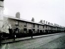
This looks like an Inner Circle 8 bus route with the bus stop and more importantly the Bundy clock.Back with a few more , here is a few rows of terrace houses, " cafe" curtains in the windows , olde style bus stop with litter bin attached Bundee clock too. Nice tidy street with brick paving.
View attachment 184415
Looks like a bridge just behind car on the right with a slight rise in the roadanother property for you to work out where it is. Corner pub but with no visible name of brewer. Motorbike and sidecar to the left . Rather distictive pub, stone/ tile downstairs and red brick up, narrow sash windows and a pediment around the roof, and a coupole of grand chimney stacks. Further up the road are a few buildings with bay windows upstairs. another nice street lamp and are we on a bridge up the road?
View attachment 184418
just wondering if this is on the lichfield roadLast one for the moment, a few shops and pub on the left , one a record shop and then a line of house , they have an interesting layout, ground floor has a small window and a front door first floor is one large window and top floor is two small small windows, this then varies as you have door alley door so there is a window or two above the alleyway . Heading up the road is an Ansells pub with its hanging advert and at the top of the road a very fine railway bridge.
View attachment 184419
lyn
Google Maps
Find local businesses, view maps and get driving directions in Google Maps.
 www.google.com
Richard Dye
master brummie
Maybe close to Victoria Rd, six ways area?just wondering if this is on the lichfield road
lyn
SteveBhx
master brummie
SteveBhx
master brummie
A different view of the a property, and some the mirror image of the properties, central alley , with a door either side and three storeys. Left hand property seems to have a small fenced off area and a brick paved " garden". Again metal framed windows with a white washed rear wall.
EDIT: From Astoness - Brearley Street houses
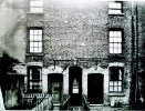
EDIT: From Astoness - Brearley Street houses

Last edited:
SteveBhx
master brummie
oh gosh steve i know both photos but will have to delve deep into the memory box...i think post 734 is a yard in summer lane and 735 could be looking down the entry into brearley st or was it new john st west  pretty sure both are on the forum but would mean going through the threads to try and confirm..will have a go but this could keep me up all night
  edit actually post 734 could also be brearley st
lyn
lyn
yes steve both are of brearley st houses...nice to know my memory is not that badoh gosh steve i know both photos but will have to delve deep into the memory box...i think post 734 is a yard in summer lane and 735 could be looking down the entry into brearley st or was it new john st westpretty sure both are on the forum but would mean going through the threads to try and confirm..will have a go but this could keep me up all night
edit actually post 734 could also be brearley st
lyn
SteveBhx
master brummie
I realise there is a thread for this but for completeness I thought I would post this photo here. ( Feel free to move or I will re post)
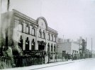
This is Hardings Royal Steam bakery, not sure of the year though, van in the front of the building, and I assume this is the office complex with the factory further down the road? . Nice styling to the building - name in the centre with a large central entrance.
EDIT: From MikeJee 1526 Coventry road

Last edited:
it is a nice building steve..where was it as i wonder if its still there..if you also want to post it on the other thread please doI realise there is a thread for this but for completeness I thought I would post this photo here. ( Feel free to move or I will re post)
This is Hardings Royal Steam bakery, not sure of the year though, van in the front of the building, and I assume this is the office complex with the factory further down the road? . Nice styling to the building - name in the centre with a large central entrance.
View attachment 184438
lyn
SteveBhx
master brummie
From Spargone #16 on the Hardings thread - I assume this is the building refered to :it is a nice building steve..where was it as i wonder if its still there..if you also want to post it on the other thread please do
lyn
Harding's bakery was on the other side of Coventry Road from The Swan pub, where Tesco's is now. The buildings would have been demolished as part of the previous development, the Swan Shopping Centre and the Bakeman House flats. The Tivoli cinema on the Lily Road/Coventry Road corner was demolished at the about the same time. (The replacement centre was 'supposed' to contain a cinema/bowling rink I believe, but never did). Harding's were certainly operating from that site (with small horse-drawn delivery vans) into the mid-1950s.
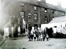
The tallest child seems to be holding a large teddy bear!This is a bit different, moms and children in a court somewhere - clothes line, pegs and a props too. Three storey buildings, metal frames windows and communal facilities with a lamp in the middle.
EDIT: From Astoness - Brearley Street houses
View attachment 184435
Re. the sheepskin booties on the foreground lady, I'd say late fifties, early sixties for this fashion. (I had a pair - they were cosy)I am sure we have seen lots of similar style pictures of the interior of the workshops in the Jewellery Quarter but another will not harm. So much to see, the stamps and the workbenches, the stove with its chimney at the end, and the old stools . There doesn't seem to be much light as the room looks to be illuminated by the flash off the camera. Gentlemen with overalls and the ladies with aprons - and note the zip up boots on the nearest woman
View attachment 183390
Transparency either means (1) the file format allows/has a transparent background or (2) it's alluding to "slides" a.ka. "transparencies" which are the two terms used to refer to describe a semi-transparent positive (ie opposite to a film negative). Jpegs, which is what you commonly want a photo format in does not support transparency. A PNG file does. A photo file can be either JPEG or PNG. It's just that the Jpeg is more common and a smaller byte size. I hope this explains. Too much information?The Gunmakers Arms is 123 Gerrard St.
With regard to the WEPB file, they save showing as jpg/jpeg but will not open in my (rather old) photo program. They can be converted at https://ezgif.com/webp-to-jpg, where the site says that the program: WebP is a relatively new image format with good compression and image quality, but not all web browsers and image viewers support it yet. It apparently shows transparency, though not sure exactly what that means
Attachments
Last edited:
izzy eckerslike
yow've med my day yaw av
All these old photo's take me back to the1960's when all those old streets were still around, it was from around then that the council began a systematic project to destroy everything and replace it with concrete.
See this photo of Little Bow street, just off Bristol street, it looks almost Dickensian and I used to walk up it to my first job in Bow street in 1961. within a few months it was gone forever along with the adjoining Catholic church and school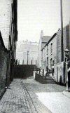
See this photo of Little Bow street, just off Bristol street, it looks almost Dickensian and I used to walk up it to my first job in Bow street in 1961. within a few months it was gone forever along with the adjoining Catholic church and school

SteveBhx
master brummie
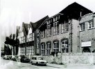
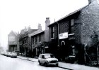
Last few from this roll , fine selection of building styles, shapes and sizes, random striped post on the pavement and a mini van at the front, some houses , and a few industrial buildings. Building at the end of the road looks interesting with the large window at first floor and a large entrance on the ground floor
EDIT: Just found another photo of the same image so have replaced the original as this one is better. It also had a date and description - 27th February 1968
EDIT, having found the new image I found a new description which follows Mikejee's words:
33 Farm St, which looks as if it would fit. The building at the end would be Farm St primary school. This does seem to fit from the map, and the building on the left would be Farm St Primary School.

Last edited:
SteveBhx
master brummie
Firstly apologies for the shading / shadow on the bottom of the picture ,
A fine church which if you know the area someone will recognise, little eaves down the side, clerestory roof ( little windows below the main roof) and a fine tall tower. There is also some fine patterned tile and brickwork on the church.
EDIT: Carolina confirmed Church of St Saviour, Villa Street
EDIT 2: Just found another photo of the same image so have replaced the original as this one is better.

Last edited:
I have two addresses for K N & S supplies, in Avenue Road on the south side between Aston Road North and Chester St, which does not seem to fit with the photo, and 33 Farm St, which looks as if it would fit. The building at the end would be Farm St primary school. This does seem to fit from the map, and the building on the left would be Farm St Primary School. No doubt someone could confirm , or otherwise.Last few from this roll , fine selection of building styles, shapes and sizes, random striped post on the pavement and a mini van at the front, some houses , and a few industrial buildings. Building at the end of the road looks interesting with the large window at first floor and a large entrance on the ground floor
View attachment 184458


