-
Welcome to this forum . We are a worldwide group with a common interest in Birmingham and its history. While here, please follow a few simple rules. We ask that you respect other members, thank those who have helped you and please keep your contributions on-topic with the thread.
We do hope you enjoy your visit. BHF Admin Team
You are using an out of date browser. It may not display this or other websites correctly.
You should upgrade or use an alternative browser.
You should upgrade or use an alternative browser.
OLD AND NEW PHOTOGRAPHS
- Thread starter Astoness
- Start date
SteveBhx
master brummie
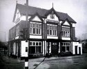
Last few on this roll, first The Erdington Arms , Gravelly Hill and Slade Road, taken in March 1969, nice symmetrical building on the front although the left hand side seems to have a few arches on the first floor, love the plasterwork on the two eaves and the little window in what we presume is the attic. not sure on the specific of the location - I presume its under Spaghetti Junction or nearby?

SteveBhx
master brummie
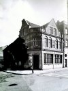
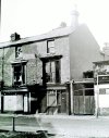
We now have the Lyttleton Arms on Balsall Heath Road 13th April 1969, looking rather run down, next door has broken windows, not sure about the roof line of the building and I cannot work out if it is still in use. A rather tired bay on the first floor and sash windows on the second. Next door has some rather industrial gates to the access way
Steve I added a comment which you may have missed about date of closing the pub
EDIT From Rob T:
Pub closed 13th April 1969 (same date it says this photo was taken).
Kind regards
RobT

Steve I added a comment which you may have missed about date of closing the pub
EDIT From Rob T:
In the book Time Please! A look back at Birmingham's Pubs by Andrew Maxam, it saysThe Lyttleton Arms was listed as 173 Balsall Heath Road in 1967/68 Kelly's, no mention in the 1972/73 Kelly's
Pub closed 13th April 1969 (same date it says this photo was taken).
Kind regards
RobT
Last edited:
only from memory think the pub was at the bottom end of slade road steve near to where they built the armada pub..think that was the name of it..near spag junction...we have discussed this pub before but need to find the thread its onLast few on this roll, first The Erdington Arms , Gravelly Hill and Slade Road, taken in March 1969, nice symmetrical building on the front although the left hand side seems to have a few arches on the first floor, love the plasterwork on the two eaves and the little window in what we presume is the attic. not sure on the specific of the location - I presume its under Spaghetti Junction or nearby?
View attachment 185752
lyn
SteveBhx
master brummie
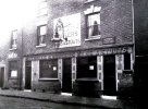
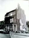
Last one on this roll ( thank goodness  ) we have The Ivy Green, corner of Sandpits Parade and Edward Street, looking like it has had a last minute reprieve as the buildings either side have been demolished. Interesting to see the shadow of the roofline and the holes where the floor joists used to sit. Interesting opening (?) on the top floor between the windows central bay window on the first floor and the offset pub name too.

Last edited:
RobT
Acemeccanoman
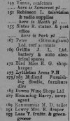
We now have the Lyttleton Arms on Balsall Heath Road 13th April 1969, looking rather run down, next door has broken windows, not sure about the roof line of the building and I cannot work out if it is still in use. A rather tired bay on the first floor and sash windows on the second. Next door has some rather industrial gates to the access way
View attachment 185753
In the book Time Please! A look back at Birmingham's Pubs by Andrew Maxam, it saysThe Lyttleton Arms was listed as 173 Balsall Heath Road in 1967/68 Kelly's, no mention in the 1972/73 Kelly's
Pub closed 13th April 1969 (same date it says this photo was taken).
Last edited:
SteveBhx
master brummie
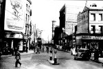
Roll 62 and something different , first to start back to 1959, and I am informed this is Old Steelhouse Lane from the top of Old Snow Hill and Colmore Row, not sure if that is strictly correct and they have added "Old" to everything. Freeman Hardy and Willis on the right , with a Police man directing traffic, a tram is moving away from us. Turret on the right and a large carpet sign on the side wall. Lot of street scene and a great picture to study.
EDIT: forgot to check- same picture? https://birminghamhistory.co.uk/forum/index.php?threads/steelhouse-lane.18311/post-482952
EDIT: forgot to check- same picture? https://birminghamhistory.co.uk/forum/index.php?threads/steelhouse-lane.18311/post-482952

Last edited:
Radiorails
master brummie
1959 is an incorrect date for this photo. It has to be be 1953, or earlier, as the trams were replaced buy buses at that date. Actually It appears to be 1947 or 1948 to me.
Last edited:
Brummie a long time ago
master brummie
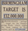
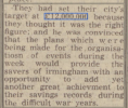
Can't quite make out what it is for, but look at that target amount above Harrisons on the left. £12,000,000 ! That was a lot of money back then, (it is now too). Worth about £450,000,000 in today's tokens.
Andrew.
Andrew.
pjmburns
master brummie
does anyone know what building the turret on the right is please...Roll 62 and something different , first to start back to 1959, and I am informed this is Old Steelhouse Lane from the top of Old Snow Hill and Colmore Row, not sure if that is strictly correct and they have added "Old" to everything. Freeman Hardy and Willis on the right , with a Police man directing traffic, a tram is moving away from us. Turret on the right and a large carpet sign on the side wall. Lot of street scene and a great picture to study.
EDIT: forgot to check- same picture? https://birminghamhistory.co.uk/forum/index.php?threads/steelhouse-lane.18311/post-482952
View attachment 185757
lyn
MWS
from Bham
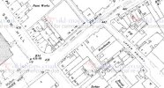
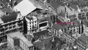
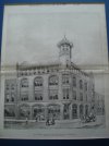
Sorry, changed my mind, I thinks it's no. 11 on the opposite corner, listed as Pickford's. Photo shows the tower here...
sorry mark i cant work out where the tower is..any chance you could mark it out pleaseSorry, changed my mind, I thinks it's no. 11 on the opposite corner, listed as Pickford's. Photo shows the tower here...
thanks
lyn
thanks mark...got it i hate losing me bearingsLyn, it's middle left, opposite the Gaumont, the frontage of which is in front of the white sloping roof.
thanks steve....look forward to more photos off you when time permitsHi Lyn, if you follow the link to the old photo there was a similar conversation which gave information and a photo I believe.
lyn
SteveBhx
master brummie
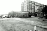
Roll 62 has the one old photo above and a couple of "tours " The first is around the Dunlop site. Fort Dunlop is much changed and makes you wonder if they could not of kept more of the original buildings however its still there in some form. Taken in February 1992 now only the modified building remains everything else has been removed.

SteveBhx
master brummie
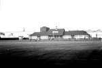
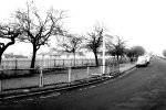
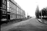
From the picture above I believe we have turned right and followed the railings so we can see the sports ground, this time there is nothing remaining and rather ironically the trees have been removed and new ones planted !!. Fine set of railing and the pavilion in the background , not sure if the grounds were for Dunlop teams or whether teams used it as there base also. I assume the fencing to the road is to direct worker in a particular position and not allow mass random road crossing.

SteveBhx
master brummie
Moving now to the front of the Dunlop building, a distinct lack of people would say that this is a weekend 9th February 1992, massive offices for a global company, four floors a main entrance and all those metal framed windows. Again much of what you can see on the right has been removed. A search on Wiki for Fort Dunlop gives some fascinating facts and a number of records for its replacement.
EDIT: A correction from Mark Tooze :- the pictures are not of the extant Fort Dunlop building by the M6, but of the commercial office block at the top end of the site, more information from Mark below - thanks, appreciated.
EDIT: A correction from Mark Tooze :- the pictures are not of the extant Fort Dunlop building by the M6, but of the commercial office block at the top end of the site, more information from Mark below - thanks, appreciated.

Last edited:
SteveBhx
master brummie
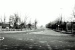
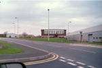
In this image my information says we are looking back along Ashold Farm Road, and while the building have been replaced it does look like the tree all remain - much larger of course. Unfortunately there are not many distinguishing feature but I am sure if you worked in the area you would recognise it.

Mark Tooze
master brummie
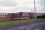
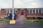
For info - the pictures above are not of the extant Fort Dunlop building by the M6, but of the commercial office block at the top end of the site, which housed the mainframe computer, buying department, etc. This was demolished not long after these photos were taken - I can remember one afternoon when we were working in the computer annexe building next to it, and the demolition men bought down half an entire floor in one go - it was like a bomb had gone off and cracked some of the brickwork on our building.
This is what the computer annexe building looked like shortly before it too was demolished a few years later:-
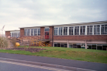
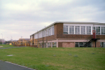
This is what the computer annexe building looked like shortly before it too was demolished a few years later:-


Mark Tooze
master brummie
Here is another view of the Sports and Social Club taken during an internal football kickaround:-We now have a broader view of the Sports Ground and shows how large the changing room and other facilities were and also how large the field were. Again nothing is left of the site and today it is probably home to a warehouse building .
View attachment 185782
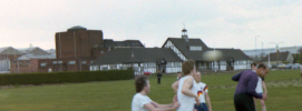
The building behind is the Dunlop Hall - this was a fully equipped theatre with flytower, and also had a cinema projection box.
We made much use of the sports field - here is the Dunlop 10K running event in 1984:-
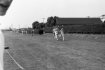
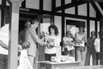
And the Dunlop 24-hr relay in 1985 - in this one the Commercial Office building can be seen in the background:-
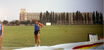
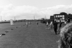
Mark Tooze
master brummie
This is indeed Ashold Farm Road - looking towards the Jaguar plant. One the left is the old Dunlop Garages where the test fleet was housed - this is now industrial units. On the right is the top end of Fort Dunlop itself with the main gatehouse and staff entrance just out of shot - the building on the extreme right is the canteen block which also housed meeting rooms, the company shop and a branch of TSB! Later entrance to Dunlop Motorsport is a bit further down on the right. Now a printing plant (Trinity Mirror?) which I believe is itself closed. Tyrefort building was built the other side of the photo on the site of the commercial offices block.In this image my information says we are looking back along Ashold Farm Road, and while the building have been replaced it does look like the tree all remain - much larger of course. Unfortunately there are not many distinguishing feature but I am sure if you worked in the area you would recognise it.
View attachment 185780

