• Welcome to this forum . We are a worldwide group with a common interest in Birmingham and its history. While here, please follow a few simple rules. We ask that you respect other members, thank those who have helped you and please keep your contributions on-topic with the thread.

    We do hope you enjoy your visit. BHF Admin Team

Digbeth Mineral Water Works and Well

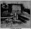
"Just past there on the right is Well Lane, which got its name from the artesian well bored about 1870..."

If you look at the sale in Post 38 for the year 1835 you can see that Well Lane was at that time called Well St. So it seems unlikely to get its name from a well bored in 1870?
 
Last edited:
The well and the spring (borehole) could be different altogether,

i believe the old well (which well street gets its name from) could have been on the site of the old school, further towards park street,

if our spring was bored mid 1800s at a depth of 400 foot, using copper pipe, wells around the area will be much older,

lots of cellars had wells in the area, most will just be filled in or covered over now,

bit harder to stop a 400 ft deep spring giving 72000 gallons a day than it is to fill in a well
i wonder what school that was sean...the map does show a well in the area you are digging in ...just to the left of the spring on this map.....lyn

well in well lane digbeth.jpg
 
Was St Martin’s School Lyn. It had a number of name changes and was relocated. Here’s a link


Viv
 
Last edited:
right thanks viv...on post 122 sean says he thinks the well was on the ground of st martins board school but the well is clearly shown on the map i posted on post 125 as being on the site that the digging is going on so i think it unlikely unless i have misread seans post

lyn
 
Lyn. There do seem to have been a number of Wells in the district which people accessed before the digbeth spring we know was bored. I think Sean meant that the well that gave the street it's name was in the grounds of the school.
 
Peter Hazlitt’s take on the history of the Digbeth ‘Reservoir’/mineral spring with a transcript of the tank inscription:

07710BDF-5D5B-4BEC-8AC1-485CAD6C672C.jpeg
 

Attachments

  • 8A27A452-5BDD-4BCB-9FE8-36AFD36C87EA.jpeg
    8A27A452-5BDD-4BCB-9FE8-36AFD36C87EA.jpeg
    322.9 KB · Views: 15
Last edited:

Well Street​

The top of Digbeth High Street near Park Street was known as Well Street in bygone times, taking its name from a public well that was situated there. It was also called Cock Street when there was an inn of that name on the spot.

(came across this from Birmingham Live while looking for another street. Well Street was also Cock Street.)
 
Also confirms it was referred to as Well Street before becoming Well Lane.
[No it doesn’t…as Janice points out below both Well Street and Well Lane are mentioned in an 1855 Directory]

Just at the end of Well Street there is ?? Mill Lane that could relate to the overshot mill noted in 1820 ?
 
Last edited:
“One of the most remarkable features of old Birmingham was the situation of the parish church. Until the beginning of the present century St. Martin's was surrounded by houses and shops.* These, as is clearly shown both in Westley's and Bradford's plan, extended from the top part of Digbeth, then called Cock or Well Street, up Corn Cheaping, the name of the spot at the top of Well Street, in which the corn market was held….”

A CENTURY OF BIRMINGHAM LIFE, Langford, 1870.
 
I’ve posted a newspaper cutting on the Springs and Wells thread about the ancient wells of Birmingham - it doesn’t mention an ancient well in Well Lane, only one in Park Street. That of course still means the Well Lane spring would still have been in full use but not as a well. Is it significant that there are references to the Well Lane water source as a ‘reservoir’ ? Viv.

Here’s the link to the Springs and Wells thread.
Viv.
 
This is a Well Lane property in Feb 1869.
Three Storey, double-lighted Manufactory…Steam engine.

CA786C4A-504D-48F4-BF98-43C365EB491C.jpeg
 
Last edited:
Re post #133, the Well Street mentioned (at one time also known as Cock Street) would be why the pump by St Martin’s Church at the top end of Digbeth was called the Cock Pump. This would have been just alongside St Martin’s Church in what is today, part of the Bull Ring. Viv.
 
Last edited:
Re post #140. From this and other references I get the feeling the spring was eventually used mainly for manufacturing purposes, rather than supplying residents with drinking water. If there was a ‘reservoir’ it would be holding a lot of water, so maybe the water was constantly being used. The developing manufacturing activity around this area plus the power of the water and it’s volume would make it a valuable resource for manufacturing.

Hazlitt seems to suggest that this substantial underground reservoir was once supplying the town with drinking water via wells connected to a number of ‘gullets’ before this time. So maybe when the Birmingham Corporation Water Act 1875 came into force, the reservoir became redundant it was put to use as an industrial supply. Viv.
 
Last edited:
The late Peter Walker mentioned the well in his thread Delving Round Digbeth in which he states it was bored in 1870:
Allison Street
First into Allison Street, with a good Victorian building on the corner and towards the railway bridge. On the right before you get there is Shaw’s Passage, with a lively veggie restaurant and food store on the near corner.
Continuing under the bridge on the left are the remains of one of the many cast iron gents loos, which were very important in the days when Digbeth was a place for hard workers and hard drinkers. All sealed up today for obvious reasons. Further down on the right is a good-looking Victorian building used 20 years ago for making crisps, but built in the early 1870s for Corder & Turley, umbrella makers. Just past there on the right is Well Lane, which got its name from the artesian well bored about 1870 to supplement the water supply delivered by horse and cart to the majority of Birmingham householders at that time. Piped water was a luxury for the wealthy, supplied by a private company until Chamberlain municipalised it in 1875. Before 1870 the main public source of water was the natural spring near Ladywell.


Extracted from
Viv
Do Not Know if this is any value on dating the well. I located a Westley Map dated 1731on which a Well court is clearly shown off Shutt lane, which I believe may be now Allison Street.

 
St Martin’s School address in 1848 was Well Lane. Afterwards it’s sometimes referred to as St Martin’s School, Well Lane, Allison Street, then sometimes just Allison Street. Viv.
 
Well St was what is now part of Digbeth, as stated in post 133.
Shutt lane is on the west of Park St (remember that the Westley map is not looking north up, south down, as are present maps)
The 1839 map shows an unnamed road, which must be Well Lane , marked in red

map c1839 showingb where Well Lane was then.jpg
 
thanks for that map mike and yes the unmarked is well lane but what i did not realise was that it does a right at the end of the lane and continues round so that part of it must have been where the car park now is


The c1824 map is very similar (the map here was a cloth map and the white line down the middle is where one of the folds was)

map c1824 showing Well St.jpg
 
Looking at the history of the spring/well again. I’ve been looking over the Peter Hazlitt article. He makes two points:

St Martin’s School became the mineral water factory with a dome covered well in the yard

At one time (pre-1889) the substantial underground water reservoir was connected to 8 wells supplying the town with fresh water through gullets.

We know from British History Online that the School moved out of Well Lane/Allison Street to Park Street in 1871 according to British History Online.

So, assuming the mineral water factory took over the school post 1871, was the reservoir used exclusively for industrial use thereafter, especially as the Birmingham Corporation Water Act was just on the horizon ? This change, if it actually took place, may well show up in the current excavation (ie maybe showing the ‘gullets’ whatever they might be !). And a nice snippet of history illustrating the changes to the area mid-late 1800s. Viv.
 
Back
Top