• Welcome to this forum . We are a worldwide group with a common interest in Birmingham and its history. While here, please follow a few simple rules. We ask that you respect other members, thank those who have helped you and please keep your contributions on-topic with the thread.

    We do hope you enjoy your visit. BHF Admin Team

Temple Row

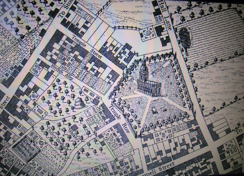
I would imagine that perspectives were somewhat out, as they are with most paintings/drawings of Birmingham in the early years, but I could well be wrong. I have so far found one mention of St Philip's burial ground - it was bounded by Church Street, Livery Street and the chuch itself. This is not actually what I was looking for, but will continue to look. I suspect the book I want is on loan to my daughter - and she is shortly to move house, so it may well be packed up!
 
Viv - I have a version of this picture, and if you look carefully, the side of the churchyard nearest to Colmore Row is much larger than it is today. Space for burials then the trees. I remember reading somewhere the ground was given up for the expansion of Colmore Row.

Found some of what I was looking for - in 1900 portions of the grounds were taken to widen Colmore Row and Temple Row, and in 1910 the churchyard was laid out as a garden, having been closed for ordinary burial since 1859.
 
Last edited:
If I remember rightly, they were demolished for the building of the TSB and another building. They are definitely not there now, I worked opposite at St Phillips Place for several years from 1989, and they were not there when I commenced work there.

Viv - you are right, the shop was on the corner of Cherry Street, right where the TSB was. I also seem to remember a sweet shop - possibly Thorntons, just inside Cherry Street, can someone clarify that please?

I think this view down Temple Row towards Temple Row West and Needless Alley is possibly the corner we've been discussing (i.e corner Cherry Street and Temple Row) but from this angle it looks a bit different to how I remember it. The building to the left marked 'Bank' must be where the Bank of England was built. Not sure of a date for the photo, possibly about 1930s or 1940s (?). Viv.

Temple_Row.JPG
 
Viv - I have a version of this picture, and if you look carefully, the side of the churchyard nearest to Colmore Row is much larger than it is today. Space for burials then the trees. I remember reading somewhere the ground was given up for the expansion of Colmore Row.

Found some of what I was looking for - in 1900 portions of the grounds were taken to widen Colmore Row and Temple Row, and in 1910 the churchyard was laid out as a garden, having been closed for ordinary burial since 1859.

Hi Shortie. That makes sense. Yes that area does look much larger than I remember it. I also seem to recall reading somewhere that there were once walkways around the church which were lined with lime trees. They seem to be shown on the 1732 drawing. So maybe they were removed to create space. Viv.
 
That's a smashing picture Viv - I have to say I don't remember it quite like that, but some memories fade. The Bank of England (a bit of a faceless building now) was built on that corner - it stretched the whole of the way from Cherry Street to Needless Alley - I have a feeling it changed and is not a bank at all now, I seem to remember something being refurbed there about ten years ago. That tall white building used to be the Leeds Permanent Building Society - in part if not in full. I remember that very clearly.

From 1989 until 2000 I walked along Temple Row daily. I parked in Dale End and walked to St Philip's Place and then when I changed jobs, to Waterloo Street. I go into Birmingham fairly frequently now, but don't always get to this part.
 
Hi Lyn and Shortie. Be interesting to be able to compare the view. The tall, white building looks almost too modern compared with the rest of the photo. Looks like it was in the process of being built and nearing completion. Viv
 
Hi Lyn and Shortie. Be interesting to be able to compare the view. The tall, white building looks almost too modern compared with the rest of the photo. Looks like it was in the process of being built and nearing completion. Viv
.

you are right there viv..the white building does look out of keeping with the rest..i will try and get the shot as close as i can..
 
Oh I think the view will be very different. The white building is still there, and yes, it does look extraordinarily modern and out of place (nothing is new!), does not look old today.

Rupert, your post #97 I suspect the burial is representative rather than factual. Possibly just to show there is burial space. Very few headstones left in St Philips, and one would have to know what date exactly in order to find out whose burial it was, if it was for real. Where is the St Edward's plaque then? Peck Lane has not been there since the 1850's. There may be a plaque in New Street - I think there is one for Thomas Attwood. Perhaps we should make a definite note of all plaques found?
 
Last edited by a moderator:
Peck Lane is still there where it always was. About the same width between two buildings on New Street. It is an access alley now and not named...but still there. The plaque is on the eastern corner building...look up. That alley marks the western corner of the old school.
 
There's a little book called "In the Midst of Life" by Joseph McKenna which used to be available at the Birmingham Library. It says that portions of the grounds of St. Philips Cathedral were taken in 1900

to widen Temple Row and Colmore Row, and in 1910 the Churchyard was laid out as a garden. There is a picture on the "Grand Hotel" thread, showing the trees.

rosie.
 
How things move on. It was only yesterday in post 105 that I asked where the Georgian Terrace was located now we have over 30 posts since then. The bank in post 93 was the Midland Bank. This was the last building standing in that block and The Bank of England did a swop with the Midland to get the whole block, with the Midland having the old Bank of England building. However the Midland never used the site and it was later occupied by Bristol and West Building Society and now by the Royal Bank of Scotland. When the Bank of England closed their Birmingham Branch the new building was taken over by the Bank of Scotland, who I believe may have moved out as there are proposals to redevelop the whole of the Bank House block again.
 
Last edited by a moderator:
Rupert, in my thread 'Curious .................'(Can't remember what I called it now), but Peck Lane, and I quote from a book:

'Peck Lane which ran from new Street to Dudley Street was perhaps of more interest after its disappearance'.
Peck Lane disappeared in the 1850's and was replaced, because it was a public right of way, by the glass covered walkway over New Street Station. Because it is a right of way, when the Pallasades was built, it became an entrance to the shops, although circuitous, via a steep flight of steps. Peck Lane is not there now, but there is the Pallasade entrance which takes its place, howeve, it is unnamed. This is from a book published in 1986 by a man with all the information at his fingertips - Joe Mckenna, who used to work in the library. I knew Joe fairly well, due to the fact I used to spend a lot of my lunchtimes in the library.
 
Down Peck Lane I walked along,
To find out Brummagem,
There was the dungil down and gone
What? no rogues in Brummagem,
They've ta'en it to a street called Moor,
A sign that rogues ain't fewer,
But rogues won't like it there I'm sure,
While Peck Lane's in Brummagem.

From I Can't Find Brummagem, Written by James Dobbs (1781-1837), a Midland music hall entertainer.
 
Rupert, in my thread 'Curious .................'(Can't remember what I called it now), but Peck Lane, and I quote from a book:

'Peck Lane which ran from new Street to Dudley Street was perhaps of more interest after its disappearance'.
Peck Lane disappeared in the 1850's and was replaced, because it was a public right of way, by the glass covered walkway over New Street Station. Because it is a right of way, when the Pallasades was built, it became an entrance to the shops, although circuitous, via a steep flight of steps. Peck Lane is not there now, but there is the Pallasade entrance which takes its place, howeve, it is unnamed. This is from a book published in 1986 by a man with all the information at his fingertips - Joe Mckenna, who used to work in the library. I knew Joe fairly well, due to the fact I used to spend a lot of my lunchtimes in the library.

Here's the link Shortie. https://birminghamhistory.co.uk/for...urious-items-of-birmingham-history.38459/Also agree with you that we should record all blue plaques. Do we need a new thread for this?
Viv.
 
Last edited by a moderator:
The Peck Lane entrance on New Street is still right there and the round school plaque is above the window on the corner of the east building. No it is not named now and is used presumably as a service entrance but that is the 'exact spot'. Right the lane was cut by the railroad but this bit remains seemingly open. Everything has changed around it right enough and the buildings tower over it but you can't change open air. Heck...you can see it on Google E.
If they can re-name Spiceal Street then why not Peck...it's fewer letters. 'What the heck..replace the Peck' Put the sign right next to the Plaque.
 
I think this is a decision made by the Council, not the Forum. Perhaps you should write to the Council?

As for the re-naming of Spiceal Street, I found this a little odd. Not because I disagree with it, quite the opposite, but I am sure I have actually seen the sign on the entrance to New Street on the wall next to Zara - this is a some time ago - about two years. Now they have re-named the new shops right in front of St Martin's as Spiceal Street. The church is now all but hidden, and personally I do not like it. I would keep all the old names myself, but not eveyone would agree with me.
 
shortie on this i do agree with you..i watched the new shops being built right next to st martins and they are so close to it i was beginning to think that at any moment they would be entering the church..just my opinion but i think it would have been nicer if st martins church had been left with a bit more space around it..its now almost engulfed...oops im going a tad off topic now...will be going out soon to take pics of temple row/street

lyn
 
Last edited:
In 1731 the row of terraces along Temple Row I think were placed in a prime spot and a probably a desirable part of town. Westley's 1731 map shows the houses would have offered views from the back across Walker's cherry orchard and Corbetts Bowling Green. From the front I think the view must have taken in not only St.Philip's churchyard encircled with its avenues of lime trees but also New Hall and the surrounding fields. Viv.

St_Philip_s_Temple_Row_1732_Westley_s_map.JPG
 
This picture has been here before the wipeout and it also shows what I believe to be the old Priory pool on the other side of what would become Colmore Row. Not used seemingly in this picture...with no feed brook shown. I have never seen a feed brook to this pool but it must have been Priory Brook.
 
Maybe it was Bournebrook, as that brook went to Water Street and was the reason for the great pool at the bottom of Consitution Hill. Peter Walker gave me that information. I am sure, if he was still with us, he would have known exactly what and where.
 
best i could do from memory folks..vivs old shot and the one i have taken today.. i did take a few more of temple row which i shall download and post later on..

image.jpeg image.jpeg
 
Last edited by a moderator:
Lovely Lyn! Just look at the carving over the arch and on the pillars. I have a feeling that the arch has been infilled with glass etc, not original and fairly recent. But could be wrong on that. I've always thought these arcades were such elegant and surprising places. Thank goodness there are some left for us to see. Viv.
 
hi viv i agree about the carvings..they are wonderful...you could be right about the glass above the archway..maybe someone has an older pic of the arcade so that we can compere them....
 
The office I worked in was just to the left of this picture - right on the corner, so I passed this every single day. I agree it is lovely, but not sure that the glass was not there originally. It may be replacement glass, but I think it was like this from the start. I have got quite a few books, when I have time I shall see if I have a picture of this, but years ago.
 
just for good measure the wonderful st phillips..

image.jpeg
 
Last edited by a moderator:
But do you know what happened to the 'war effort' railings and other stuff? It was dumped in the North Sea. It beggars belief - glad I have seen these, it gives a whole new look to the cathedral's past. Much more substantial than the present ones.
 
Back
Top