Terence David Lines
master brummie
Plenty of Dunstall roads in the Black Country me thinks. One 800 yards from where l reside.
Last edited:
Tardebigge, spent many a day on those pounds catching Bream, Roach. Never caught many Gudgeon a canal staple in those days. The lake you see in the photograph at Hewell Grange has a large amount of Bream nowadays.
Wonderful piece of history! And SO much I took for granted….
That’s the way I always used to go. If I remember correctly, Ariel had a facility near by!Always thought the Birmingham Uni was in Edgbaston, by the Bristol Road, could be wrong been away a long time!!
That is the place! As I walked rode my bike past there, wishing I could afford a new something!I remember as a boy after going to the Saturday Minors, at the "Oak Cinema", would walk down the Bristol Road, to where the Bridge was, facing the old Pawn Brokers shop on the opposite side , and look down on the Ariel Factory yard, where all the new Ariel Arrows and leaders were parked in long Lines.. Happy days indeed....
I think last I was there was about 1960.Thanks Richard, it has been an awfully long time since I have seen that view from the Bristol Road, actually my Niece "Kate West went to Birmingham and graduated in music, but that was the 90's...
Boarders Selly Oak / Edgbaston on the Bristol Rd. The canal has been cleaned up a lot since the new QE was built close by. Nice walk along towpath now.Always thought the Birmingham Uni was in Edgbaston, by the Bristol Road, could be wrong been away a long time!!


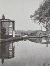
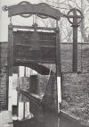
Not sure if this is in the forum but I found this atmospheric photograph of Kings Norton lock keeper's house and (guillotine?) lock taken in 1965.


Wonderful picture. So utility looking yet multifaceted with the chimney, canal, locks and variety in type of building! Thanks for sharing.Bowyer Street pumping station, silualed close to Camp Hill Fifth Lock, pictured probably in 1898.
The Warwick canals by Faulkner, Alan H (1985)
View attachment 176216

