Yes, I think you're probably right brummy-lad.
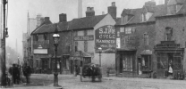
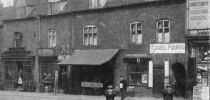
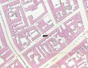
The photo in Post #26 shows a row of 6 terraced houses with a gap at either end, and an entry between the second and third houses from the right. That configuration is shown in this 1855 map of Potter Street, with the picture angle indicated by the black arrow.
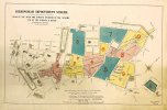
This was in the area affected by the Corporation Street development. Presumably these houses were demolished before the 1886 map (Post #14) was drawn, along with the Balloon Street area behind it.
Therefore the old houses would have been in the vacant area shown on the left of the photo in Post #14 .... dated 1905.
View attachment 207609
View attachment 207611


