Dennis Williams
Gone but not forgotten
A little back alley off Allison Street, Deritend...HACK STREET...used to have a pub I've never heard of...changed a bit now....


Snow Hill I think Paul....but Phil, mikejee or a thousand others will know....it ran from Bordesley Station.....must be GWR surely?

Rupert
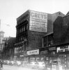
This is Dr Johnson Passage, I believe the Meeting House is still there today but in a much altered condition. In this photo which I suppose could have been taken from Lewis's if you look along the passage you can see Greys department store opposite.
Phil

I remember going to see my Auntie Nell who worked in the furniture department of Greys which was on Steelhouse Lane. (I was going to put 'see my aunt' but I have dim recollections of this phrase having another meaning!)
If she was at lunch we would go out of the back door (I seem to remember having to go upstairs in the shop - there was a mezzanine floor), and then into a passage at the back which took you to a canteen. I always thought this belonged to Greys but I wonder if it was a British Restaurant? Any ideas anyone, it was a long time ago?


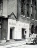
Does this help LP? An 1888 map and the Brasshouse Passage on Broad Street
View attachment 94294View attachment 94295
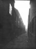
Whilst we are on this thread I might as well include this photo of Henns Walk taken sometime before it was widened out and made into a road which must have been sometime before 1920 as the maps after then show it as a road running from Moor St to Dale End. Previous to that it was only an alley with a tunnel entrance at the Moor St end.

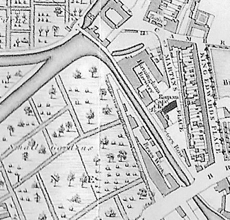
Thanks Dennis but I do know that everything had gone by the 1880's. I have a copy of Norman Bartlam's book with the other picture in but I think I will have to go and find out more about the Brasshouse itself and the buildings behind in the early 1800's. I expect they were built for the workers/owners but whether there is any information I don't know. There is an earlier map from 1839 in Maps & Sketches from Georgian & Early Victorian Birmingham which shows a completely different layout. The area to the West of the Brasshouse is just 'small gardens' and the canal layout - how different from now! From the description I expect the houses were similar to those in the city centre. Thanks again.


Dennis they were Mikes maps
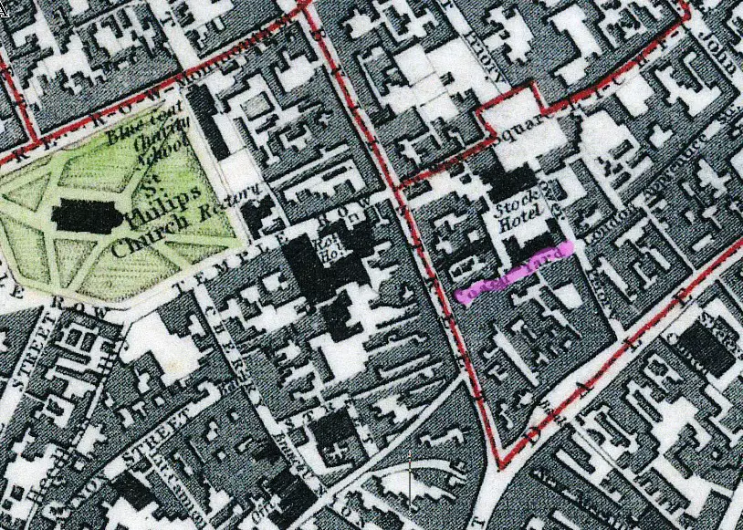
Dennis I would agree with Mike on the location of the Coach Yard, as this description here, mentions a few landmarks. Hudson's book shop would have then been at number 18 Bull Street which would be on the corner of the alley marked in pink on Mikes third map. The description comes from an Ebook in the Guttenburgh collection.
https://www.gutenberg.org/files/18821/18821-h/18821-h.htm
Bull Street was then the principal street in Birmingham for retail business, and it contained some very excellent shops. Most of the then existing names have disappeared, but a few remain. Mr. Suffield, to whose courtesy I am indebted for the loan of the rare print from which the frontispiece to this little book is copied, then occupied the premises near the bottom of the street, which he still retains. Mr. Adkins, the druggist, carried on the business established almost a century ago. He is now the oldest inhabitant of Bull Street, having been born in the house he still occupies before the commencement of the present century. Mr. Gargory—still hale, vigorous, and hearty, although rapidly approaching his eightieth year—then tenanted the shop next below Mr. Keirle, the fishmonger. His present shop and that of Mr. Harris, the dyer, occupy the site of the then Quakers' Meeting House, which was a long, barn-like building, standing lengthwise to the street, and not having a window on that side to break the dreary expanse of brickwork. Mr. Benson was in those days as celebrated for beef and civility as he is now. Mr. Page had just opened the shawl shop still carried on by his widow. Near the Coach Yard was the shop of Mr. Hudson, the bookseller, whose son still carries on the business established by his father in 1821. In 1837, Mr. Hudson, Sen., was the publisher of a very well conducted liberal paper called The Philanthropist.

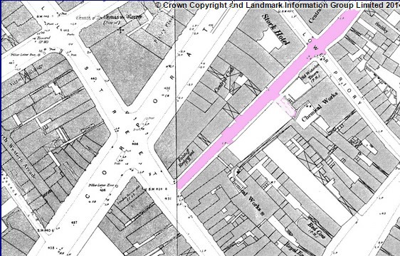
There was an alley named coach yard on the 1828 and 1839 maps (marked in purple) , which ran along the back side of the Stork Hotel. I am assuming that Old Coach Yard is the same. When Corporation St was developed this area was considerably rebuilt . Judging by the fact that Coach Yard ran behind the Stork, i would say from the c1889 map that Coach Yard, extended and widened , became Dalton St (again in purple)