• Welcome to this forum . We are a worldwide group with a common interest in Birmingham and its history. While here, please follow a few simple rules. We ask that you respect other members, thank those who have helped you and please keep your contributions on-topic with the thread.

    We do hope you enjoy your visit. BHF Admin Team

New unseen photos with no locations

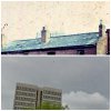
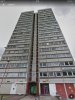
The houses are positioned on top of a hill as the houses to the left are in a much, much lower position. Does anyone remember a road at the top of a hill/high slope or a road with a steep gradient? So far I've suggested top of Camden St/Clissold St or along Rosebery St. Does anyone know others that are quite high up around the area? Viv.
 
Last edited:
A 1945 aerial view on which I have marked the position of some flats which might be the flats seen over the rooftops in the pics. The road in which the houses are seems to run at a slight angle to the south face of the flats.
hockley.JPG
 
I've compared the tower block behind the houses with this block seen from Whitmore Street. Could be the tower block, similar features or could be the tower block to the left.. But not suggesting the houses were on Whitmore Street itself as I think it's a bit too close and too low lying. Viv.
 

Attachments

  • image.jpg
    image.jpg
    212 KB · Views: 19
  • image.jpg
    image.jpg
    172.4 KB · Views: 20
Last edited:
This is the comparison of the other block Lyn suggested. Look similar, except middle section painted differently. That could be modern day painting. Can't quite get the angle right though. Still think the houses were on higher ground.Viv.

image.jpg
 
thanks viv i think its there or there abouts ...could be hard to say for certain...
 
How about All Saints Street? Viv.
The original photos in post#294 show a terrace of two houses with smaller side buildings each side. The side building on the right looks like a house but lower and with that imposing chimney. In the 1945 image below I've superimposed the tower blocks as near as where they show on modern maps and marked All Saints Rd on which there possibly seems to be short terraces of houses with gaps or lower buildings between them.
hockley4.JPG
 
Here is a map c 1955 od All Saints Road

map_c1955_All_Saints_road~0.jpg
 
Last edited:
I wonder if the area we're talking about suffered WW2 bomb damage. I thought the building to the right of the terrace looks like it was put up in place of a house that has disappeared. I imagined the terrace to have originally continued to the right. I suspect the chimney is one attached to another row of houses behind this terrace i.e. not attached to the small building to the right. It's the same design of chimney as is on the terrace of houses. Unlikely one of this size would be attached to the smaller building. Not sure that gets us any further forward though! Viv.
 
Last edited:
Hi viv,
You are correct in what you are stating those two houses are or was at the top of rosemary street and yes it was a very steep hill
And they was the longest and original batch belonging to in those days to the bargie family's of clissold street wharf
As it was well known in later years there gate way was moved into the top end of new spring street
But the houses being last on the end was at the junction of clissold passage as it was known
And the main clissold street longing along the road heading towards Camden street first then new spring street
Then pitford street and ingestion street
And years later people got to know these couple of family's in the fortys and fifths and spoke to them with sign langue
As they was death and dumb and two of them lads had ginger hair very
Popular kids I just cannot recall there surname as its been near sixty years or more
I used to run errands for an boldly lady every Saturday morning fetching her coal from around the wharf for half a crown
Until I broke my arm one sat morning with the coasl wharfs big builder hand carts they lent you
When I was a nipper
As I said the houses was rosemary street with the walk way along the paths of the houses was clissold street and clissold passage
And the first of block flats and nearest built was Camden street in the late fifty s I believed it was Camden tower
Walking from the house along the paths you would end up on dudley red by Weston road
Along that paths there was warehouses and one was a bedding ware house which was set on fire in the fifths and could been seen from most area of brum
Whilst on Rosemary street down the steep hill was rosemary bus depot facing colledge road
Walk to the bottom was rosemary passage walk through to George street west and facing st peters church
Best wishes to you viv , Alan,, Astonian,,,,,
 
Hi Carolina
You are quite correct there was no double fronted house around that completed area from spring hill down ickneild street
Pickford street ingestion street new spring street ford st and the ones you have stated nor crab tree road Weston red
Nor lodge red Devonshire street the nearest would have hands worth new road and some on Baccaus red
Neither any of the side streets off Winston green road. Best wishes. Astonian,,,,
 
Viv - I think the base of the chimney stack is just about discernible on the forward-pitching roof of the low building. But as you say: why such a tall chimney? An annex for smoking or smelting?

I keep going back to the tower-block in the original photo and the enlargement on post 305. OldMohawk has established that the recessed central strip exists only on the south and north elevations. Could we be looking at the tower-block from the north, not from the south as we have assumed?
 
Thanks Alan. Very interesting to hear your memories of the area. I think this is the tower block. Been studying it a bit more and it seems to fit the design more accurately with the tower block in a Mikes original photos. There's a white concrete strip running down the centre. Do you think this is Camden Tower? I'm also posting a view of the Tower from All Saints Road. Viv.
 

Attachments

  • image.jpg
    image.jpg
    265.7 KB · Views: 26
  • image.jpg
    image.jpg
    251 KB · Views: 24
Last edited:
The recessed vertical strip in the modern photo fits perfectly. All Saints Road appears to be the right distance from the tower. What about the topography - any evidence of a dip that we see in the original photo?
 
Been trying to get my bearings following Astonian's posts. Here are two views of the Tower: looking north from Pitsford Street (towards All Saints Road) and looking south from All Saints Road (towards Pitsford Street). So basically looking across the railway line in Carolina's map. And this gives us the north and south elevations of the Tower. Can we now pinpoint the houses in relation to Astonian's suggestion of Rosebery Street. Or am I getting wires crossed? Can anyone help please? Viv.
 

Attachments

  • image.jpg
    image.jpg
    217.3 KB · Views: 30
  • image.jpg
    image.jpg
    251 KB · Views: 27
Last edited:
The left hand tower in my uploaded images appears to be Norfolk Tower in what is left of Lodge Rd. The view of it over the roof seems full face and from the general locations suggested in post#294 I would guess that the photo location could be on a line due south from the tower crossing All Saints Rd, Pitsford St, and Hingeston St. A similar south line from the other tower on Ford St crosses Lodge Rd, Park Rd, and some distance away Icknield St. Perhaps if we knew the height of the tower in the photo and with some trigonometry and maths, we could calculate an approximate distance to the tower - it looks quite close but distances in photos can be deceptive.
Is this photo going to be the one that has defeated us ....
 
Last edited:
Think the answer to my question about the tower seen from Rosebery is that it's a different tower. Many of the towers built around that time seem very similar, so it's the less obvious details that distinguishes them one from each other. Viv.
 

Attachments

  • image.jpg
    image.jpg
    197.1 KB · Views: 20
Last edited:
To me it looks like the block of flats on Rocky Lane close to the old Charles Arthur Street.....? but I honesty don't know........the flats in the photo may no longer be standing ?.....
 
The left hand tower in my uploaded images appears to be Norfolk Tower in what is left of Lodge Rd. The view of it over the roof seems full face and from the general locations suggested in post#294 I would guess that the photo location could be on a line due south from the tower crossing All Saints Rd, Pitsford St, and Hingeston St. A similar south line from the other tower on Ford St crosses Lodge Rd, Park Rd, and some distance away Icknield St. Perhaps if we knew the height of the tower in the photo and with some trigonometry and maths, we could calculate an approximate distance to the tower - it looks quite close but distances in photos can be deceptive.
Is this photo going to be the one that has defeated us ....
friendly_wink.png

Good thinking, oldMowhawk, though I'm afraid I have forgotten the little I once knew about trigonometry! Looking at my 1970s A to Z, I follow your logic about the sight-lines across the various roads to each of the two towers. If we assume that the photographer is facing roughly north, we want a road running east to west, the axis of the houses in the picture. All Saints Road does fit the bill, but seems perhaps too close to the towers when compared to the photo. How about Prescott Street?

I also looked at the direction of sunlight and the way the shadows fall - they indicate that the sun was quite low in the east. If Mike were to say he never photographed in early morning, that would suggest he was standing north of the tower in the late afternoon, when the sun was in the west.
 
Another point. There are at most only two floors of the tower block visible above the house rooflines. Trigonometry not being on my radar (!), does this help in any way in the equation by measuring the average size of a tower floor etc? Got brain ache ....... Viv.
 

Attachments

  • image.jpg
    image.jpg
    11.1 KB · Views: 22
To me it looks like the block of flats on Rocky Lane close to the old Charles Arthur Street.....? but I honesty don't know........the flats in the photo may no longer be standing ?.....
Hi aston lad .... I've just had a look in the area you have mentioned and there are two same style tower blocks on or near Sutton St, but Mike said he took the pics in Hockley.
 
Norfolk Tower on Lodge Rd has 17 floors, plus services at the bottom. Viv.
 

Attachments

  • image.jpg
    image.jpg
    269.9 KB · Views: 13
Another point. There are at most only two floors of the tower block visible above the house rooflines. Trigonometry not being on my radar (!), does this help in any way in the equation by measuring the average size of a tower floor etc? Got brain ache ....... Viv.

The city council or housing authority should be able to tell us the precise height of the tower. We can make a pretty accurate estimate of the height of the roof of the derelict house. Mike will tell us his height, i.e. the distance from his eye to his shoes. From those three figures we can calculate the exact distance between the photographer and the tower - I think!
 
Oops....Sorry oldMohawk, I didn't read Mike's posting.......I know for a fact it isn't Sutton Street, that is my area of Aston ......
 
I'm about 5ft 3inch. I thought it was probably Hockley as the photos were immediately before some in Hockley, by Lodge Road. But photos before were from another day when I was outside birmingham. If by early morning viewfinder means before 9.00, then I think I can reasonably say that they were not taken early morning.
 
A report on the web says the height of Norfolk Tower is 52 metres. (Incidentally, it is to be - or has been - demolished this year.) I estimate the top of the roof of the derelict house is 6 metres from the ground, and 10 metres from Mike, who is 1.6 metres tall. Someone here will be able to deduce how far Mike was from the tower...
 
A report on the web says the height of Norfolk Tower is 52 metres. (Incidentally, it is to be - or has been - demolished this year.) I estimate the top of the roof of the derelict house is 6 metres from the ground, and 10 metres from Mike, who is 1.6 metres tall. Someone here will be able to deduce how far Mike was from the tower...
Thanks Viewfinder - so subtracting Mike's height from the other heights we have heights of 4.4 and 50.4. I have some trig tables somewhere but I vaguely remember some rules called 'similar triangles' so I might try that after I have had my tea unless someone has already worked it out ...
friendly_wink.png
 
Last edited:
Back
Top