-
Welcome to this forum . We are a worldwide group with a common interest in Birmingham and its history. While here, please follow a few simple rules. We ask that you respect other members, thank those who have helped you and please keep your contributions on-topic with the thread.
We do hope you enjoy your visit. BHF Admin Team
You are using an out of date browser. It may not display this or other websites correctly.
You should upgrade or use an alternative browser.
You should upgrade or use an alternative browser.
Then & Now
- Thread starter Phil
- Start date

Radiorails
master brummie
Keep quiet Maurice, they may think about cutting it down! I am sure it is welcome in a rain shower or strong sunshine. 
Banjo
master brummie
The lamp on the right of the photo was also a pub. Would I be correct in thinking it was The Greenaway?The Cattell Rd / Coventry Rd junction in 1934 and behind the trolleybus is a pub.

forum image from https://birminghamhistory.co.uk/for...ur-old-street-pics.41947/page-116#post-601348
A similar (almost) today's view is shown below ... the pub has gone.
View attachment 118494


oldMohawk
gone but not forgotten
Two pics, one from the 1970s and the other now. Folks in the early pic were getting used to new style 'Pay As You Enter' buses like the one turning into Corporation Street but probably never thought that the Midland Bank would be taken over by a company from Hong Kong. They might have smiled if told that a company with an half eaten apple as it's trademark would later move into the building. Would they have expected trams to make a come back but maybe they had thought of wearing sunglasses on the top their of heads !
Pic 1 ... from the Birmingham Buses thread post#1197

Pic2

Pic 1 ... from the Birmingham Buses thread post#1197
Pic2
Last edited:


Radiorails
master brummie
The older photograph has a given date of July, 1913. The bus service was an extension, at that time, from Selly Oak to Rednal taking over from where the 35 tram route then terminated. There were also buses from there to Rubery. The route had no number at the time but became 6 in 1916. These 40HP Daimler buses, ten were purchased, in the photo were used in war service but the bodies were later fitted to Tilling Stevens engined buses post war so had a chequered history. The bus is OA 1607 (37).
The tram is No. 343 of 1911, so a fairly new car.
The tram is No. 343 of 1911, so a fairly new car.
Smudger
master brummie
Alan,The older photograph has a given date of July, 1913. The bus service was an extension, at that time, from Selly Oak to Rednal taking over from where the 35 tram route then terminated. There were also buses from there to Rubery. The route had no number at the time but became 6 in 1916. These 40HP Daimler buses, ten were purchased, in the photo were used in war service but the bodies were later fitted to Tilling Stevens engined buses post war so had a chequered history. The bus is OA 1607 (37).
The tram is No. 343 of 1911, so a fairly new car.
What is the secret of your detailed memory, cos i could do with some help along those lines. ( Please tell me it`s copious amounts of single malt ) :-}
Radiorails
master brummie
Now as far as whisky/whiskey is concerned I am afraid the answer is no. When I was in the RAF and foot free I did, when based near Weston-suer-Mare and before I bought my first car, did fins Georges Glucose Stout very palatable. Also when based in Malvern, I found good watering holes in Worcester. I have never driven if I have drunk alcohol, so Worcester was an easy journey - train there and back plus taxi to quarters. Joining the fire service veered me virtually into temperance , however after training on Thursday evenings a couple of halves of draught Guinness and a game or two of crib were in order (never liked the tinned version.). I do, however, have a bottle of 12 year old Glenfiddich which was given to me eight years ago. It is still unopened. However, I decided that the forthcoming holidays will be a good time try try it out.
As far as the bus information is concerned, I have to say that I learned much as a youngster and have, over the years kept my interest in the subjects. Usually what is learned at a young age is stored until required and age generally makes for long memories, Many here will have good memories of a long time ago but have trouble with what happened a few minutes ago.
I do have a good reference library and knew instantly that I had seen Old M's pic and where I could locate it. As I mentioned before I prefer to try and give accurate information whenever possible especially as this is not Facebook but a dedicated history arena.
, however after training on Thursday evenings a couple of halves of draught Guinness and a game or two of crib were in order (never liked the tinned version.). I do, however, have a bottle of 12 year old Glenfiddich which was given to me eight years ago. It is still unopened. However, I decided that the forthcoming holidays will be a good time try try it out. As far as the bus information is concerned, I have to say that I learned much as a youngster and have, over the years kept my interest in the subjects. Usually what is learned at a young age is stored until required and age generally makes for long memories, Many here will have good memories of a long time ago but have trouble with what happened a few minutes ago.
I do have a good reference library and knew instantly that I had seen Old M's pic and where I could locate it. As I mentioned before I prefer to try and give accurate information whenever possible especially as this is not Facebook but a dedicated history arena.
oldMohawk
gone but not forgotten
Anyone who started working life in a 1950s/1960s Drawing Office would have initially worked in the print room and probably used print machines, papers, and ammonia produced by Ozalid who had a shop on the Chester Road opposite Pype Hayes park as seen in this 1958 photo.

Eventually from the 1980s onward Drawing Offices converted to Computer Aided Design and gradually stopped using paper. The shops are still there but Ozalid is long gone. Google's camera was facing into the sun so not a good pic.

Eventually from the 1980s onward Drawing Offices converted to Computer Aided Design and gradually stopped using paper. The shops are still there but Ozalid is long gone. Google's camera was facing into the sun so not a good pic.
ellbrown
ell brown on Flickr
New St - Corporation St in the 1950s

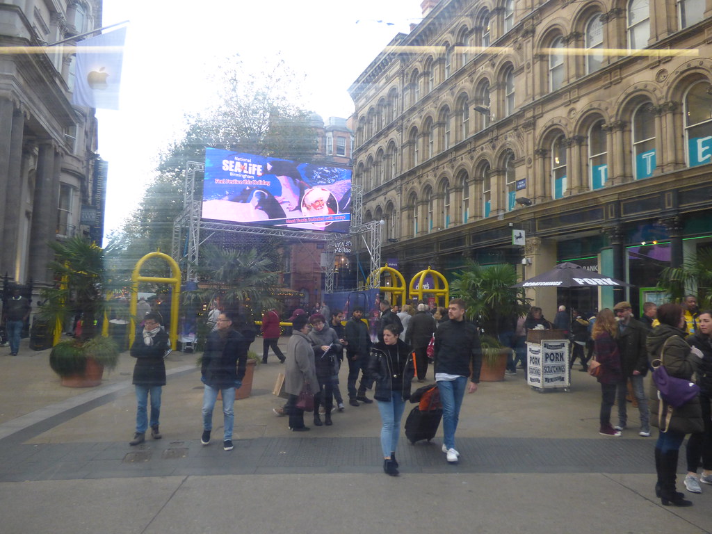
Now ... trees, tramlines, no vehicle traffic, only one person not wearing jeans, and buildings survive ...
View attachment 118514
From the tram earlier this month of the Birmingham Frankfurt Christmas Market on New Street, same location. Between Apple and Lloyds Bank.
oldMohawk
gone but not forgotten
Hazelmoor Cafe stood on the corner of Stratford Road and Cole Bank Road in 1935 and it looks like a coalman has stopped his horse and cart and maybe gone into the cafe for a cup of tea. 'Wednesday's Girl' and 'The Count of Monte Cristo' on at the Warwick Cinema.

Image above from the Library of Birmingham archive, image below from Google
From old maps etc, I think the cafe was where the tree is in today's scene. The junction has been realigned and the original Cole Bank Road is to the right of the tree but now blocked off.

Image above from the Library of Birmingham archive, image below from Google
From old maps etc, I think the cafe was where the tree is in today's scene. The junction has been realigned and the original Cole Bank Road is to the right of the tree but now blocked off.
ellbrown
ell brown on Flickr
Hazelmoor Cafe stood on the corner of Stratford Road and Cole Bank Road in 1935 and it looks like a coalman has stopped his horse and cart and maybe gone into the cafe for a cup of tea. 'Wednesday's Girl' and 'The Count of Monte Cristo' on at the Warwick Cinema.
View attachment 120745
Image above from the Library of Birmingham archive, image below from Google
From old maps etc, I think the cafe was where the tree is in today's scene. The junction has been realigned and the original Cole Bank Road is to the right of the tree but now blocked off.
View attachment 120746
I think it was closer to here, as I think Cole Bank Road used to end on the blocked off road. This building has been recently been refurbished.

devonjim
master brummie
The road was realigned pre-late 50's. used to go through this junction to school and later went to Hall Green tech when I would park in the cut off length of roadHazelmoor Cafe stood on the corner of Stratford Road and Cole Bank Road in 1935 and it looks like a coalman has stopped his horse and cart and maybe gone into the cafe for a cup of tea. 'Wednesday's Girl' and 'The Count of Monte Cristo' on at the Warwick Cinema.
View attachment 120745
Image above from the Library of Birmingham archive, image below from Google
From old maps etc, I think the cafe was where the tree is in today's scene. The junction has been realigned and the original Cole Bank Road is to the right of the tree but now blocked off.
View attachment 120746

Elmdon Boy
master brummie
When I went to Hall Green Tech in 1965/66 I used to park my BSA Bantam motorbike in that cut off part of Cole Bank Road along with all the other students on motorbikes or scooters.

norfolk brummie
gone but not forgotten
Having been at Golden Hillock Road school in the forties, our only area for football was the tarmac school playground, so we would use the Cole Bank Road playing field for all of our football and cricket matches against other schools.
Eddie
Eddie
ellbrown
ell brown on Flickr
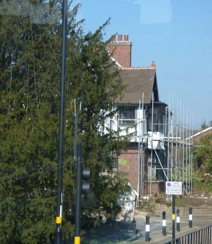
The Crossways (the house Ell has photographed #348) then Colebank Road and then Hazelmoor.
That was a screenshot from Google Maps Street View.
I have got this one of the Christmas tree in 2011 (the lights were never taken down!)
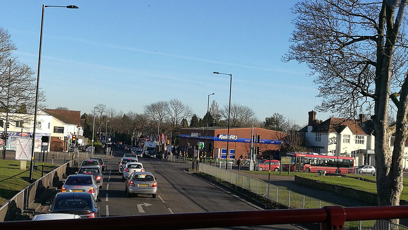
A more recent bus view of the current layout of Cole Bank Road to School Road at the Stratford Road junction.
The Crossways in 2013 a few years before refurbishment (all the trees / bushes around it have now gone).


oldMohawk
gone but not forgotten
Hi Jim the reference is https://britainfromabove.org.uk/en/image/EAW044054
Look at the extreme right of the image and there are several adjacent images.
What intrigues me is ... even if the cafe was closed, why would the building be demolished? It would have made a nice private house unless it was structurally unsound.
oldmohawk ...
Look at the extreme right of the image and there are several adjacent images.
What intrigues me is ... even if the cafe was closed, why would the building be demolished? It would have made a nice private house unless it was structurally unsound.
oldmohawk ...
