-
Welcome to this forum . We are a worldwide group with a common interest in Birmingham and its history. While here, please follow a few simple rules. We ask that you respect other members, thank those who have helped you and please keep your contributions on-topic with the thread.
We do hope you enjoy your visit. BHF Admin Team
You are using an out of date browser. It may not display this or other websites correctly.
You should upgrade or use an alternative browser.
You should upgrade or use an alternative browser.
Passages, Alleyways Gulletts and Snickets of Old Brum
- Thread starter Dennis Williams
- Start date
Dennis Williams
Gone but not forgotten
Musn't miss out St Marys Row, Moseley, as opposed to St Marys Row, Whittall street. Two nice shots from the Whybrow Book 'How Birmingham Became A Great City'.


Last edited:
I think you are right. The railings must be around the traffic island on the map. What a coincidence; same names, Row and Church and the second row building on the right looked good. Ah well.
Map ref. https://www.british-history.ac.uk/m...d=10106&ox=3355&oy=2669&zm=1&czm=1&x=109&y=80
I thought the angle of the church did not gell. Those are tram lines and they go around the island.
Map ref. https://www.british-history.ac.uk/m...d=10106&ox=3355&oy=2669&zm=1&czm=1&x=109&y=80
I thought the angle of the church did not gell. Those are tram lines and they go around the island.
S
Stitcher
Guest
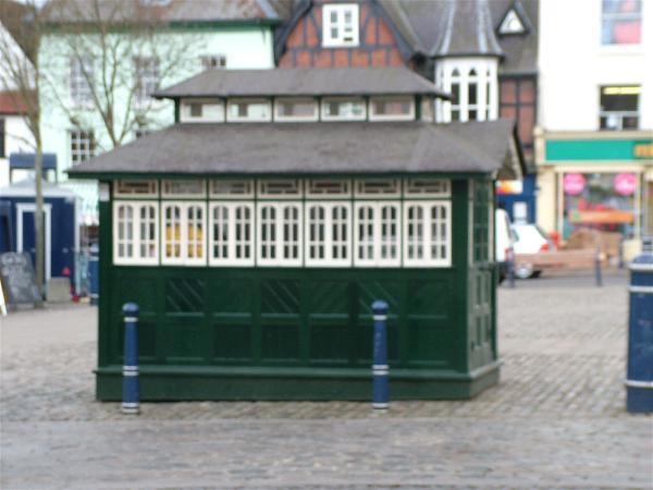
Brasshouse Passage, Broad Streeet.
View attachment 63832
View attachment 63832
Dennis Williams
Gone but not forgotten
And here's one I prepared earlier Pierre....two birds, one stone as well etc....RATCLIFFE PLACE, complete with similar cab stand of the day.
The Church tower just behind the shopping facade is St Marys (natch), where No 1 son got married last year. The underground public toilets in the foregound behind the foliage and railings are no more. Although the winos still sleep on the benches there, and in the Church grounds. Great cosmopolitan Village though Moseley. Brilliant place to live if you like 'life' to the full and can afford it.

The Church tower just behind the shopping facade is St Marys (natch), where No 1 son got married last year. The underground public toilets in the foregound behind the foliage and railings are no more. Although the winos still sleep on the benches there, and in the Church grounds. Great cosmopolitan Village though Moseley. Brilliant place to live if you like 'life' to the full and can afford it.
Last edited:
Well I got the location of the old St Mary's photo wrong. Still the cabbies shelters have come to light, for me anyway and a whole new location of a very similar place including the incline of the row. Have not seen that photo of Ratcliffe Place before. The early camera's did not capture motion very well but there do not seem to be any blurs on that one of people moving by. If that cabby got his finger out and stopped drinking tea; he could nip around to Edmond Street and maybe get a fare. Gosh I miss all of that and to know that it is all gone now is to lose part of ones existance.
Dennis Williams
Gone but not forgotten
No worries Rupert, I do it all the time my friend! Just found this beautiful shot of St Mary's Row (Whittall Street) from David Harvey's Past & Present Book. He notes the first Georgian House on the corner is the St Chad's Convent, then rather incongruously next door, is Ward and Sons Gunmakers! As were most of the other frontages featured here.

Last edited:
Dennis Williams
Gone but not forgotten
This one is a nice old narrow one - DALTON STREET. Don't remember it. Ran parallel to Corporation Street. I would like to know what buildings these 'Bridges' connected to and from, and what are the big impressive buildings in the distance. Not much to ask surely? mikejee's 1930s map included for orientation purposes.


Last edited:
Dennis Williams
Gone but not forgotten
And whilst in the Gun Quarter, how can we ignore the charms of LOVEDAY and PRICE STREETS, especially as on that corner they feature that famous old Pub, and meeting place of many of our most revered BHF ale lovers, The Bull. This was also where the old Gun gaffers paid their men's wages allegedly. What a splendid idea...do you think they had shares in the takings?

Last edited:
dek carr
gone but not forgotten
This one is a nice old narrow one - Dalton Street. Don't remember it. Ran parallel to Corporation Street. I would like to know what buildings these 'Bridges' connected to and from, and what are the big impressive buildings in the distance. Not much to ask surely? mikejee's 1930s map included for orientation purposes.
Dennis that reminds me of the old B,ham dispatch and mail premises the building in the back ground is the back of the Hall opposite the Law Courts in Corporation St. Dek
Dennis that reminds me of the old B,ham dispatch and mail premises the building in the back ground is the back of the Hall opposite the Law Courts in Corporation St. Dek
Dalton Street is still there-all 25 yards of it remaining in the Bulls Street direction. . Runs from opposite the Magistrates to the entry to another multi-storey car park. What we can see is the corner of the Army Recruiting Office on the corner of James Watt Street in the section that used to go all the way to Lancaster circus (?)
Dennis Williams
Gone but not forgotten
Dalton Street is still there-all 25 yards of it remaining in the Bulls Street direction. . Runs from opposite the Magistrates to the entry to another multi-storey car park. What we can see is the corner of the Army Recruiting Office on the corner of James Watt Street in the section that used to go all the way to Lancaster circus (?)
Brilliant Richie, you are a true gent. Now for something equally interesting (to me). Another old favourite truncated by 'progress' - STATION STREET. Simple old cramped Station street, home of the Crown, The Tatler (Jacey then), the Market Hotel, and the Old Rep to name but four resident icons of Brum's past (and present thankfully still). Look what they did to it when the Bull Ring was developed (again and again..). I'd forgotten you could see right through to the Market Hall once upon a time...probably too young to register things like that. Great shot though. From David Harvey's Past & Present book also.


Last edited:
Dennis Williams
Gone but not forgotten
And just round the corner, literally, into tiny DUDLEY STREET, now a mere shadow of its former glorious self. As it was here in the 70s that Den's friday nights were always completed at Alex's Pie Stand, after far too many brown and milds at the Swan Yardley, as I followed my mate Wilf Clare and his group the Modernaires in their band bus to our Fleur de Lys Mecca. A late night meeting place for all the Brumbeat groups and groupies that has been well featured on this Forum many times. Brilliant times, if only I could remember more...


Last edited:
Thylacine
master brummie
... Another old favourite truncated by 'progress' - Station Street ...
Your second picture (1951) is a lovely one for the "buzz nuts", DW, with a Corporation trolleybus in the foreground and a few Midland Reds in the distance. Thanks for that.
I wonder if the view of the Market Hall (or fish market as we knew it) on Worcester Street was meant to be the back or the front of the building. The stairway was more flamboyant than the one in the Bull Ring and in some ways the Worcester Street entrance was more impressive. Caught the Malvern Midland Red #144 many times at the top of Station Street. I have been in a quandry over the Midland red terminous...if it was on Station Street or Queens drive. Anyway there are the reds.
Dennis Williams
Gone but not forgotten
An old atmospheric shot of a snickets in Brearley Street, and some similar ones in nearby Hospital Street. I have relatives who used to live in both these Streets around that period at the turn of the Century or before, and all with BIG families. Very humbling when I hear of modern folks that 'need' five bedroomed houses to cope with their broods....
Further to these historic old Streets and their back alleys and gunnels, here are two highly recommended further reading Threads with many super maps and pictures from lyn and mikejee, etc. and great stories about these two streets. I include two nice pub shots and a map of the area to illustrate what's on offer...
https://forum.birminghamhistory.co.uk/showthread.php?t=32754&highlight=Brearley+Street
https://forum.birminghamhistory.co.uk/showthread.php?t=18334&highlight=Brearley+Street


Last edited:
Dennis Williams
Gone but not forgotten
Another fond favourite of mine is LOWER SEVERN STREET as it shoots us over John Bright Street from its Suffolk Street beginnings, down to Hill Street and the old New St Station Car Park entrance.


Last edited:
Dennis Williams
Gone but not forgotten
Two more for the Balsall Heath fraternity, both unknown to me, but they certainly look very narrow Roads, ARTER STREET and LONGBRIDGE ROAD.


Last edited:
Bernard67Arnold
master brummie
One of my brothers Joe and his family lived in Longbridge Road for years, number 35, I think, Bernard
(looks like a Austin A30/35 parked up)
(looks like a Austin A30/35 parked up)
Bernard67Arnold
master brummie
Hi Rupert, in 1953 I started as a Postman at HPO as it was called, I was"Spare man" for about a
year doing what ever was going, One of the afternoons shifts I did was Ipm to 9 pm, 6Days
On Saturday you used to sign on and collect a padlock key and (Proceed on Foot) to the Bull Ring
to meet the Midland bus from Sutton Coldfield at 1,45pm. The driver had a Mail Bag locked behind
his seat with a padlock and chain, you gave him the the key ah1 presto you got a bag of mail to take
back to the office. It was a way of giving Sutton a later collection without sending a van out there, Oh!
to be 23 again and have over fifty years in front of me with a wonderfull lady, Bernard
Dennis Williams
Gone but not forgotten
Thanks Bernard, you always come up trumps and add a bit of personal colour to my otherwise sterile posts.
Here's something for our Winson Green residents. Spooky looking Don Street. Two shots of the opening onto Lodge Road and one of the cobbled Street itself. Grateful thanks to Ted Rudge for the marvellous pictures and research. Top man.


Here's something for our Winson Green residents. Spooky looking Don Street. Two shots of the opening onto Lodge Road and one of the cobbled Street itself. Grateful thanks to Ted Rudge for the marvellous pictures and research. Top man.
Last edited:
ellbrown
ell brown on Flickr
And just round the corner, literally, into tiny DUDLEY STREET, now a mere shadow of its former glorious self. As it was here in the 70s that Den's friday nights were always completed at Alex's Pie Stand, after far too many brown and milds at the Swan Yardley, as I followed my mate Wilf Clare and his group the Modernaires in their band bus to our Fleur de Lys Mecca. A late night meeting place for all the Brumbeat groups and groupies that has been well featured on this Forum many times. Brilliant times, if only I could remember more...
Got some shots of this yesterday from Dudley Street
Wades Building - TK Maxx - Dudley Street by ell brown, on Flickr
Now a TK Maxx up on the Queensway
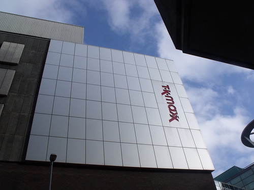
Wades Building - TK Maxx - Dudley Street by ell brown, on Flickr
ellbrown
ell brown on Flickr
Another fond favourite of mine is Lower Severn Street as it shoots us over John Bright Street from its Suffolk Street beginnings, down to Hill Street and the old New St Station Car Park entrance.
Got some shots on John Bright Street yesterday. That sculpture is in one of my books, but it isn't there now.
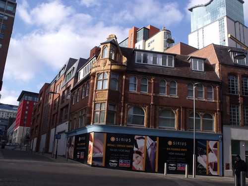
Geoffrey Buildings, John Bright Street by ell brown, on Flickr
Interesting to note that this used to be a car show room

Roseberry Buildings, John Bright Street by ell brown, on Flickr
