Hi I'm new to this forum, but I'm from Birmingham originally. I've been researching my family history since 2008. Right now I'm looking for my family in the early 1900's. They lived in Small Heath and Yardley. So I'm trying to find an online map of this area in 1920. Google says this forum has such images. So how do I find them, please?
-
Welcome to this forum . We are a worldwide group with a common interest in Birmingham and its history. While here, please follow a few simple rules. We ask that you respect other members, thank those who have helped you and please keep your contributions on-topic with the thread.
We do hope you enjoy your visit. BHF Admin Team
You are using an out of date browser. It may not display this or other websites correctly.
You should upgrade or use an alternative browser.
You should upgrade or use an alternative browser.
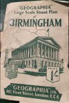
Old Maps of Birmingham
- Thread starter peteralw
- Start date
-
- Tags
- maps. old maps
devonjim
master brummie
As good as most
Hi I'm new to this forum, but I'm from Birmingham originally. I've been researching my family history since 2008. Right now I'm looking for my family in the early 1900's. They lived in Small Heath and Yardley. So I'm trying to find an online map of this area in 1920. Google says this forum has such images. So how do I find them, please?
pjmburns
master brummie
If you know a road then use the search on here (magnifying glass top right) to look for the name. If there is a thread then start at post 1 and you will most likely find a map somewhere on the threadHi I'm new to this forum, but I'm from Birmingham originally. I've been researching my family history since 2008. Right now I'm looking for my family in the early 1900's. They lived in Small Heath and Yardley. So I'm trying to find an online map of this area in 1920. Google says this forum has such images. So how do I find them, please?
Banjo
master brummie
I've tried all ways online to find a street map or Kelly's directory referring to the chip shop on Stoney Lane Sparkbrook in 1954. Looking at Google Earth I think the house number would have been around No 137 - 141. My Aunt Bessie (Betty) Middleham ran it then for a while with Uncle Frank. I visited as many times as possible because of the free chips I got. The thing is, Aunt Bet ran many cafes, pubs and clubs during the 50s, 60s and 70s but I'm not sure if she actually owned them or was a manager for them. If anyone remembers it or can offer advice, I would be most grateful.


brummy-lad
master brummie
In Kelly's 1955 listed at 171 Stoney Lane, Sparkbrook is Harry Ravenscroft (fried fish dealer).
Banjo
master brummie
Thank you all for your help.
MWS, your map shows me it was No171. Incidently, it also shows 69 Leamington Rd which was where I lived at that time.
PJMBURNS, I assume they lived above the shop in 1954 but not sure for how long they were there. The electoral roll you posted made me smile because I lived there with them a short while in 1956 but do not remember those other people living there.
BRUMMYLAD, your post makes me think that perhaps she was working for someone else.
I had an eventful childhood (but I'm okay now) where I lived at many different households throughout the 50s. The only Family I stayed with was at Aunt Bet's in Berners St 1956 and later at the Manor Tavern Pub in 1957-8.
Last edited: