-
Welcome to this forum . We are a worldwide group with a common interest in Birmingham and its history. While here, please follow a few simple rules. We ask that you respect other members, thank those who have helped you and please keep your contributions on-topic with the thread.
We do hope you enjoy your visit. BHF Admin Team
You are using an out of date browser. It may not display this or other websites correctly.
You should upgrade or use an alternative browser.
You should upgrade or use an alternative browser.
Carrs Lane
- Thread starter oldMohawk
- Start date


Radiorails
master brummie
I think that pic of Lees building was already here but shown from a different aspect. It was Carrs Lane/ Moor Street area from memory.
oldMohawk
gone but not forgotten
Having a look at some pre-war and post-war aerial images of Carrs Lane there was very considerable bomb damage on the left side looking up from Moor street and the site was cleared. It seems that the building (Jay's Store) on the corner with High Street survived but buildings below it were seriously damaged. I can also see a trolleybus coming out of Carrs Lane on its way to Albert Street and a single tram track as can be seen in Viv's image 5.

oldMohawk
gone but not forgotten
With reference to the image in the previous post showing the cleared land of bomb damaged buildings in Carrs Lane.
Pic 1 here (enlarged part of Image5) shows there is a building set back and behind the building possibly on Carrs lane.

Arrow 1 marks a ledge on the front building
Arrow 2 marks a ledge on the set back building.
Arrow 3 marks the lower (John Lees) building.
Note a stone facing on the corner of the set back building and the spiral staircase.
A pitched roof on the left might be the Corner Pub.
Pic 2

Is an aerial view of the undamaged buildings as they were in 1933.
Arrow 1 marks a ledge on the front building
Arrow 2 marks a ledge on the build behind
Arrow 3 marks the lower (John Lees) building.
Note a stone facing on the corner of the set back building and a hint of the spiral staircase ... shows better on an iPad.
All speculation of course ... does anyone know what businesses were in the two large buildings?
shoothill
Pic 1 here (enlarged part of Image5) shows there is a building set back and behind the building possibly on Carrs lane.
Arrow 1 marks a ledge on the front building
Arrow 2 marks a ledge on the set back building.
Arrow 3 marks the lower (John Lees) building.
Note a stone facing on the corner of the set back building and the spiral staircase.
A pitched roof on the left might be the Corner Pub.
Pic 2
Is an aerial view of the undamaged buildings as they were in 1933.
Arrow 1 marks a ledge on the front building
Arrow 2 marks a ledge on the build behind
Arrow 3 marks the lower (John Lees) building.
Note a stone facing on the corner of the set back building and a hint of the spiral staircase ... shows better on an iPad.
All speculation of course ... does anyone know what businesses were in the two large buildings?
shoothill
Last edited by a moderator:
Dennis Williams
Gone but not forgotten
MWS
from Bham
There appear to be a number of mentions of a menagerie in Carrs Lane in the 1860s under various names - Mander's Excelsior Menagerie (1862) and Wombwell's Royal Excelsior Menagerie (1866).
There's also a mention in 1854 of Wombell's Huge Menagerie occupying the vacant ground at the top of Carrs Lane and corner of High St.
And another in 1857 of Windsor Castle Menagerie exhibiting on Moor St bottom of Carrs Lane
There's also a mention in 1854 of Wombell's Huge Menagerie occupying the vacant ground at the top of Carrs Lane and corner of High St.
And another in 1857 of Windsor Castle Menagerie exhibiting on Moor St bottom of Carrs Lane
Last edited:
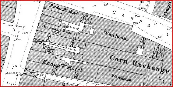
Another report shows that the menagerie was next to the church, so was on the ground in red on the 1880s map


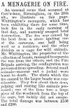
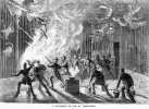
There were a number of vans advertised for sale by the menagerie shortly after,but the menagerie seemed to survive in Ireland, as this amazing cutting from a year later shows. A child was injured by a leopard, the crowd killed the leopard and the owner was compensated for the value of it

There were a number of vans advertised for sale by the menagerie shortly after,but the menagerie seemed to survive in Ireland, as this amazing cutting from a year later shows. A child was injured by a leopard, the crowd killed the leopard and the owner was compensated for the value of it
how awful for the animals that perished but thankfully we have now come a long way to ensure this sort of thing does not happen nowSaw this from Graham Knight, and wondered if anyone has any further information on Whittington's Menagerie in Carr's Lane....pics from 1870....?
lyn
Dennis Williams
Gone but not forgotten
Another report shows that the menagerie was next to the church, so was on the ground in red on the 1880s map
View attachment 180324View attachment 180325
There were a number of vans advertised for sale by the menagerie shortly after,but the menagerie seemed to survive in Ireland, as this amazing cutting from a year later shows. A child was injured by a leopard, the crowd killed the leopard and the owner was compensated for the value of it
View attachment 180326
Dennis Williams
Gone but not forgotten
Once again...you never let me down! Genius sleuthing....many many thanks...
Last edited:
This building was planned in 1899 above the GWR tunnels beneath Carrs Lane. I expect it must have required specific engineering. Not much left of the old street and buildings with Moor Street Queensway cutting across it near Moor Street Station. So unable to tell if this was built.
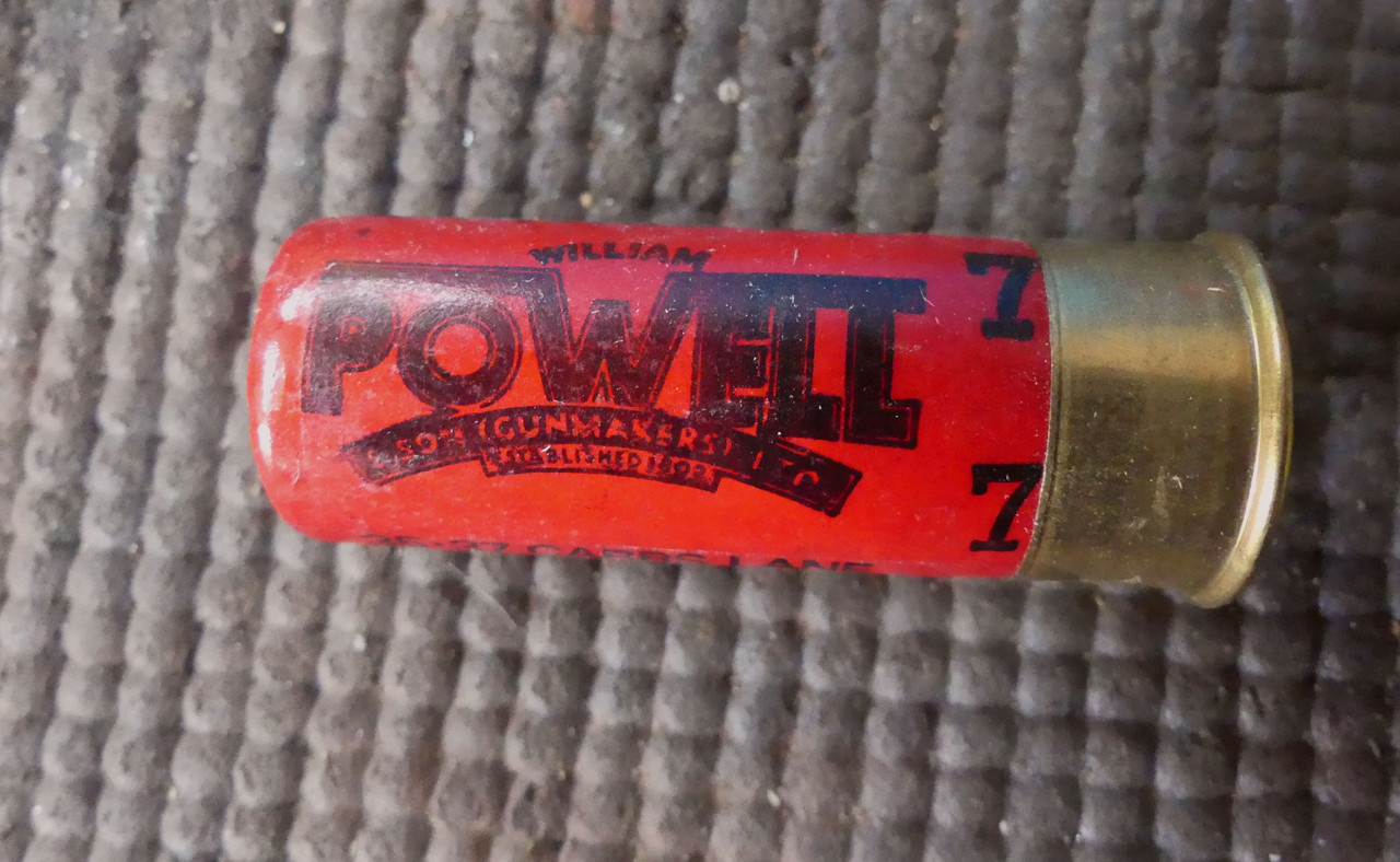
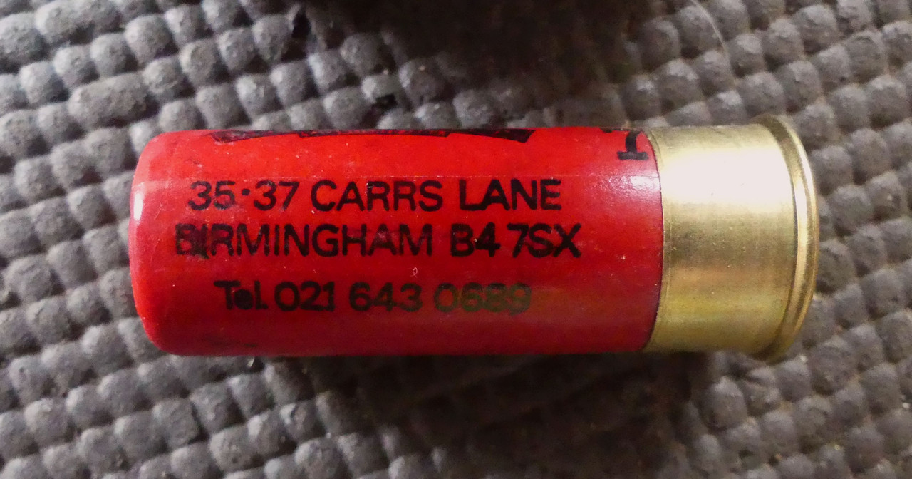
We dont seem to have much in the way of images of Carrs Lane (except for the Chapel and Powells, the gun makers). Showells dictionary tells us:
"Originally this is believed to have been known as "Goddes Cart Lane," and was sufficiently steep to be dangerous, as evidenced by accidents noted in past history"
Viv.
Last edited:
The late Phil posted this on another thread of the Corner pub at the Carrs Lane/Moor Street junction. Viv

Looking through various Internet references, Goddes Carte Lane may refer to a cart to carry the sacraments to St Martin's-in-the-Bull Ring, or a mobile stage for mystery plays. But there is no evidence that survives of either reference.
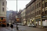
I've gathered together a few images posted on other threads showing glimpses of Carrs Lane. They're not particularly striking in terms of architecture, so it's no surprise there are few photos of the street. The majority of references to Carrs Lane seem to be either about buses using the lane/termini for bus routes, the Chapel or the Powell business.
This one was posted by Stitcher on the Electric Trams thread

This one of Carrs Lane in 1958 was posted by mossg on the William Powells Gunmakers Shop thread.

This last one was posted by gingerjohn on the Dale End thread. Carrs Lane is the first turning on the left. Later M&S would occupy the site behind the policeman
I've gathered together a few images posted on other threads showing glimpses of Carrs Lane. They're not particularly striking in terms of architecture, so it's no surprise there are few photos of the street. The majority of references to Carrs Lane seem to be either about buses using the lane/termini for bus routes, the Chapel or the Powell business.
This one was posted by Stitcher on the Electric Trams thread
This one of Carrs Lane in 1958 was posted by mossg on the William Powells Gunmakers Shop thread.
This last one was posted by gingerjohn on the Dale End thread. Carrs Lane is the first turning on the left. Later M&S would occupy the site behind the policeman
Last edited:
the view in your last photo looks a tad different now viv...had to take this 2010 street view so that we could see the corner of carrs lane and high st

 www.google.com
Google Maps
Find local businesses, view maps and get driving directions in Google Maps.
www.google.com
A very nice image of Powells shop front windows with very full displays in better times. Viv.

Please would someone check if Town Mills was located in Carrs Lane - see post #16 tram photo. The building to the left is named Town Mills. Thanks.
To the right of the tram is an Atkinson pub, so it could be the Corner pub. Viv.
To the right of the tram is an Atkinson pub, so it could be the Corner pub. Viv.
Last edited:
Great thank you. Viv.
devonjim
master brummie
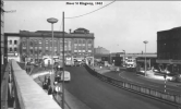
Firebird, 1950's coffee bar on right.View attachment 97036Carr's Lane viewed from Moor Street courtesy of John Ball 1963
Attachments
Last edited by a moderator:
Radiorails
master brummie
The tram referred to in post 16 I believe was going to Kyotts Lake Road depot on the last day of the BCT trams on 4th. July, 1953. Actually I believe it is was coasting down Carrs Lane from its junction with High Street as there doesn't seem to any overhead wires. It will take a right hand turn into Moor Street where it will re-connect to the overhead line. A BCT breakdown lorry was provided to give a tram a shove should they require assistance at that right hand turn. From Moor Street the journey was through Digbeth and Camp Hill ending at Kyotts Lake Road.
Last edited by a moderator:
That John Ball 1963 photo is the best one I've seen of Carrs Lane. Thanks for posting Jim.Firebird, 1950's coffee bar on right.
I think the building in the architectural drawing in post #14 shows up on that photo - ie. to the left of the dark building with the pediment (ie Carrs Lane Chapel). This aeriel view is from StevebHx's Old Birmingham photos thread. The yellow dot's are, I think, the building in the architectural drawing post #14 and the red dot marks Powells. But does anyone know if underneath this/these buildings was where the GWR tunnel was located ?

The businesses to the right in John Ball's photo look like they're boarded/closed down. So the photo was probably taken just before demolition to make way for Moor Street Queensway perhaps (?).
Thanks all ! Viv
Last edited:
A comparison of the John Ball photo Jim posted in post #22 with present day Streetview.

Source: John Ball photos

And the Streetview below shows a little section of road in the middle of Moor Street Queensway that's still labelled Carrs Lane ! Moor Street Station buildings are to the top right of this view. Viv.

Source: John Ball photos
And the Streetview below shows a little section of road in the middle of Moor Street Queensway that's still labelled Carrs Lane ! Moor Street Station buildings are to the top right of this view. Viv.
Last edited:
devonjim
master brummie
That John Ball 1963 photo is the best one I've seen of Carrs Lane. Thanks for posting Jim.
I think the building in the architectural drawing in post #14 shows up on that photo - ie. to the left of the dark building with the pediment (ie Carrs Lane Chapel). This aeriel view is from StevebHx's Old Birmingham photos thread. The yellow dot's are, I think, the building in the architectural drawing post #14 and the red dot marks Powells. But does anyone know if underneath this/these buildings was where the GWR tunnel was located ?
View attachment 180528
The businesses to the right in John Ball's photo look like they're boarded/closed down. So the photo was probably taken just before demolition to make way for Moor Street Queensway perhaps (?).
Thanks all ! Viv
.png")
A map showing line of GWR tunnel
Last edited by a moderator: