• Welcome to this forum . We are a worldwide group with a common interest in Birmingham and its history. While here, please follow a few simple rules. We ask that you respect other members, thank those who have helped you and please keep your contributions on-topic with the thread.

    We do hope you enjoy your visit. BHF Admin Team

Then & Now

I've been exploring the Historic England website (www.historicengland.org.uk) - for those who have not been on it before it is full of many photos I have not seen before - a search on "Birmingham" brings back nearly 7700 for a start and whilst many are recent and some are duplicated there are hundreds and hundreds of brilliant old photos on there - and some (as Drew Prichard would say) are "absolute belters"! Even better - once you have opened the photo in high resolution by clicking the "+" symbol you can zoom in - and the zoom displays the close up in even higher resolution in most cases.
An example - this is Moat Lane (by the Bull Ring - St Martins Church in the distance) in 1902:-
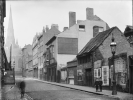
1668119083093.png
The zoom function then allows you to see this level of detail:-
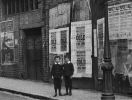
1668119171474.png
So far I have looked at sets of photos covering such diverse topics such as the Bull Ring demolition / construction from 1959-1966, Curzon St Station before it closed as a goods yard in the mid 1960s, a set covering the Theatre Royal in New St in 1901, the Grand Hotel in 1891, Queens Hotel just before it was demolished in 1966, a study of St Pauls Square in 1941, Ansells Brewery expansion in the late 1960s and a lot showing bomb damage during 1941-42. Also lots of city centre photos from the late 1800's / early 1900's- this is where the zoom function comes into its own

I have also found some of High St Sutton in 1942 - tonight I walked the dogs to the same locations to do a "then and now". Firstly numbers 20-24 - full view and zoomed - the sign on the lamppost dates the scene perfectly:-
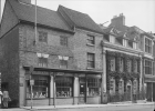
1668119742145.png
1668119865596.png
And the same scene earlier this evening - only the frontages have changed:-
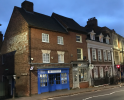
1668119939370.png

Then - just to the left we have numbers 38-42:-
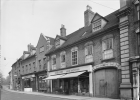
1668120003612.png
I was surprised to see a bakers called "W.Bromwich" - but my wife's uncle said they were the Greggs of the day, and apparently had a large bakery behind the shop, accessed through the archway on the right:-
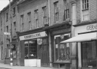
1668120113299.png
Present day - again only the shop fronts and a chimney stack have changed:-
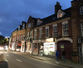
1668120196443.png
 
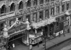
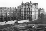
Make the time to do it - here are a few assorted examples of photos from the site:-
View attachment 174871
St Pauls Square 1941

View attachment 174872
Union St 1941

View attachment 174873
Corporation St 1890

View attachment 174874
Snow Hill Station 1965

View attachment 174875
King Edwards School from New St Station roof 1935
Mark, thank you for those photos! Reflecting how magnificent the buildings were in their day. The engineer in me marvels at how difficult it was to build them so long ago without all we have today and how well they lasted!
 
Mark, thank you for those photos! Reflecting how magnificent the buildings were in their day. The engineer in me marvels at how difficult it was to build them so long ago without all we have today and how well they lasted!
For anybody wanting to take a much closer look, and learn a bit of history, about some of the old buildings still standing in the city centre, try the pocket guide book "FACES of OLD BIRMINGHAM", I think it is only available from Symphony Hall Gift Shop. (130 pages in full colour)
PA739
 

Attachments

  • bc 5.jpg
    bc 5.jpg
    1.2 MB · Views: 10
to be able too pay that much rent a month,just goes to show how much some folks ern . i could not afford half that when working.and still cant...i am just as happy here in my hovel in the stick, maybe happier:grinning:
 
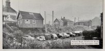
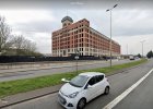
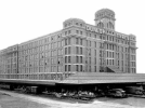
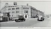
Fort Dunlop, 27 November 1952.

View attachment 174986

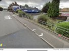
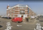
Google view…Fort Parkway


View attachment 174987
For info - these are not the same building! The picture from 1952 is actually the Commercial Office block from the northern end of the site - the IBM computer used to be on the ground floor. This was demolished (I think) in the mid-1990's. The "Fort Dunlop" building is actually the old base stores building at the south end of the site which was used until the early 1980's then lay derelict for many years until it became what it is today ("The Fort").
 
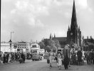
A 'Then' photo of the Bull Ring I saw as a child. It was untidy, noisy and busy and most of us used buses. Clothing was a bit formal in those days and there are probably no jeans or trainers in the scene.
1_AE8E0193052E.jpeg
image from

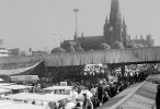
Then someone decided to build a large concrete road across the place and traffic could move more quickly to the next traffic jam. I didn't tend to visit the area in these times apart from driving over it on the road.
2_img915.jpg
image from

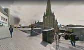
Today it has all changed again and I have never actually seen this view in real life but Google visited on a quiet day. It looks ok and tidy.
bullringnow.jpg
 
A 'Then' photo of the Bull Ring I saw as a child. It was untidy, noisy and busy and most of us used buses. Clothing was a bit formal in those days and there are probably no jeans or trainers in the scene.
View attachment 175065
image from

Then someone decided to build a large concrete road across the place and traffic could move more quickly to the next traffic jam. I didn't tend to visit the area in these times apart from driving over it on the road.
View attachment 175066
image from

Today it has all changed again and I have never actually seen this view in real life but Google visited on a quiet day. It looks ok and tidy.
View attachment 175067
The first picture is memorable! At least the cathedral is still there, fingers crossed!
 
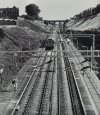
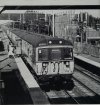
Leaving Adderley Park on 28 August is emu No 310 085 as the 12.25 to Coventry. Tickets were not collected or checked at the old New Street station. Ticket collectors boarded trains approaching Birmingham at Adderley Park to collect tickets before they reached New Street.

(The London and Birmingham Railway, 150 years on by Gould, David.)

E8CDA69B-0776-4F34-81DC-FD49163521B8.jpeg

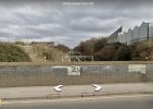
Google View.

72AED993-A6A5-41DC-B02B-67288D853FBB.jpeg
 
Last edited:
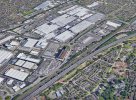
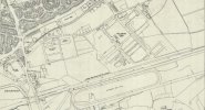
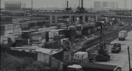
“As the line emerges from the Adderley Park cutting it passes Lawley Street Freightliner terminal which occupies the site of the short lived Birmingham & Derby Junction terminus.”

(The London and Birmingham Railway, 150 years on by Gould, David. 1987)​


A0A6BFAA-1E94-4E37-91A9-D4F9503C5E9A.jpeg

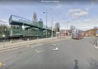
Google view…

BC306DBB-9749-48C2-8786-82EF22432CEC.jpeg
 
Last edited:
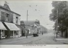
Court Road Balsall Heath - nothing special but trams ran along it. There was a Paynes Shoe Repairs shop 'Always Dependable' and H.Betts Gents Outfitters selling Swallow Raincoats with nice car outside. Tram 723 is turning right into Edward Road.
View attachment 168767

Today - no trams but the buildings are still there minus the attic rooms and Pizzas can be bought. The old houses further along the road are still there.
View attachment 168768

One to add to OldM’s picture, minus the tram…

E34D1BA6-928A-4F13-BEF7-257735BC8041.jpeg
 
Back
Top