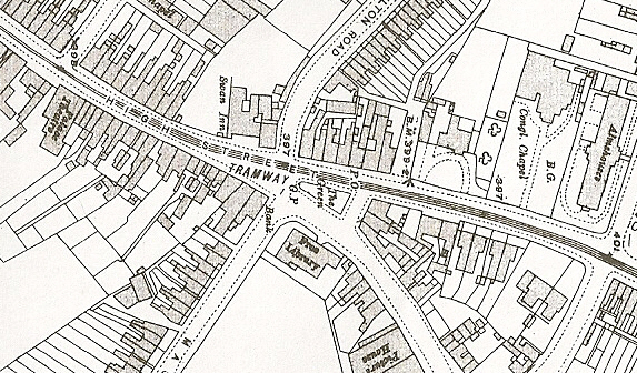
Thanks for that PMC. I think that the second picture is the most informative and the sign post plinth may be in the same spot but not the same material. We are looking at very different eras here and your old picture did not have the triangular cultivated road separator with the railing around it. The second picture is looking south and Masons Road is on the left I think. The road on the right is not shown on the 1890 survey map and maybe most of those buildings were not present at the time of the old picture. So assuming my assumptions to be correct (been wrong before) the old shop would have been off to the right in the second picture and the Green shown on the map has a building on it. The pillar there today is also about that same spot and it all seems to line up.
-
Welcome to this forum . We are a worldwide group with a common interest in Birmingham and its history. While here, please follow a few simple rules. We ask that you respect other members, thank those who have helped you and please keep your contributions on-topic with the thread.
We do hope you enjoy your visit. BHF Admin Team
Where is This? 90
- Thread starter Phil
- Start date

