Hi got your message and have looked to see what pictures I had of Watery Lane
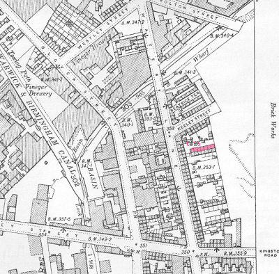
only able to find these 3. The first is Watery Lane as it is today and it runs from the Island junction with Great Barr St /Lawley Street/Garrison Lane. The second is a picture of the Barrel Pub that used to be on the corner of Watery Lane and Kingston Hill (which is the left of picture) The shop after the pub on Kingston Hill used to owed by Shepherd family. Finally the last picture shows the Sailors Return which again was on the corner of Watery Lane and Gt Barr St (which is off to the right) If you want to find detailed maps of the area you can get plenty off the internet or Google Eart in both Map and satelite form. I lived in Watery Lane when I was very very young and have very little memory except that I believe we lived above a greengrocers which was on the oposite corner to the Barrel Pub and I guess we must have move to Lower Trinity st whilst I was still ayoung child but we stayed in the area and I attended school at Ada Road (St Andrews)
I have various members of my Rogers family living in Watery Lane from about 1917 to at least 1955. Addresses were, 5 back 211, 4 back 211 and 5 court 26.
It seems any pictures or maps that were on this thread have now disappeared? Would it be possible to post some of them again please as I would like to try and pinpoint Watery Lane.
Many thanks
Suzanne


