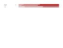
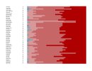
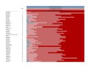
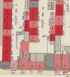
Hello, For the last 10 plus years, I have been working on an on-going project to create a coloured poverty line map for Birmingham. Over the years I have dropped in and out with my research and studies. Similar to Charles Booth 'Life and Labour of the people in London' and his coloured maps, as well as Benjamin Seebohm Rowntree and other Historians, I have created my own methodology to create a coloured Poverty Line Map.
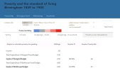
Using the 1881 census and my research records for income and expenditure for each household, I am able to ascertain if the family are in poverty or very poor, poor, moderate or comfortable. I have just finished creating a website that explains all. https://birmingham1889.wixsite.com/birmingham1889
The reason for this post is, it takes me months to complete one street. I have downloaded more or less 140 streets census records. If anybody is interested in assisting me in growing the map, please let me know. I am not looking at any commercial incentives, its purely a research thesis that some people I hope will find interesting. I need individuals who can update shared google spreadsheets for various streets using my data records.
Thank you Andy


Last edited:

