Phil
Gone, but not forgotten.
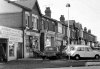
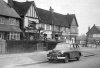
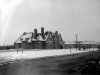
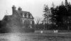
Now at the top of the hill (10) we pass by on the left Gowan Road (11) and on the right College Rd (12). Further up as we pass the Morris Commercial Club we can see the Parkfield café (13) next door and Parkfield Rd itself (14).
Attachments
-
 10 Alum Rock Alum Rock Rd.jpg72.4 KB · Views: 182
 -
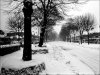
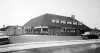
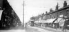
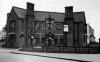
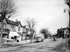
 11 Alum Rock Gowan Rd 1935.jpg143.6 KB · Views: 186
 -
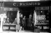
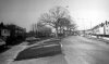
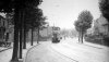
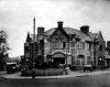
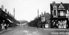 12 Alum Rock Alum Rock Rd - College Rd (7).JPG98.9 KB · Views: 168
 -
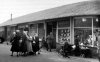
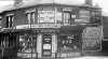
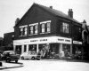
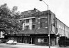
 13 Alum Rock Alum Rock Rd Parkfield Cafe Nr Parkfield Rd.jpg145.2 KB · Views: 176
 -
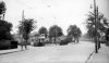
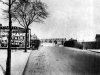
 14 Alum Rock Parkfield Rd 1972.jpg105 KB · Views: 172
![24 alumrock1932[1].jpg](/forum/data/attachments/6/6019-9652e2cac09d57e7fd12f66bcdc2e534.jpg?hash=llLiysCdV-)