• Welcome to this forum . We are a worldwide group with a common interest in Birmingham and its history. While here, please follow a few simple rules. We ask that you respect other members, thank those who have helped you and please keep your contributions on-topic with the thread.

    We do hope you enjoy your visit. BHF Admin Team

OLD AND NEW PHOTOGRAPHS

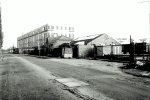
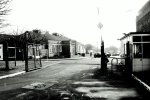
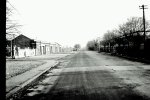
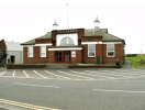
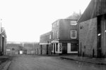
This is indeed Ashold Farm Road - looking towards the Jaguar plant. One the left is the old Dunlop Garages where the test fleet was housed - this is now industrial units. On the right is the top end of Fort Dunlop itself with the main gatehouse and staff entrance just out of shot - the building on the extreme right is the canteen block which also housed meeting rooms, the company shop and a branch of TSB! Later entrance to Dunlop Motorsport is a bit further down on the right. Now a printing plant (Trinity Mirror?) which I believe is itself closed. Tyrefort building was built the other side of the photo on the site of the commercial offices block.
Always a pleasure to play at "the dunlop" such a quality sports ground. Mind M&B always provided a crate of ale at the end of a game which perhaps made them the top choice venue.
 
Firstly can I thank Mark for the correction and additional information he has provided in relation to the Dunlop picture and secondly hope he is around to view the next few pictures from Dunlop so that we have the correct information!!
Not much i can add as you can see what I know, buildings and sheds by the side of the what we now know is the commercial building
20230110212038_07.jpg
 
The other "Tour" on this roll of photos is around Brindley Place and Sheepcote street, although the picture are similar I don't think I have posted them before.
First is a shot taken in Sheepcote street looking across the site of what is now Brindley Place and towards the line of Broad Street, amazing the changes taken in a few years, this is 23rd March 1992 and the ICC is already in place. I believe we are on the banks of one of the canals or arms off it here.
20230110212336_02.jpg
 
The other "Tour" on this roll of photos is around Brindley Place and Sheepcote street, although the picture are similar I don't think I have posted them before.
First is a shot taken in Sheepcote street looking across the site of what is now Brindley Place and towards the line of Broad Street, amazing the changes taken in a few years, this is 23rd March 1992 and the ICC is already in place. I believe we are on the banks of one of the canals or arms off it here.
View attachment 185808
steve the city is forever changing...as someone once said many years ago..."will birmingham ever be finished" think the short answer is no...its just a never ending round of demolish..build..demolish build

lyn
 
We now move to the front of the Indoor Arena , easier than trying to work out what the name of the sponsor is this week!!, We have the line of Galton Tower etc and the Post Office Tower peeking over the top. This piece of land is now covered by apartment and the piece of water has come into its own as the canalside has developed.


20230110212336_03.jpg
 
steve the city is forever changing...as someone once said many years ago..."will birmingham ever be finished" think the short answer is no...its just a never ending round of demolish..build..demolish build

lyn
The funny part is they always seem to demolish the good bits and leave the rubbish behind :worried:
 
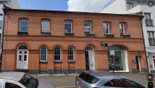
Moving on to Sheepcote Street and looking back and forth with Street View I believe this is 26 Sheepcote Street judging by the window and arch layout , I don't usually put a modern image with the picture but I am quite proud of finding this one !!
Looks a good "save"


20230110212336_04.jpg
1699476065977.png
 
The next picture is the building along covered in scaffolding and hoping to save the frontage, you can just see the edge of it on the modern picture above - not sure they have been successful - it looks like the frontage but now looks like any other modern front and has lost that historic edge.
20230110212336_06.jpg
 
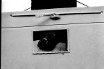
The last picture on the roll is more to show what I had to work with - not blowing my own trumpet people do a lot better job than me, but shows how the photo of the photo is captured . Stuck to a board and hung up outside hence the shadows on some picture,
20230110212038_11.jpg
not the best but better than been lost, any offers, I am aware that this method of taking picture did change later on !!
20230110212038_10.jpg
 
For info - the pictures above are not of the extant Fort Dunlop building by the M6, but of the commercial office block at the top end of the site, which housed the mainframe computer, buying department, etc. This was demolished not long after these photos were taken - I can remember one afternoon when we were working in the computer annexe building next to it, and the demolition men bought down half an entire floor in one go - it was like a bomb had gone off and cracked some of the brickwork on our building.

This is what the computer annexe building looked like shortly before it too was demolished a few years later:-
View attachment 185783
View attachment 185784
View attachment 185785
View attachment 185786
View attachment 185788

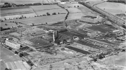
Here is an Aerofilms view of Fort Dunlop in 1937 - the "Fort" building is on the right and the Commercial Offices building is on the left:-
1699480310985.png
 
Firstly can I thank Mark for the correction and additional information he has provided in relation to the Dunlop picture and secondly hope he is around to view the next few pictures from Dunlop so that we have the correct information!!
Not much i can add as you can see what I know, buildings and sheds by the side of the what we now know is the commercial building
View attachment 185802
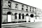
The end building with the gable roof is where in latter years you could have a set of brand new "test tyres" fitted to your car - all you had to do was log your mileage on a regular basis. A nice "staff perk"!
 
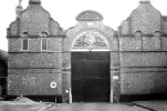
Next we have a security gate and single storey building with the sign " safety starts here", I must say the chainlink gate looks a bit flimsy though.
View attachment 185804

Again courtesy of Aerofilms this is the the main gate in 1930:-
1699514452123.png
As you can see an additional building (like a small house) then was in the main gate. The canteen block on the left had different levels of dining room including one with silver service for executives! The steps on the left were in latter years the entrance to the company shop where you could buy just about anything with the "Dunlop" brand on it. Behind it was a small branch of TSB. The small building with the flagpole opposite the steps was the council chamber which later (I started in 1982) became the Dunlop museum.
1699514890711.png
 
Roll 41 now , and a more of a mix of types although there are pubs!!
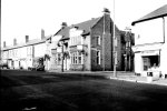
First we have a pub corner of Yardley Green Road and Blakeland Street, M&B pub with the leaded windows and large clock over the entrance and patterned brickwork on the chimney. Cannot quite see the name of the pub , but it has had a few names, but surprisingly remains intact with large clock still there , lot quieter on the road then.
EDIT: Pub was called Samson & Lion - Thanks Tinpot.
20230108160930_02.jpg
 
Last edited:
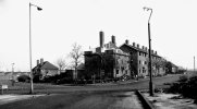
We now move to what my list says roads and streets around Garrison Lane and Montague Street I have no year but are thinking around 1991. Taken when there was the wholesale redevelopment of what became Bordesley Village . We have the end of Barwell Street here and the start of the demolition, Garrison Lane (?) crossing with Wolsesley Street and Gordon street in front I think.

20230108160930_04.jpg
 
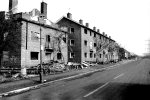
We now moved down Wolseley Street and a closer picture of the demolition , and the subsequent fly tippers, shame that these solid looking buildings were in the way of demolition, but not sure of how the inhabitants viewed them. Fine old lamppost and a few battered trees
20230108160930_06.jpg
 
Roll 41 now , and a more of a mix of types although there are pubs!!
First we have a pub corner of Yardley Green Road and Blakeland Street, M&B pub with the leaded windows and large clock over the entrance and patterned brickwork on the chimney. Cannot quite see the name of the pub , but it has had a few names, but surprisingly remains intact with large clock still there , lot quieter on the road then.
View attachment 185935
Samson & Lion. I used to go to the outdoor on Blakeland St as a child. It was Dad's local.
 
I am now stuck for a location as I cannot match the picture to the list, a cafe that was once was a pub ( there seems to be a name board on the wall - in a heavily industrial area, we presume Digbeth area as some of the later pictures are this area. Road is on a slope down to the factory at the end. Any offers?
20230108160930_07.jpg
 
Gun Barrel Proof House in Banbury Street. Built in 1813, brick built building which has seen many changes around it. Note the two gun barrels either side of the entrance to protect the walls.
The Birmingham Proof House was established by Act of Parliament in 1813 to ensure small arm user safety, as far as it is practicable, by the compulsory and statutory proof of small arms. http://www.gunproof.com/

20230108160930_09.jpg
 
I am now stuck for a location as I cannot match the picture to the list, a cafe that was once was a pub ( there seems to be a name board on the wall - in a heavily industrial area, we presume Digbeth area as some of the later pictures are this area. Road is on a slope down to the factory at the end. Any offers?
View attachment 185938
could well have been a pub steve but for me it could be anywhere...hopefully someone may know its location

lyn
 
could well have been a pub steve but for me it could be anywhere...hopefully someone may know its location

lyn
Its the slope down to a junction with a factory wall at the end and the road to the right , pictures on the roll come from Bordesley then go around Digbeth and head towards Curzon Street but I cannot make it fit. !! I appreciate peoples guesses as I have not got a clue and they are no worse than mine.
 
Its the slope down to a junction with a factory wall at the end and the road to the right , pictures on the roll come from Bordesley then go around Digbeth and head towards Curzon Street but I cannot make it fit. !! I appreciate peoples guesses as I have not got a clue and they are no worse than mine.
steve casting my mind back a long way marks friend who took that photo did print some off and i posted a few on the forum..i cant recall now if the location was on the back of the photo or if i posted it and someone knew the location..sure ive seen it before..bit late now but i think ive still got the actual photo in a box of others ...i will see if i can find them tomorrow and report back...lyn
 
I am now stuck for a location as I cannot match the picture to the list, a cafe that was once was a pub ( there seems to be a name board on the wall - in a heavily industrial area, we presume Digbeth area as some of the later pictures are this area. Road is on a slope down to the factory at the end. Any offers?
View attachment 185938
maybe off AB row Gosta Green...vague memory ?
 
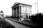
Moving on with our wander around the Curzon Street area, apologies for the picture quality- a scene which is unrecognisable today , Curzon Street Station building, on the right are the parcel depot and to the left are a few industrial buildings, all this has now gone to be cleared on the right and on the left we now have Think Tank, and over the top of the hoarding is The Woodman
20230108160930_10.jpg
 
Moving on with our wander around the Curzon Street area, apologies for the picture quality- a scene which is unrecognisable today , Curzon Street Station building, on the right are the parcel depot and to the left are a few industrial buildings, all this has now gone to be cleared on the right and on the left we now have Think Tank, and over the top of the hoarding is The Woodman
View attachment 185945
woodman still closed steve and totally isolated thanks to HS2...i think only time will tell if the pub survives and re opens

lyn
 
Back
Top