• Welcome to this forum . We are a worldwide group with a common interest in Birmingham and its history. While here, please follow a few simple rules. We ask that you respect other members, thank those who have helped you and please keep your contributions on-topic with the thread.

    We do hope you enjoy your visit. BHF Admin Team

Moats Moated Sites of Birmingham and surrounding areas

Vivienne14

Kentish Brummie Moderator
Staff member
Last edited:
An interesting and informative summary of moated sites around Birmingham.from Birmingham.gov.uk. I always believed moats were for defensive purposes, but it seems not. And Birmingham once had 90 moated sites ! There would have been various reasons for having a moat, but one I hadn't appreciated is as a social status symbol like a mini castle.

Screenshot_20240712_165729_Samsung Notes.jpg
 
Last edited:
Anyone know where this would have been on the Warwick Road, Acocks Green ? Extract from Birmingham City Council site

Trenches were dug in a car park on Warwick Road to investigate a medieval moated site as part of an upcoming planning application. Part of the moat is indicated by an L-shaped pond on 19th century maps, but nothing is now visible above ground.

The trenches revealed a pebble surface which may have been a yard or path, a pit and part of the moat, which had a channel leading into it to keep it water-filled.
 
Just checked out the Acocks Green History Society site and there were, apparently 5 moats - as listed below. The Gatteridge Road moat must be the one mentioned in post #7

Hiron Hall Moat
Moat arms to the south and east of "Iron Hall" can be seen on the 1st edition OS map

Broomhall Moat
Moat arms can be seen on two sides of the house on the 1st edition OS map

Tyseley Hall
The 1st edition OS map shows an L-shaped pond to the south-east of Tyseley Farm

Pearl Grove Moat
The 1st edition OS map shows an L-shaped pond forming the north-east corner of the moat and a change in the direction of a field boundary possibly indicating the south-west corner.

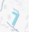
Warwick Road/Grattidge Road
The moat is indicated by an L-shaped pond, on the 1st edition OS map, forming the south-west and south-east moat arms. A desk based assessment and evaluation were conducted in 2007. Excavated trenches revealed good survival of archaeological features in the south-east part of the site, consisting of a pit-like feature and cobbled surface within the interior of the moated enclosure. Further north-west, severe truncation had removed all archaeological traces with the exception of deeper features. The truncated base of the moat was found. A possible leat ran into the moat from the south-east. One sherd of medieval pottery and two fragments of medieval roof tile were found in the moat. The archaeological report can be accessed by entering the search terms 'Warwick Road Grattidge Road moat' in a search engine and choosing the archaeology data service link.
 
More on Kemp’s Moat…”In this field also was found a sword thrust into the ground, and this is now in the possession of Mr. Parker at the Yardley Post Office, and probably tells of a warlike encounter.”
(Birmingham Daily Mail, July 1911)

IMG_1476.jpeg
 
1886 map showing Hyron Hall moat
View attachment 193149
In the 1300s it was referred to as Huyon Hall. And I've also seen it referred to as ' Hiron Hall' and 'Iron Hall'.

This is from the late Bill Dargue:

Hyron Hall, first recorded as Huyon in 1349, was such an assart and was built with a moat surrounding it. Its 15th-century timber-framed successor survived to witness a Georgian rebuilding alongside it which stood until the late 19th-century. The original moated site is now occupied by Oaklands School in Dolphin Lane and the Hyron Hall is commemorated by a street name.
 
Last edited:
At the moment I can't find maps with the other moats marked (ie Pearl Grove and Grattidge Road/Warwick Road).
Still looking.
 
Hawkesley Farm - must be silting up Lyn. It's still marked as water on the terrain map.

And not a very good image of the information board, perhaps someone could post a copy if they're in the area.
 

Attachments

  • Screenshot_20240713_135952_Maps.jpg
    Screenshot_20240713_135952_Maps.jpg
    81.7 KB · Views: 8
  • Screenshot_20240713_084933_Chrome.jpg
    Screenshot_20240713_084933_Chrome.jpg
    279.9 KB · Views: 8
Last edited:
There was a moated house in Walmley, Sutton Coldfield called New Hall which I believe is now a hotel. When I was a child the house was owned by Sir Alfred Owen of the Rubery Owen company
 
There was a moated house in Walmley, Sutton Coldfield called New Hall which I believe is now a hotel. When I was a child the house was owned by Sir Alfred Owen of the Rubery Owen company


interesting mary...maybe we can look into that one a bit more

lyn
 
Back
Top