• Welcome to this forum . We are a worldwide group with a common interest in Birmingham and its history. While here, please follow a few simple rules. We ask that you respect other members, thank those who have helped you and please keep your contributions on-topic with the thread.

    We do hope you enjoy your visit. BHF Admin Team

Keith Berry's Photos (bhf Recovered)

On page 1 image 27 there is a photo that used to be on the "unknown images page" I left a message for Keith on the site saying that the building in the background was Nechells House on Dartmouth Street the first flatted factory units in Birmingham and therefore the photo must have been taken from the Aston Rd somewhere near Love Lane. It seems he was willing to accept that the Dartmouth St theory but wasn't quite sure about Aston Road.
Maybe a detailed old map showing buildings on Aston Road would help with identification. A line projected through the centre of the building would pass either through or very close to the distant gas holders.
 
Photos 6 and 7 in Page 11 show demolition of a modern looking maisonette. The roof and brickwork look good and the window frames are intact even though all the glass has been smashed out of them. Maybe they were being demolished to make way for the Aston Expressway or some other major road.

The first pic shows a tall building on the left with the sloping roof. It seems to be clad in polythene sheeting.
6wheremaisonette.jpg

The second pic shows part of a building name.
7kjccq1WF.jpg
 
I've added an additional page of Keith Berry's Canal photos in post#23 and will also place the page in the Canals of Birmingham thread
 
Last edited:
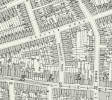
Here is map around junction aston road/dartmouth st if it is any help
 

Attachments

  • map c 1950 area around junc. aston road dartmouth st.jpg
    map c 1950 area around junc. aston road dartmouth st.jpg
    333.5 KB · Views: 27
Maybe a detailed old map showing buildings on Aston Road would help with identification. A line projected through the centre of the building would pass either through or very close to the distant gas holders.

Phil

I've just noticed that Keith had titled this photo Aston Street although he doesn't refer to it in the text. The attached photo shows a modern view from what must be almost the same spot only it has been renamed Holt St now. I've also attached a photo of Nechells House from around the same time as Keiths photo.
 

Attachments

  • Aston rd - Holt St.jpg
    Aston rd - Holt St.jpg
    135.7 KB · Views: 49
  • Nechells House Dartmouth St Flatted Factory 1.jpg
    Nechells House Dartmouth St Flatted Factory 1.jpg
    94 KB · Views: 38
Here is map around junction aston road/dartmouth st if it is any help

Mike

On your map the bottom grid line cuts across Aston Road just about where Keith would have stood to take photo. In fact if you had used the 1966-77 map it would shown Nechells House next to the junior school on Dartmouth Street as the complex wasn't built until the early 60's.
 
I suppose we will never know what that ornate little building was used for, but with Phil's information I think we know where it was situated.

Pic 1 showing Holt St and the building was somewhere in the ellipse shape. The canal junction is to the left and above the ellipse, and the bridge to the left. The canal branch goes off to the left of the gas works.
HoltSt1.JPG

Pic 2
A view from the gas works and '1' marks the canal bend, '2' marks the junction, and '3' the canal going past the gas works.
HoltSt2.JPG

Pic 3
A 1933 aerial view showing a similar view to Pic 2 with same markings, and the building could be somewhere in the ellipse.
HoltSt1933.JPG
 
thanks phil....silly me did not save keiths photos when i could so my next task is to save the ones that you are posting for us...:)
 
Keith Berry might have been thinking about some 'then and now' photos because here is a comment from under one of his photos..
I was so pleased to see this view today because it had niggled me that I could
not identify the location of these buildings from my old photograph of them.
 
Keith Berry visited George Street Lozells in the 1970s and photographed some houses being refurbished.
a44where5.jpg

Many years later in 2006 he revisited the street and photographed it showing that the houses were looking good, and the church roof had been re-tiled.
b27GeorgeSt.jpg

Recently Google went along the street and their photo shows the houses still looking good but the church appears to have been replaced by a new building ... still a church, maybe it is nice inside.
cGeorgeSt2016.JPG
Last edited: Aug 5, 2016
 
Last edited:
Concerning post 32......The two photographs are of the maisonettes which are still standing in Philips Street in Aston, close to the Aston Manor school, I had a couple of mates who lived in them during the 1960's, I think they are the only dwellings that survived the redevelopment of that area......
 
re photos post 41 a view very familiar to me as lived just a little way down in villa street and walked up george st either to the villa cross pic house or to go shopping with our mom...the old church you can just see is the weslyan chapel and it was in this church that aston villa football club was formed...the area was originally called aston villa...i was very sad when the church was demolished and replaced by a new one especially given its connection with the football club

lyn
 
OldMohawk has solved a problem for me. I now live 15 miles from Hay on Wye. In the 70s I was living in London but often visited there. I have been puzzled about where a particular bookshop was then but isn’t there now but now I know.
Seeing the streets in Birmingham were I spent my youth and were friends and family lived makes me very sad; but they are a treasure chest. Many thanks
 
What a spectacular collection, and so well noted. The memories they brought back made it seem like yesterday I was walking there,or had something to do with work, or running at Birchfield Harriers. And my wife, who was then my girlfriend
running the totaliser at the Greyhound track on Saturday nights. I plan to do a complete review and will keep in touch. One thing for certain None of us have really progressed - but gone backward
Absolutly spectactular collection with excellent notes!

Thank you!
 
Absolutly spectactular collection with excellent notes!

Thank you!
Page 1 photo 48 I agree I think it's the other will it's shop in collage rd .I lived in Devonshire rd for short time in 2000 and saw one of the staff , Barbra there from the long gone old shop on villa road. Ps wonderful photos.
 
Concerning post 32......The two photographs are of the maisonettes which are still standing in Philips Street in Aston, close to the Aston Manor school, I had a couple of mates who lived in them during the 1960's, I think they are the only dwellings that survived the redevelopment of that area......
 

Attachments

  • philip st.png
    philip st.png
    861.2 KB · Views: 22
for anyone interested in keith berrys collection you will find the whole 600 photos on below thread...very kindly recovered by oldmohawk after keiths database was closed down after his death


Attachment #4 Picture 28 taken by Keith Berry incorrectly states houses awaiting demolition Carlyle Road, it is HARTING ROAD, which runs from Lozells Road to Carlyle Road.
 
Attachment #2 Old Birmingham Page 2, photo number 20 is not Terrace Road with its junction with Soho Hill and Hamstead Road it is WREATHAM ROAD.
 
As a lot of you know the amazing photography of Keith Berry and most of you are also aware that he passed away.
I have been in touch with the hosting company who displayed his gallery, and asked if it was possible to still view his gallery.
they said that his account had been closed because of non payment of their fees.
I explained that it is very hard for someone to make payments when they are dead and I would willingly pay the outstanding amount if they continue to show his gallery.
I have just received their final word on the subject and it aint good news...

Hi Jim,

Unfortunately this account has been deleted. Please let me know if you have any other
questions.

Thanks,
Ashlee
PBase Support

Sorry for the bad news but there is nothing further anyone can do..
Jim
grrrrrrrrrrrrrrrr
 
Attachment #2 Old Birmingham Page 2, photo number 20 is not Terrace Road with its junction with Soho Hill and Hamstead Road it is WREATHAM ROAD.
Thanks for the information. I simply copied Keith Berry's comments and put them under his photos. As mentioned earlier in the thread they had disappeared off Pbase so I had to get them from the 'wayback machine' which was a bit tricky. I did notice a few errors myself and corrected them. I also noticed that he over-sharpened some photos but he operated in the early days of computing and it must have been difficult on the computer he had as shown below.
62591954.3M8jXAMX.jpg
The pdf files are stored on the forum's image host server so it might take me some time to find them and alter them.
 
Attachment #4 Picture 28 taken by Keith Berry incorrectly states houses awaiting demolition Carlyle Road, it is HARTING ROAD, which runs from Lozells Road to Carlyle Road.
It definitely is Harting Road see a map below. I had forgotten about some forum discussions 10 years ago in the 'people thread' see link below
I notice back then that I had the name of the road incorrect :rolleyes:Nice large pic in #797.
1914 map
download map.png
 
Back
Top