-
Welcome to this forum . We are a worldwide group with a common interest in Birmingham and its history. While here, please follow a few simple rules. We ask that you respect other members, thank those who have helped you and please keep your contributions on-topic with the thread.
We do hope you enjoy your visit. BHF Admin Team
You are using an out of date browser. It may not display this or other websites correctly.
You should upgrade or use an alternative browser.
You should upgrade or use an alternative browser.
Inner Ring Road
- Thread starter Vivienne14
- Start date
Thanks Brumgum, couldn't get the B'ham Post link to work. Vlv.
guilbert53
master brummie
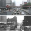
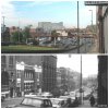
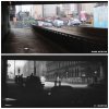
I understand that some land which is just to the right of these pictures is one of the only bomb sites in the City never to be built on, there's a car park there now just right of the tunnel entrance.
I was not aware it was a bomb site, but it certainly has not been built on and is just a surface car park (according to Google maps).
I think this is just an example of how the inner ring road isolates those areas outside the ring road.
This land would be prime building land if it was INSIDE the inner ring road, yet because it is just OUTSIDE the ring road it is allowed to lie virtually unused for decades.
There is now an exit from Snow Hill station nearby (in Livery St, right opposite the car park) so I wonder if that will help make the area more popular and encourage visitors.
Mind you I am not sure how many people even KNOW about exit from Snow Hil station into Livery St (I assume it is open?).
brumgum
Proud to be a Brummie!
I was not aware it was a bomb site, but it certainly has not been built on and is just a surface car park (according to Google maps).
I think this is just an example of how the inner ring road isolates those areas outside the ring road.
This land would be prime building land if it was INSIDE the inner ring road, yet because it is just OUTSIDE the ring road it is allowed to lie virtually unused for decades.
There is now an exit from Snow Hill station nearby (in Livery St, right opposite the car park) so I wonder if that will help make the area more popular and encourage visitors.
Mind you I am not sure how many people even KNOW about exit from Snow Hil station into Livery St (I assume it is open?).
Would love to know the history of the derelict building facing the car park on Ludgate Hill. it would be useful for apts
https://www.flickr.com/photos/ell-r-brown/4169793701/sizes/z/in/photostream/
one of ells shots
just found a thread on this...
https://birminghamhistory.co.uk/forum/showthread.php?t=32608
ellbrown
ell brown on Flickr
(Copied photo here for easy ref. hope that's ok)
No problem Viv with copying it. Yes that is the same view / location.
Doubt that the existing footbridge would have been there when it looked like a mess!
Note that the Livery Subway between both sides of Livery Street (split by Great Charles Street Queensway) is still there!


ellbrown
ell brown on Flickr
There is now an exit from Snow Hill station nearby (in Livery St, right opposite the car park) so I wonder if that will help make the area more popular and encourage visitors.
Mind you I am not sure how many people even KNOW about exit from Snow Hil station into Livery St (I assume it is open?).
Yes the Livery Street entrance of Snow Hill Station is open - but from Monday's to Saturday's - daytime I think.
Not many people use it (at least not when I've used it).


B
BernardR
Guest
Linda uses that entrance 4 days a week - 5 if she works 5 days.
brumgum
Proud to be a Brummie!
I was not aware it was a bomb site, but it certainly has not been built on and is just a surface car park (according to Google maps).
I think this is just an example of how the inner ring road isolates those areas outside the ring road.
This land would be prime building land if it was INSIDE the inner ring road, yet because it is just OUTSIDE the ring road it is allowed to lie virtually unused for decades.
There is now an exit from Snow Hill station nearby (in Livery St, right opposite the car park) so I wonder if that will help make the area more popular and encourage visitors.
Mind you I am not sure how many people even KNOW about exit from Snow Hil station into Livery St (I assume it is open?).
Plans are afoot...
https://www.birminghammail.co.uk/news/local-news/birmingham-great-charles-street-bomb-4869676
horsencart
master brummie
This site nearly became a Coach Station to replace Digbeth Coach Station nothing came of it
I understand that some land which is just to the right of these pictures is one of the only bomb sites in the City never to be built on, there's a car park there now just right of the tunnel entrance.
ellbrown
ell brown on Flickr
Getting close to the summer 2013 Queensway tunnel closure.
Picked up a leaflet in the National Express West Midlands shop in Solihull today.


www.brumtunnels.co.uk
Picked up a leaflet in the National Express West Midlands shop in Solihull today.
www.brumtunnels.co.uk
Why is it closing? Useful App to help you plan alternative routes - funny to think that computers were just arriving on the scene when the tunnel was built and the mobile phone hadn't even been invented! In many respects we've come a long way. Viv.
brumgum
Proud to be a Brummie!
Why is it closing? Useful App to help you plan alternative routes - funny to think that computers were just arriving on the scene when the tunnel was built and the mobile phone hadn't even been invented! In many respects we've come a long way. Viv.
Refurbishment..
https://www.amey.co.uk/BrumTunnels/WhatsHappening.aspx
Beat the jams with a Bike Train..
https://www.birminghammail.co.uk/news/local-news/birmingham-tunnel-closures-commuters-urged-4864173
Thanks Brumgum. Good luck with the alternatives. With only (?) 1.5 million people using the tunnels per month should be a breeze to get every one of them to use the alternatives! Viv.
brumgum
Proud to be a Brummie!
Exactly!..they did a nice job of the Holloway Circus tunnel, i like this shot...Thanks Brumgum. Good luck with the alternatives. With only (?) 1.5 million people using the tunnels per month should be breeze to get every one of them to use the alternatives! Viv.
https://www.flickr.com/photos/ropemonkey/3456026645/in/faves-13974995@N02/
An interesting analysis. Didn't know the future of St. Chad's had ever been in doubt. Not much sympathy for Mr Manzoni in this article, and criticised for very little public consultation. Viv.
https://www.bbc.co.uk/news/uk-england-birmingham-23319775
https://www.bbc.co.uk/news/uk-england-birmingham-23319775
Thanks for the update Ell. Let's face it, it was never meant to be a pretty addition to Birmingham! Viv.
brumgum
Proud to be a Brummie!
ellbrown
ell brown on Flickr
It's Beneficial House. Built in the 1960s. Refurbished early 2000s. More refurbishment started in 2010, but work stalled due to the builders owners falling into administration.
Not new.
Not new.
brumgum
Proud to be a Brummie!
Thank's ell, oh dear sounds about right.It's Beneficial House. Built in the 1960s. Refurbished early 2000s. More refurbishment started in 2010, but work stalled due to the builders owners falling into administration.
Not new.


