• Welcome to this forum . We are a worldwide group with a common interest in Birmingham and its history. While here, please follow a few simple rules. We ask that you respect other members, thank those who have helped you and please keep your contributions on-topic with the thread.

    We do hope you enjoy your visit. BHF Admin Team

Hospital Street

Moss
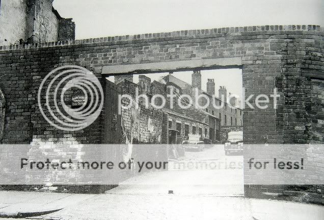
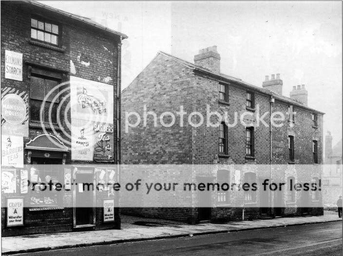
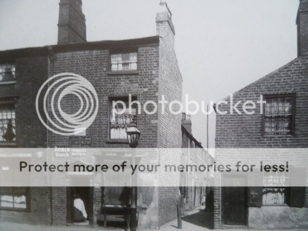
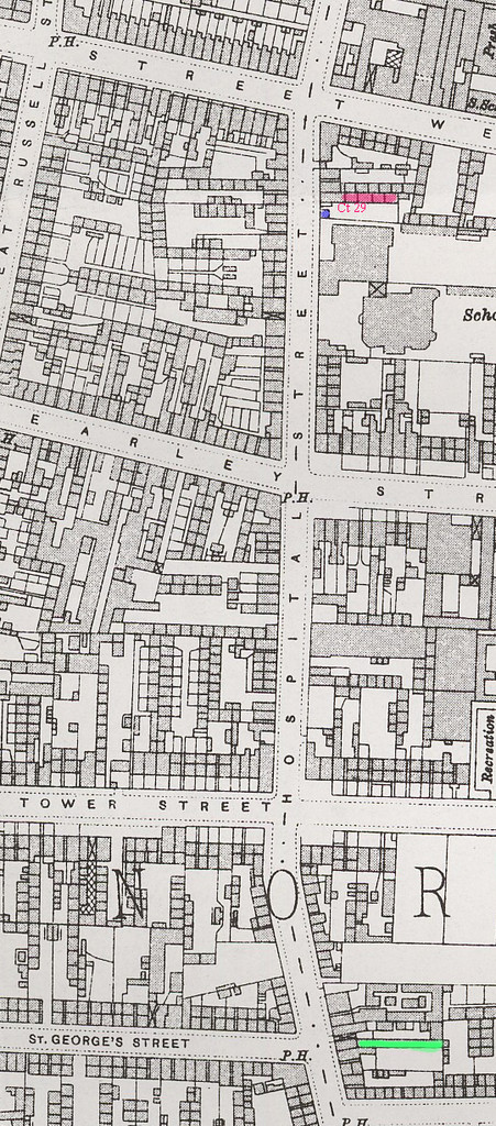
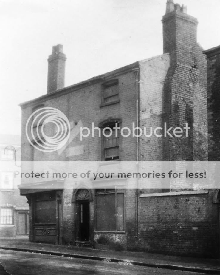
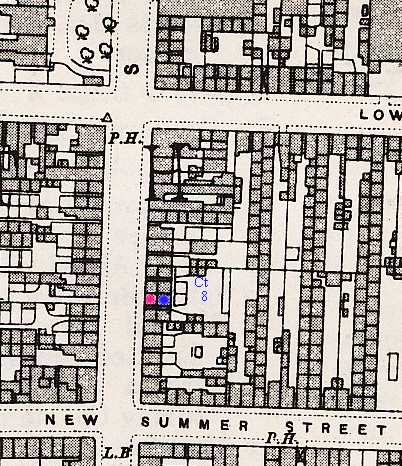
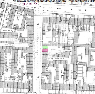
Upper hospital St was combined with hospital sT between 1883 and 1884. In 1883 9-10 upper hospital St were occupied by Reuben Heaton, the fishing reel manufacturers. In 1884 they occupied (presumably the same buildings ) 161-165 Hospital St. Below is a map c 1889. I am not quite certain ar to where no 10 was exactly, but think the most likely position is the red building. However it is possible that previously there could have been a building in the gateway (marked green). Heaton's factory is marked as set back behind these, and you can just read. Universal works (fishing tackle)

map_c_1889_showing_approx_position_of_10_upper_hospital_st_before_1884.jpg
 
oops...posted the smaller pic will repost when i find the correct one..


hosp3.jpg
 
Last edited:
brilliant pic topsy..first time i have seen one of that corner...this would be on the opposite corner to where box carton now is...the newish building you see where the cars are parked is still there but all the rest has gone

thanks topsy...

lyn
 
hi kev thanks for that now pic...this is a good find of topsys....always wanted to see what that corner looked like

lyn
 
im following you around again topsy lol..thats a great pic of the flats..here is another one and the flats are still there today..

colmoreflatshospitalst.jpg
 
front of no 221 and the entrance to court 29...

mike if you spot this post i wonder if you could let us have a map please showing where the last 2 pics were situated...thank you mike...

oldpics006.jpg
 
Lyn
Map below as requested. court 29 is in red. No 221 is probably thebuilding in blue, which is on the right hand of the opening in the photo, but might possibly be the one th eother side of the opening. Originally i thought it would be the second choice, but numbering doesn;t seem to make that likely. The picture is almost certainly pre WW2, as maps after this show the non-existence of either , presumably due to bombing.
Court 17 is in green at the bottom of the map. Note map shows continuous building rather than individual houses. Earlier maps (1905 , 1890) show individual houses, so presumably the picture is pre 1913

map_hospital_st_c_1913_showing_ct_29_and_ct_17.jpg
 
yes mike hosptal st took quite a battering during ww2...so court 29 was almost next to summer lane school and court 17 very close to the globe pub on the corner of william st west and hosp st where dad was born...

brilliant mike thank you....
 
smashing pic here of the queen adelaide pub at no 93 hospital street..demolished in 1928

Hospital_St_Queen_Adelaide_Pub_Demolished_1928_Newtown_jh_.jpg
 
great mike i thought the street running off had a look of new summer st to it..so the adelaide was not far from the globe inn corner of hosp and william st north...

thanks mike..
 
Mike, if you have the information, could you indicate where 2BK48 Summer Lane would have been on the map. Sorry to divert the thread but it is in the area.
Thanks in advance.
Rupert.
 
Rupert.
The map is below. No 48 is in red. You are lucky. Back 48 corresponds to court 8. Often you cannot tell how the houses in a court are numbered. In the 1920 electoral roll there is 2,3 & 4 court 8 listed, but no 1 court 8 . there is however one described as back 47 (47 is immediately below 48 on map), so I would consider it probable that 2 back 48 is the house immediately behind no 48 (in blue)
mike

map_c_1913_showing_48_summer_lane_and_2_bk_48.jpg
 
Rupert
Have you seen the photo which shows back 43 Hospital St? You can see the window on the second floor of your birthplace over the separating outhouse. If you haven't I will put it on tomorrow
Mike
 
Back
Top