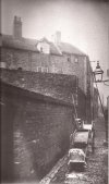
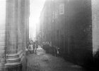
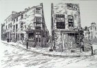
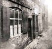
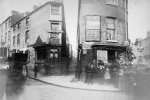
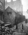
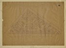
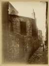
I have found information on-line referring to 'The Gullet' in 1800s Birmingham, photos and description. I understand it was off Lichfield Street at the end of Corporation Street. However, there is 'The Gullet' referenced in the 1851 Census as part of the Enumerator's route where one of my ancestors lived. The problem is the route is on the east end of Deritend, quite a ways from The Gullet's location off of Lichfield Street. So the question - is The Gullet one specific laneway in Birmingham, or does it reference any narrow laneway in a poor area?
-
Welcome to this forum . We are a worldwide group with a common interest in Birmingham and its history. While here, please follow a few simple rules. We ask that you respect other members, thank those who have helped you and please keep your contributions on-topic with the thread.
We do hope you enjoy your visit. BHF Admin Team
You are using an out of date browser. It may not display this or other websites correctly.
You should upgrade or use an alternative browser.
You should upgrade or use an alternative browser.
Gullet - Name of a Street or Type of a Street
- Thread starter CarolynL
- Start date
Welcome to the Birmingham History Forum. We have a thread on the Gullet here, enjoy
The exact route recorded was "High Street north side from the B.A. (Bordesley/Aston) mark to Heath Mill Lane, south side from Rea Street to The Gullet ex______ Bridge Row including Meeting House Yard, and all Courts having their entrances within the aforesaid distance. Also Alcester Street east side"Normally I would understand it referring only to the one street, but here it would seem that there was a second one in Birmingham. This one however is very obscure
splinter555
master brummie
In the 1940s/50s I lived in Holliday street and the bridge that carries the canal between gas street and the mailbox was always known as 'under the gullet'by the locals, my sisters and I still use that expression when talking about that areaNormally I would understand it referring only to the one street, but here it would seem that there was a second one in Birmingham. This one however is very obscure
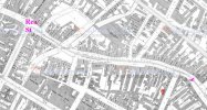
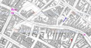
The maps are great! Thank you so much for your help.MWS you are right. I have just gone through the properties and marked the limits of the enumeration of the south side of High St and this is shown below. what is marked as court 13 must have been the Gullet. Maybe in earlier times they thought 13 was unlucky !
View attachment 154524
Looking at the census, the houses after my ancestor's (which is one of 5 households in Wood Bridge Yard) are the Meeting House Yard on High Street, then households on Alcester Street. The houses before my ancestor's are 197 - 226 High Street (which includes the Three Crown Pub at 221 High Street). On this map where is Heath Mill Lane?
This is a great close-up map. I'll spend some time looking at it closer. Looks like you found it! It was a frustrating mystery to me. Thanks for your help!What are the next roads mentioned after your relative?
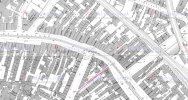
On the 1889 map there is a court (no 13) running between High St & Alcester St that doesn't look like a typical court. It seems to be in the right area but no idea if that's relevant.
View attachment 154516
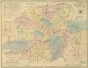
Quick question - when was this map made?If you look at the parish boundaries below, you can see that the boundary between Deritend and Bordesley does cut accross that corner. sorry the map is not clearer, but I think it shows it reasonably well
View attachment 154525
Mark Tooze
master brummie
There are loads of photos on the Birmingham Collections website, plus the ratings maps show the locations of both Gullets!

