• Welcome to this forum . We are a worldwide group with a common interest in Birmingham and its history. While here, please follow a few simple rules. We ask that you respect other members, thank those who have helped you and please keep your contributions on-topic with the thread.

    We do hope you enjoy your visit. BHF Admin Team

Gravelly Hill Gravelly Hill North

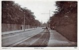
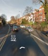
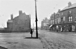
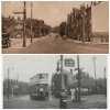
That photo is the bottom of Gravelly Hill, looking towards Salford Bridge. Erdington Arms on the right, then Slade Road. Minstead Road on the left

Thanks for the info. Fascinating how things are theae days and how they were some years ago. Cheers. Mac
 
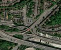
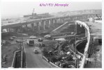
Hi Lyn, yes, it got well trimmed back when they built the island, dual carrageway and ramp for the Aston Expressway
 
One of the buildings opposite the Erdington arms in the late sixties was the Bird cage Cafe, was a bit of a dive if I remember correctly.
 
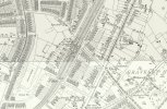
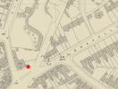
Does anyone have an early map showing Gravelly Hill Station please? We're doing a project at the moment based on the book 'Steaming up to Sutton' by Roger Lea. Thanks.
 
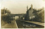
A good selection of Gravelly Hill can be seen to Warwickshire Railways web site. The above photo shows some interesting features namely a First Class position for passengers, tall signals for oversight above bridges and lower signals with white painted sighting board. There are the usual instructions for crossing over the bridge and way out signs.
 
Definitely sheep John! My dad would have been 5 in 1918 and lived at Salford Bridge - wonder if he ever saw sheep being hereded down the road.
It really is amazing to see the difference that 50 years has made to Gravelly Hill. You certainly wouldn't have been able to see sheep in the middle of that road in 1968. I remember my Dad told me about following horses and carts around with a bucket, when he was a young lad in the early 30s, to supplement his pocket money. The things that we could ask our family about now. I told my son about walking under Spaghetti Junction, whilst it was being built on my way to Villa Park and I'm sure that's his "sheep" equivalent. :)
 
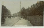
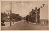
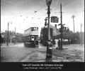
This postcard is labelled 'Gravelly Hill', but is it Gravelly Lane given that it's signposting Perry Common off to the left ? Can't quite place it. Or was it, in fact, Gravelly Hill but was completely demolished to make way for Spaghetti Junction ?

Screenshot_20260808_081542_Chrome.jpg
 
I think your right Viv it was Gravelly Hill prior to being completely demolished to make way for Spaghetti Junction. The car on the left is outside the Erdington Arms and Slade Road. Tyburn Road on the right.
 
Back
Top