
-
Welcome to this forum . We are a worldwide group with a common interest in Birmingham and its history. While here, please follow a few simple rules. We ask that you respect other members, thank those who have helped you and please keep your contributions on-topic with the thread.
We do hope you enjoy your visit. BHF Admin Team
You are using an out of date browser. It may not display this or other websites correctly.
You should upgrade or use an alternative browser.
You should upgrade or use an alternative browser.
Erdington
- Thread starter Alberta
- Start date

Trendy stuff back then:My dad was a big fan of Tootal shirts, sports tops etc. Had forgotten about that brand. I like the "See our windows" in the advert. You used to be able to go to a shop and see a mass of items crammed into window displays. Hence why 'window shopping' was so popular. Window displays are quite boring by comparison today, with their minimalist selective items on display.


I'd say the date is late 1930s/1940ish Pete. And it looks like a place the cycling group were visiting. Wondered if it was Tamworth or Lichfield ?

Pedrocut
Master Barmmie
This picture on Flashback entitled Uncle Walter and The Erdington Cycling ano Social Club in 1947.
“Walter Frank Quiney was about twenty-one or twenty-two when he appeared in or took these pictures of a group of friends that belonged to the Erdington Cycling and Social Club. It was 1947 and many of the young men are wearing either army surplus clothes or even their own battledress stripped of insignia…”
“Walter Frank Quiney was about twenty-one or twenty-two when he appeared in or took these pictures of a group of friends that belonged to the Erdington Cycling and Social Club. It was 1947 and many of the young men are wearing either army surplus clothes or even their own battledress stripped of insignia…”

superdad3
master brummie
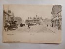
An earlier view about 1904. Same building in centre above? Don't think it has been posted before.On the Green with the Library (centre) and to the right the Birmingham City (?) and Midland Bank. Possibly 1910/20s. Still a bank (HSBC - or was) but the building’s been replaced with a non-descript modern design. Viv.
View attachment 159184
Can’t get the comparable modern Google Streetview due to pedestrianisation. Viv.
View attachment 159185
Richard Dye
master brummie
What a wonderful connection for you to have!Thank you for posting this. It is how it would have looked when my Grandmother lived there aged 11.
Lincolnshire poacher
knowlegable brummie
Lincolnshire poacher
knowlegable brummie
Just taking a walk down memory lane looking at this Erdington thread
On page 5, half way down there is a lovely photo of Woolworths on the high Street Barnabus Road junction.
When my wife Pat and I married in 1960, one of the first things we bought was a wooden ironing board from this Woolies, we still have and use this ironing board.
We also have a hair dryer and food mixer from around the same time, still going strong.
On page 5, half way down there is a lovely photo of Woolworths on the high Street Barnabus Road junction.
When my wife Pat and I married in 1960, one of the first things we bought was a wooden ironing board from this Woolies, we still have and use this ironing board.
We also have a hair dryer and food mixer from around the same time, still going strong.

Lloyd
master brummie
I don't suppose those sort of things are made in the UK any more.When my wife Pat and I married in 1960, one of the first things we bought was a wooden ironing board from this Woolies, we still have and use this ironing board.
We also have a hair dryer and food mixer from around the same time, still going strong.
Lincolnshire poacher
knowlegable brummie
Sad,but so true.
Lincolnshire poacher
knowlegable brummie
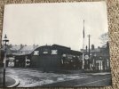
Picture 609, Station Roadi 1914, just round the corner to the left was Gibournes hardware store.
Does anyone remember Don who ran it? Wonder if he is still around.?
Does anyone remember Don who ran it? Wonder if he is still around.?
There are some posts on page 1 of a previous thread "Station Road Erdington" from Morturn (post #4) and Alberta (post #20) that refer to Gibournes LP.Picture 609, Station Roadi 1914, just round the corner to the left was Gibournes hardware store.
Does anyone remember Don who ran it? Wonder if he is still around.?
Pedrocut
Master Barmmie
One for Lady P…
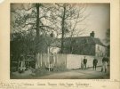
Cottons Farm House, Bell Lane, Erdington. Creator: Sir John Benjamin Stone.
Cottons Farm House, Bell Lane, Erdington. Corner of Blythe on Bride Lane. 1893.
Formerly occupied by G. Holden in old time 1818 by Greensall.
(Birmingham Archives and Collections)
Bell Lane is the old name of today’s Orphanage Road in Erdington (renamed after Sir Josiah Mason built his large orphanage there in the 1860s).
Cottons Farm House, Bell Lane, Erdington. Creator: Sir John Benjamin Stone.
Cottons Farm House, Bell Lane, Erdington. Corner of Blythe on Bride Lane. 1893.
Formerly occupied by G. Holden in old time 1818 by Greensall.
(Birmingham Archives and Collections)
Bell Lane is the old name of today’s Orphanage Road in Erdington (renamed after Sir Josiah Mason built his large orphanage there in the 1860s).

Lady Penelope
master brummie
Hi Again Viv,The first Erdington tram in 1907. They all look like dignitaries in this photo. Viv.
View attachment 84646
This photo was taken at the tram terminus outside Broadfields House. I have lots of photos of the area but none of the house even though the wall is sometimes visible. It was also the bus terminus. Most frustrating! The usual view of this event is the other side of the tram.
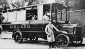
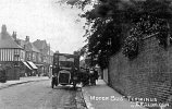 Penny
Penny
Two threads have been merged into this one, in the process some posts were moved to other related thread (please see the list of linked threads at the beginning of post #1).

Radiorails
master brummie
Pedro, I take it the horse is having a drink!

Smudger
master brummie
Not many scruffy little oiks there. We wuz posh in Erdington.Rick fire, farmyard corner of Chester Road and Grange Lane, Erdington. July 31st 1899. Sir Benjamin Stone. July 1899.
(Birmingham Archives and Collections)
View attachment 215171

Lady Penelope
master brummie
Pedro, I'm having a senior moment I think. What does the previous post refer to please?
Radiorails
master brummie
On reflection (  ), I should have put a "smilie" instead of a exclamation mark at the end of my post as my joke was not evident.
), I should have put a "smilie" instead of a exclamation mark at the end of my post as my joke was not evident.Moor End Lad
master brummie
Here's the 1833 Turnpike Map, which shows the Bell & Cuckoo on Sutton Road:
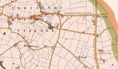
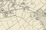
On the corner of Bell Lane we can see two buildings similar to those on the 1804 Enclosure Map, which names the eastern building as the 'Old Bell'. I suggest that the westmost building is 'Hollywood'. Here is the 1760 Map for comparison:
Here is a summary of the info that I have on Hollywood, which does not mention the Bell:
HOLLYWOOD
=========
Date/Source
Info
c1950 Old Buildings of Erdington
House numbered 791 Chester Road
1947 Old Buildings of Erdington
Rented to JH Harwood
1920 Old Buildings of Erdington
Occupied by John Antrobus
1910 Old Buildings of Erdington
Occupied by John Antrobus
1907 Kelly's Directory
'Hollywood' occupied by Ernest Yates
1904 Old Buildings of Erdington
Occupied by William J Sutton
1891 Census
Unoccupied ?
1881 Census
'Berwood' (more likely 'Hollywood') Chester Road household:
Name Relation Status Age Birthplace Occupation
William LOVETH Father WM 71 Sutton, Warwick Retired gardener
William LOVETH Head MM 34 Erdington, Warwick General foreign merchant
Elizabeth LOVETH Wife MF 30 Birmingham, Warwick
Elizabeth LOVETH Daughter SF 9 Erdington, Warwick Scholar
William LOVETH Son SM 8 Erdington, Warwick
Phoebe M LOVETH Daughter SF 5 Erdington, Warwick
John M LOVETH Son SM 3 Erdington, Warwick
Elizabeth MCLUES Servant UF 26 Wolverhampton, Staffs Cook
Mary LEE Servant UF 26 Birmingham, Warwick Nurse
Emma CRISP Servant UF 22 Birmingham, Warwick Housemaid
1872 Will
Will of Mary Fowler, widow of John Fowler dated 23 October 1872
1858 Proposed Route of Railway
Villa residence owned by Mary Fowler
1848 Tithe Map
No change from Fowler's 1833 Enclosure Map
1841 Census
? Chester Road household:
Name Relation Status Age Birthplace Occupation
John FOWLER M 35 Warwicks Independent
Mary FOWLER F 45 Warwicks
William FOWLER M 10 Warwicks
Elizabeth PARKES F 50 Warwicks Independent
Amelia LUCAS F 20 Warwicks Servant
Sarah SHEPHERD F 18 Warwicks Servant
1834 OS Map
Buildings and adjoining fields are identifiable in the first ordnance survey
1833 Fowler Enclosure Map
Estate comprising house & garden, 'Lower Field' and 'Upper Field' and
'Hollyhurst Piece' on the other side of Chester Road (site of Yenton School) owned and occupied by John Fowler.
Cottage and garden occupied by Joseph Fellowes
1817 Mary Ashford Murder Investigation
House occupied by Freeman.
Cottage and garden facing onto Bell Lane (later Orphanage Road) occupied
by Mary Ashford's grandfather Coleman
1760 Old Buildings of Erdington
Occupied by Edward Clemson ?
1760 Tomlinson Map
House, garden and croft in corner of Bell Lane and Chester Road known as
'Hollywood' owned by Mr Hannen and occupied by John Dingley.
Strip of land bordering Chester Road is common land
On the corner of Bell Lane we can see two buildings similar to those on the 1804 Enclosure Map, which names the eastern building as the 'Old Bell'. I suggest that the westmost building is 'Hollywood'. Here is the 1760 Map for comparison:
Here is a summary of the info that I have on Hollywood, which does not mention the Bell:
HOLLYWOOD
=========
Date/Source
Info
c1950 Old Buildings of Erdington
House numbered 791 Chester Road
1947 Old Buildings of Erdington
Rented to JH Harwood
1920 Old Buildings of Erdington
Occupied by John Antrobus
1910 Old Buildings of Erdington
Occupied by John Antrobus
1907 Kelly's Directory
'Hollywood' occupied by Ernest Yates
1904 Old Buildings of Erdington
Occupied by William J Sutton
1891 Census
Unoccupied ?
1881 Census
'Berwood' (more likely 'Hollywood') Chester Road household:
Name Relation Status Age Birthplace Occupation
William LOVETH Father WM 71 Sutton, Warwick Retired gardener
William LOVETH Head MM 34 Erdington, Warwick General foreign merchant
Elizabeth LOVETH Wife MF 30 Birmingham, Warwick
Elizabeth LOVETH Daughter SF 9 Erdington, Warwick Scholar
William LOVETH Son SM 8 Erdington, Warwick
Phoebe M LOVETH Daughter SF 5 Erdington, Warwick
John M LOVETH Son SM 3 Erdington, Warwick
Elizabeth MCLUES Servant UF 26 Wolverhampton, Staffs Cook
Mary LEE Servant UF 26 Birmingham, Warwick Nurse
Emma CRISP Servant UF 22 Birmingham, Warwick Housemaid
1872 Will
Will of Mary Fowler, widow of John Fowler dated 23 October 1872
1858 Proposed Route of Railway
Villa residence owned by Mary Fowler
1848 Tithe Map
No change from Fowler's 1833 Enclosure Map
1841 Census
? Chester Road household:
Name Relation Status Age Birthplace Occupation
John FOWLER M 35 Warwicks Independent
Mary FOWLER F 45 Warwicks
William FOWLER M 10 Warwicks
Elizabeth PARKES F 50 Warwicks Independent
Amelia LUCAS F 20 Warwicks Servant
Sarah SHEPHERD F 18 Warwicks Servant
1834 OS Map
Buildings and adjoining fields are identifiable in the first ordnance survey
1833 Fowler Enclosure Map
Estate comprising house & garden, 'Lower Field' and 'Upper Field' and
'Hollyhurst Piece' on the other side of Chester Road (site of Yenton School) owned and occupied by John Fowler.
Cottage and garden occupied by Joseph Fellowes
1817 Mary Ashford Murder Investigation
House occupied by Freeman.
Cottage and garden facing onto Bell Lane (later Orphanage Road) occupied
by Mary Ashford's grandfather Coleman
1760 Old Buildings of Erdington
Occupied by Edward Clemson ?
1760 Tomlinson Map
House, garden and croft in corner of Bell Lane and Chester Road known as
'Hollywood' owned by Mr Hannen and occupied by John Dingley.
Strip of land bordering Chester Road is common land
Very good to see the Erdington maps in #648. Thanks for those. Only ever seen low resolutions of these. I note that the tollgate was close to the Green. At the time was this the Sutton Turnpike Road (ie was the road up to its entering Erdington at the Green known as Sutton Road ? Currently it's a short section of High Street reaching up to the junction with Station Road).
Last edited:
Discussion about The Bell Inn Bell and Cuckoo is now in the dedicated thread below.
https://birminghamhistory.co.uk/forum/threads/the-bell-inn-the-bell-and-cuckoo-erdington.62403
https://birminghamhistory.co.uk/forum/threads/the-bell-inn-the-bell-and-cuckoo-erdington.62403
Last edited: