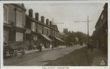
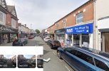
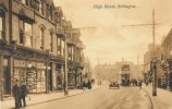
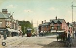
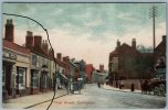
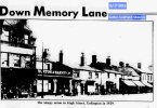
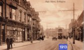
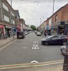
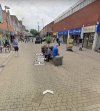
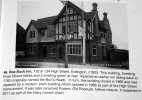
Me too Viv, I am now thinking the Yenton?Totally at a loss as to where this was in the High Street.
View attachment 191502
Source: British Newspaper Archive
-
Welcome to this forum . We are a worldwide group with a common interest in Birmingham and its history. While here, please follow a few simple rules. We ask that you respect other members, thank those who have helped you and please keep your contributions on-topic with the thread.
We do hope you enjoy your visit. BHF Admin Team
You are using an out of date browser. It may not display this or other websites correctly.
You should upgrade or use an alternative browser.
You should upgrade or use an alternative browser.
Erdington - High Street
- Thread starter Ian FOFB
- Start date
Brasscaster
master brummie
In an advert for Bywater Pies in the Birmingham Daily Post of 21 August 1924, Burton and Harvey of The Green, Erdington is listed as a place where the pies can be obtained.
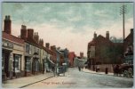
Thanks all. Think the tall building to the left might still be there, but everything to the right has gone.
richardthompson
proper brummie kid
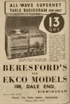
Looks like the case of this was one of those made in bakelite , som possibly the material came from Tyseley
Lady Penelope
master brummie
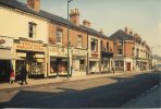
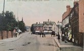
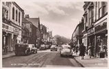
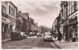
Lovely photo Viv. I remember it looking like this.
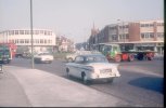
I have marked the photo (with what is supposed to be an arrow!!) where I remember two very old buildings stood. In my mind they were wooden but I'm probably wrong. I thing the next building is probably the Roebuck. Any ideas please?
I have marked the photo (with what is supposed to be an arrow!!) where I remember two very old buildings stood. In my mind they were wooden but I'm probably wrong. I thing the next building is probably the Roebuck. Any ideas please?
Attachments
Quite possible Pen, the pub sign looks like a deer so 'Roebuck' is possible.
Mickymoo
master brummie
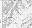
A 1950s map here,showing that stretch of the High Street..Lovely photo Viv. I remember it looking like this.
I have marked the photo (with what is supposed to be an arrow!!) where I remember two very old buildings stood. In my mind they were wooden but I'm probably wrong. I thing the next building is probably the Roebuck. Any ideas please?
Mickymoo
master brummie
Yes Lyn,that's the Palace Ballroom and Cinema at the top of the map..It also shows the Roebuck pub ,next to the National School and in the bottom left corner is St. Barnabas Church.thanks micky i can see the palace ballroom on the left of pens photo so would that be the cinema marked on your map...looks about the right distance
lyn
Lady Penelope
master brummie
Thanks Micky. Definitely Roebuck (I used to wait outside on a Saturday morning for my Dad till Mom put a stop to it.) I had misplaced the buildings I was referring to. Facing Woolies, they were the other side of the school, the three in a row slighter further back from the road.
poker_pete82
master brummie
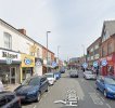
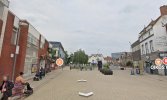
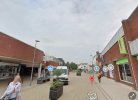
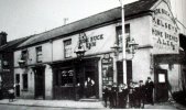
Wow great pics. Is that the same lamppost that I see? The ones the boys are leaning against and the aged darker one in the foreground of the newer pic? Love it!just to complete here are 2 photos of the roebuck 2nd one the rebuildView attachment 193359View attachment 193360
lyn
Wow great pics. Is that the same lamppost I see? The ones the boys are leaning against and the aged darker one in the foreground of the newer pic? Love it!
yes its the same lamp post
lyn
Lady Penelope
master brummie
Thanks Lyn, it was the right hand side I used to wait by. Down the side entrance. Dad took me in to see the clock once, I mentioned it some time ago. I think the face revolved rather than it having hands and it appeared to go backwards. No-one else remembers it but then I don't think many of my friends stood outside on a Saturday morning!
Richard Loud
proper brummie kid
Richard Loud
proper brummie kid
Six Ways in the 1960sView attachment 193423

