• Welcome to this forum . We are a worldwide group with a common interest in Birmingham and its history. While here, please follow a few simple rules. We ask that you respect other members, thank those who have helped you and please keep your contributions on-topic with the thread.

    We do hope you enjoy your visit. BHF Admin Team

Bull Street

Yeah, Viv's last picture #124 is pretty much the last of the Lamb House which must have featured prominently in the years of the Welch Market at Dale End. If you look at the extreame bottom left you can just see what had become the tunnel entrance to Crooked Lane and Martieneau Street ran right through where the old house stood. Many of us would have rode a tram up by there which would have been the town terminus for several routes. You can see that there was not a great understanding of roof truss design at that time. So that the old roofs that are seen on artists paintings are not mostly an exageration for effect. Many suffered from the 'sway back' effect.
The entrance to Crooked Lane led to a well at one time, probably behind the house...long gone by the photo time I suspect...but a stone structure of the well head was found when the old house was demolished; I read somewhere. Possibly the well would have been a neccessary feature of the old Welch Market. Another of the great photo's on this forum.
 
The picture #125 has some hints of the old wild west in a way...maybe it's just the covered wagon. Anyway I wonder what building is right at the top of Bull Street. It seems too far away to be Lewis's on the corner of Corporation St. and the latter Lewis's building was built in 1920 I believe, but they had an earlier building which was short lived and demoed when the Berlin House was purchased. It will always be known as Lewis's to me no matter what name they put on it. The structure has stood up well and still seems to meld in as a standout in the current surroundings. A fine building which was frowned upon for not fitting in with the Victorian style of the past, but seems to have bridged nicely now. You see the Lewis's sign in the photo but surely that is too close to be Corporation St. so maybe in the photo Corporation St. had not been put through at that time and Lewis's was in another location. So maybe there was a Lewis's presence before Corporation St.
 
Rupert, I think I am right in saying that the Berlin House building along with the Lewis's building was not demolished, merely clad in a Palladian style during the 1930's. The original was terracotta and rather ornate, I think I would have liked to have seen it in the flesh, so to speak, but the Palladian style of the cladding is easy on the eye and does not offend - at least in my opinion. It was Joseph Chamberlain who persuaded David Lewis to open a shop in Birmingham, and if my memory served me right, the Corporation Street bit was the later addition - the original was the one opposite Temple Row - it was joined to the new one by the bridge over the Minories. That's as I remember reading, if I am wrong, I will be happy to be corrected!
 
My first attempt to submit two images will probably go horribly wrong - no idea if they will be legible. My 3xg.grandfather Samuel Hallam advertising his worldly goods for sale in 1845. It paints a wonderful picture. French corsets indeed - not what I was expecting at all. On the 1841 census he was a "straw hat maker" and I just had visions of someone humbly working away in a backroom. " High Street near Carrs Lane" was all that was entered on the schedule - whether that was actually this shop at 7 Bull Street I'm not sure, hopefully one of you might know!

Thank you for all the photographs and extra information you've provided.

Nickie
 

Attachments

  • SHallam_Auction_Shop.JPG
    SHallam_Auction_Shop.JPG
    72.7 KB · Views: 33
  • Samuel_FrenchCorsets1844.JPG
    Samuel_FrenchCorsets1844.JPG
    48.5 KB · Views: 28
The 1845 Post Office directory lists Samuel Hallam as starw hat maker at 7 bull St,while the 1841 Pigot's directory lists him as straw hat maker at 47 High St.
 
Thanks for the 1841 Pigot's listing Mike.
In the 1830s there are also listings in Dudley and Stourbridge for him, which has really helped pinpoint his movements - seems he may also have been into tea dealing.
 
Finding this very interesting, some good photos and info. Hammer, your newspaper extracts are a nice find. I think we had a discussion a while back about 'toilet' items. Your ancestor's toilet bottles and toilet cabinets are probably for ladies lotions and potions. Also a loo table was probably a card table. I think there was a discussion about these on Mikejee's thread here: https://birminghamhistory.co.uk/forum/showthread.php?t=39848

Rupert, agree Astoness's photo #124 is a little gem. Hadn't realised the passageway to Crooked Lane went through the buildings. I too would like to know what the building was at the top of Mikejee's photo #125. It looks like it might be on Monmouth Street (later Colmore Row - the stretch in front of Snow Hill Station/Great Western Hotel).

Shortie - there seem to be various dates in the development of Lewis's. I've seen 1885 for the 're-placement' of Berlin House, and 1925 for further development of Lewis's store (I assume this would have been for the further modifications you mention like the bridge etc). Then as for the Lewis's sign in photo #125, yes Rupert, it certainly does look too near to be the Lewis's site we all know . I didn't think Lewis's had an earlier presence in Birmingham. Quite strange.

Viv.
 
Viv. Lewis's drapers first seem to appear at 32 bull st between the 1884 & 1888 directories. If the photo was taken with a long focus lens (I think that is the right way round) then Lewis's might appear nearer. Not sure what the other building is According to 1890 map it should be the end of Snow hill, or perhaps the corner of Steelhouse lane.
 
Thanks Mike. Maybe then, the building in the distance is the (old) Wesleyan & General Head Office. If so I think it would date the photo post-1900. Viv.
 
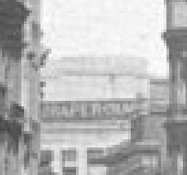
I'm mystifiedb Viv. Enlarging the building at the end it does look as if it says "Draper" on the roof, and it is reminiscent of Lewis's !!

draper_towards_end_of_bull_st_from_high_st.jpg
 
I think that the two pictures of Bull Street are fairly close date wise and maybe what I thought was a ladder up Bull St. may in fact be a prop. Anyway it seems to me, by looking at both photo's, that the road to the right might be Dalton St. It looks more in perspective distance wise on the Lamb House shot and that has the prop also. Anyway if this is correct then Corporation St is just the other side of there, but can't see it and no Lewis's building of any sort. Further up possibly is the Minories and Temple Row and suggest that is where the horse drawn carriages are crossing Bull St.
If this is so then the buildings on the right further up are what was there from longer before and perhaps the later looking building in the distance is on the corner of Steelhouse Lane which was a drapers as I recall.
 
I just spotted on Ebay this promissary halfpenny token of 1792 for No 29 Bull Street - Donald & Co, stocking manufacturers. I'm intrigued. Did most shops trade like this?BullStreetDonald_Token2.jpgBullStreetDonald_Token1.jpg
 
Were they early banknotes - didn't banknotes say in the past something along the lines of 'promising to pay the bearer' So were these heavy coins replaced by banknotes?

To add to the picture we have of Bull Street, this extract from E.Edwards' 1887 'Recollections of Birmingham & Birmingham Men' gives his memories of Bull Street and its traders in the 1840s. He depicts a great picture of a bustling retail community. The rare print Edwards refers to in the extract is, I think, the 1840 sketch (commissioned by Suffield) which was posted earlier on this thread.

ImageUploadedByTapatalk1365327550.901076.jpg

Viv.
 
Viv, Thank you very much for the Recollections of Birmingham and Birmingham Men depicting Bull Street in the 1840s. It will really add colour to my family history. I was thinking along the same lines about the coins - will see what I can find out.
 
Re the Bull Street Tokens.
This is from https://en.wikipedia.org/wiki/Token_coin

Trade tokens or barter tokens
From the 17th to the early 19th century in the British Isles and North America these were commonly issued by merchants in times of acute shortage of coins of the state to enable trading activities to proceed. The token was in effect a pledge redeemable in goods but not necessarily for currency. These tokens never received official sanction from government but were accepted and circulated quite widely.


In England the production of copper farthings was permitted by royal license in the first few decades of the 17th century, but production ceased during the English Civil War and a great shortage of small change resulted. This shortage was felt more keenly because of the rapid growth of trade in the towns and cities, and this in turn prompted both local authorities and merchants to issue tokens.


These tokens were most commonly made of copper or brass, but pewter, lead and occasionally leather tokens are also found. Most were not given a specific denomination and were intended to pass as farthings, but there are also a large number of halfpenny and sometimes penny tokens. Halfpenny and penny tokens usually, but not always, bear the denomination on their face.
Most such tokens indicate the name of their issuer, which might either be his or her full name or initials. Where initials were provided it was common practice to provide three, one for the surname and the other two for the first names of husband and wife. Tokens would also normally indicate the merchant establishment concerned, either by name or by picture. Most were round, but they are also found in square, heart or octagonal shapes.
Thousands of towns and merchants issued these tokens between 1648 and 1672, when official production of farthings resumed and private production was suppressed.


Another period of coin shortage occurred in the late 18th century, when the British Royal Mint almost ceased production. Merchants once again produced tokens, but they were now machine made and typically larger than their 17th century predecessors with values of a halfpenny or more. While many were used in trade, they were also produced for advertising and political purposes, and some series were produced for the primary purpose of sale to collectors. These tokens are usually known as "Conder" tokens, after the writer of the first reference book on them.


These were issued by merchants in payment for goods with the agreement that they will be redeemed in goods to an equivalent value at the merchants' own outlets. The transaction is therefore one of barter, with the tokens playing a role of convenience, allowing the seller to receive his goods at a rate and time convenient to himself and the merchant to tie the holder of the token coin to his shop. Trade tokens often change slowly and subtly into barter tokens over time, as evidenced by the continued circulation of former trade tokens when the need for their use had passed.
 
Viv, I found the cutting from Recollections of Birmingham.... so interesting. In 1815 my 4 x Gt.Grandfather had a Boot & Shoe Maker's shop at 34 Bull Street and like Hammer, I would love to know whereabouts in the street it was situated. I don't know how long he had been in Bull Street (as in 1800 his shop was in Snow Hill) but he was here at least until 1823 - by 1829 he had moved to 62 Constitution Hill. Reading the comments on the thread I guess that his shop would have been more towards the Snow Hill/Steelhouse Lane end of Bull Street rather than the Dale End part where Hammer's 3 x Gt.Grandfather had his shop.

As Mike says that Lewis's first appeared in 1884 at 32 Bull Street then James Stephens' shop must have been next door or next but one to whatever building was there at that time, i.e. opposite Temple Row? Somewhere near the Minories area perhaps?

And Hammer's token showing Donald & Co at 29 Bull Street - again would have been close by.

Judy
 
Last edited:
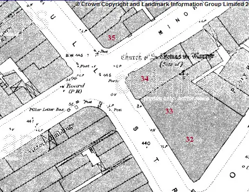
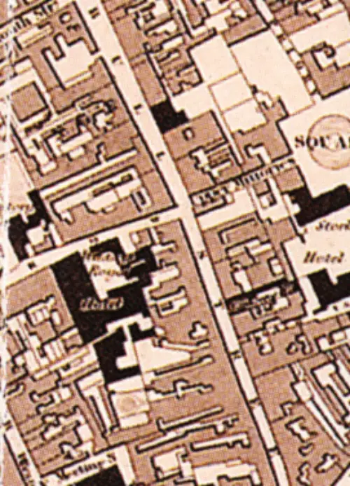
i have checked, and it would seem that, with the possible exception of the driving through of Corporation st inn the early 1880s, when there would have been a slight shifting of numbers in Bull st, there was no renumbering of the street, certainly to 1823, and probably to 1815, though pre-1823 no numbers are listed in directories. In 1880, going north up the street, no 35 is after the minories,and no 34 is before. In 1888 again no 35 is after the minories, bi 34 is not listed , but 32 & 33 are between corporation st and the Minories. What i believe was the numbering is given on the c 1890 map below.
No 29 was between the Minories and where Dalton st is now. I am not sure where 29 was, but suspect it is under what is now Corporation st.

map_c_1889_showing_no32_332C_34_and_35_Bull_st.jpg
 
Refering to post #94. I have difficulty in seeing how the older Meeting House could have fronted on Bull Street. Since photography only started about 1848 the picture looks decidedly refined and I can't see how that garden would have fitted in. Another thing is that it is decidedly not a barn like structure as described. It was north of the Minories I believe and maybe it faced at right angles to Bull St...not being critical, but perhaps these sentiments might have occured to others. What am I missing here?
Anyway, this painting has been on here before but may have been errased. The junction of Bull and High streets at the bottom of Crooked Lane. This is the same place as in the old photo above in better times for the Lamb house and it shows a bit more of the lane. The lane was open at one time and somewhere there is another picture of that time.
In the old photo post #124 anyone see the two guys on the delapidated roof. Does it occur that...every soul in the photo's is dead and all of the horses are long gone and...for the most part any semblance of the buildings is completely missing. The formative city only exists in pages like these now...put together again so that others can relive the past also. I was going to say that Martineau St. ran right up through the included picture...oh ok, said it before but it occurs to me that, grown-ups now, never saw this street which was a frequent feature for those of us who used busses and trams. It's gone.
 

Attachments

  • Bull%20St%20corner%20Cr&.jpg
    Bull%20St%20corner%20Cr&.jpg
    69.4 KB · Views: 43
Thank you Mike for the information and the map. It would seem that my assumption of No.34 being near the Minories, and under what is (or was) Lewis's is right then. If only there was a sketch of how it was in those days! Thank you for taking the trouble to work it out for me, you are a star.

Judy
 
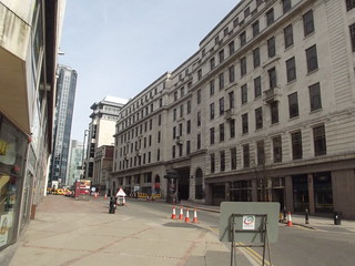
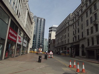
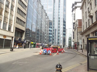
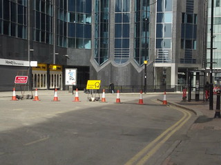
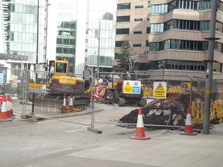
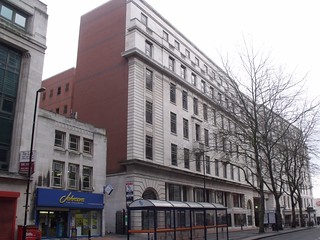
I took a couple of Bull Street photos this morning for you guys (the Midland Metro section).

Leaving Corporation Street past the Minories (ex Lewis's to you all)


The modern end with Colmore Gate


Joining the junction of Colmore Row and Colmore Circus Queensway

 
Thanks everyone for the info and pics. All helping to build a picture of the old Bull Street and the people who lived there. It's an extra bonus when descendants find a connection too. Thanks Ell for the 'present' photos and for going out of your way to update us all. I almost don't recognise the place!

Rupert, you've raised a very good point about the Meeting House.
Refering to post #94. I have difficulty in seeing how the older Meeting House could have fronted on Bull Street. Since photography only started about 1848 the picture looks decidedly refined and I can't see how that garden would have fitted in. Another thing is that it is decidedly not a barn like structure as described. It was north of the Minories I believe and maybe it faced at right angles to Bull St...not being critical, but perhaps these sentiments might have occured to others. What am I missing here?

According to Showells Dictionary:


ImageUploadedByTapatalk1365357564.480817.jpg

So it was originally built in 1703 - the photo in #94 is definitely not a building of that period. The photo must be a later building. Be good to find a drawing of the original building. Viv.
 
No problem Viv. Thought it was about time to get an update of part of the Midland Metro extension route. Plus it was pretty empty on a Sunday morning (hour before the shops opened).
 
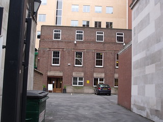
Ah, well done. I was just about to say that I did not remember the other building being on Bull St. either.with the parking places and all. So is this down Dr. Johnson's passage? On the corner of Dr. Johnsons Passage is a dry cleaners called...Johnson's. OK I like it. Further back from there fronting on the Upper Priory was a British Restaurant in wartime and after. Went in there a few times with my dad. Both long gone now. If you look at the other building on Viv's post, you can see a dome behind, which may help. The photo does not look like a meeting house somehow...more like a bankers house in Edgebaston somewhere.
 
Pevsner says that the current Friends Meeting House dates to 1931-33. But the Quaker's have been meeting on this site since 1702.
 
The 1828 pigot smith map of birmingham is not as detailed as later OS maps, but it shows themeeting gouse in bullst as a black building (all churches , civic and other important bulidings were in black, and thes can only be the meeting house, just north of the minories). It certainly seems to show that , then, the meeting house was on the street, not down an alley. Being businessmen they probably thought it best, when rebuilding sometime after 1828, to sell/rent the front premises , which would get a better price, and have the meeting house behind on cheaper land -quakers are not a proselytising faith so there was no need to have a gaudy presence.

Bull_st_pigot_smith_1824.jpg
 
Wikipedia timeline claims the meeting house was damaged in 1759:

ImageUploadedByTapatalk1365407568.346132.jpg

Interesting that the Bull Street meeting house was the only Quaker meeting house in Birmingham from 1703 until 1873 - 170 years. The replacement for the original Meeting House was in 1856/7, so maybe this was when it was moved further back off the road. The 1933 Meeting House (the one we see now) was built in the same place as the 1856/7 structure.

ImageUploadedByTapatalk1365407641.251755.jpg

Viv.
 
This is Page's mantle and shawl warehouse on Bull Street. It's an interior view from M. Billings's Directory "Men and Things Modern" of 1856. It looks like a pretty substantial building on the inside, but not on the exterior sketch of 1840. Maybe business boomed for Mr Page and he later expanded. Viv.

ImageUploadedByTapatalk1365426741.830999.jpgImageUploadedByTapatalk1365426752.474622.jpg
 
Viv - your sketch of Bull Street in 1840 doesn't have a second part showing further up the road does it? Just hoping that No.34 might be visible on it! I know you put the full version on earlier in this thread (#38) but wondered if there was any more of Bull Street shown in the book, Birmingham and Birmingham Men.

Judy
 
Back
Top