-
Welcome to this forum . We are a worldwide group with a common interest in Birmingham and its history. While here, please follow a few simple rules. We ask that you respect other members, thank those who have helped you and please keep your contributions on-topic with the thread.
We do hope you enjoy your visit. BHF Admin Team
You are using an out of date browser. It may not display this or other websites correctly.
You should upgrade or use an alternative browser.
You should upgrade or use an alternative browser.
There are many possibilities here. The conical shaped stack behind Cadbury's looks like the stacks mentioned for glass works and if you look at the 1890 OS there is a circle just below where it says 'Glass Works' so if the Glass Works was behind Cadbury's then it would place Cadbury's on the west side of Bridge St....but it does say school opposite. Ah well.
According to the records of the Cadbury family listed on the National Archives site, the Bridge Road Works were ruined in the 1940 Blitz. For those interested and able to access the B'ham City Archives here are the doc references held by them. I'd go and have a nose myself if I lived near!
Birmingham City Archives has documents of:
Sketch Plan of Bridge Street Works MS 466/41/1/19
Engraving from Henry Newman's drawing of Bridge Street Factory MS 466/41/1/18 (this might be the one posted in #253 above)
Bridge Street Factory yard (artist's sketch) MS 466/41/1/21
Bridge St Factory as it appeared in 1938 MS/41/1/47 Viv
Bridge St Factory the ruins after the blitz of 1940 MS 466/41/1/48 and 49
Looks like it was still being referred to as a factory in 1940.
And here's a link to a modern aerial view of the area between Bridge Street and Suffolk St Queensway. Could come in handy. https://www.arena-central.com/
DavidGrain
master brummie
Bridge Street School was founded by George Dixon in 1884 in Cadbury's old factory. School moved first to Oozells Street then in 1904 to City Road where it still is. The Air Shaft would be for the Stour Valley Railway Tunnel and I presume has been capped off as I have found no trace of it since. Airshafts normally look like this picture which shows an airshaft in somebody's front garden in Old Hill.
View attachment 69249Picute taken from www.geograph.co.uk under Creative Commons Licence.
Can we date the Old Wharf photo? I see Christ Church in the background.
View attachment 69249Picute taken from www.geograph.co.uk under Creative Commons Licence.
Can we date the Old Wharf photo? I see Christ Church in the background.
Last edited:
I thought that at first Phil. It is in about the right place. However , if you look at the c1905 map below, then the building doesn't seem to be there (unless the OS survey did there measurements wrong), which means it must be post 1905, and I don't see a builfing with that sort of appearenc ebeing post 1905.


I believe Christchurch was demolished in 1889 so before that time. I think I zoomed in one time and thought that the clock on Christchurch was not set at the correct time comparing to Big Brum. I thought that this may have been indicative to being close to being pulled down. Anyway, the perspective of the Old Wharf photo indicates that it was taken from a high vantage point directly adjacent to the canal and suggest that this would have been on the western side of Bridge Street which quite possibly would have been from the top of the square tower.
Is this better Mike?
The Birmingham City Council website puts this photo at approximately 1895, but admits it's a little difficult to date. The buildings on the near left are Cadbury's old buildings. https://www.birmingham.gov.uk/cs/Sa...806&pagename=BCC/Common/Wrapper/InlineWrapper
Can anyone glean anything from this photo looking towards Bridge Steet? 'Borrowed' this photo from the Canals of Birmingham thread.
https://forum.birminghamhistory.co.uk/attachment.php?attachmentid=36587&d=1252334080
Viv
Viv.
Last edited:
DavidGrain
master brummie
Can anyone glean anything from this photo looking towards Bridge Steet? 'Borrowed' this photo from the Canals of Birmingham thread.
https://forum.birminghamhistory.co.uk/attachment.php?attachmentid=36587&d=1252334080
Viv.
There it is on the 1958 Gas Street basin photo. Can anyone work out the perspective to see which side of Bridge Street it can be as it does not look part of the building in front of it to me. I think it is some distance beyond the canalside buildings.
S
Stitcher
Guest

I like this one from 1956.
stitcher
S
Stitcher
Guest

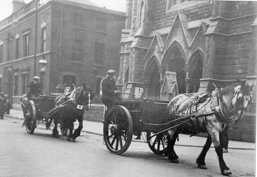
The Church of The Messiah with The Brasshouse next door. Note the pre-motorised transport, 1936.
B
BernardR
Guest
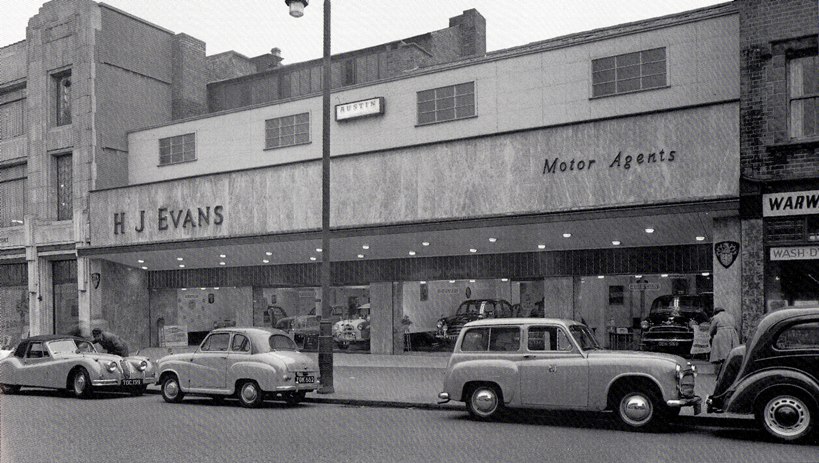
Hi Stitcher - I remember that branch of H J Evans.
S
Stitcher
Guest
Yes, me too. I was too young to buy a car but that did not stop me from looking
stitcher
stitcher
paul stacey
master brummie
XK150, A30, Hillman Husky, 100E. what memories.
S
Stitcher
Guest

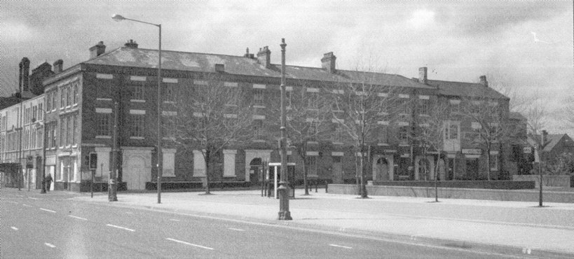
King Edwards Place junction with Broad Street in 1986.
stitcher
Last edited by a moderator:
S
Stitcher
Guest
S
Stitcher
Guest
I was just checking to make sure you are alert Lloyd, you were and I have now corrected the text. Ha Ha
stitcher
stitcher
paul stacey
master brummie
I think this a good photo of such an iconic place in Birmingham.
S
Stitcher
Guest
Wonder if the remains of the buildings in the foreground are on Bridge Street? If so, would they be Cadbury's old factory? Viv.
S
Stitcher
Guest
I really could not help you there Vivienne, we need one of the experts again.
S
Stitcher
Guest
S
Stitcher
Guest
Seeing the Waterworks Arch reminds me of a school project. When I was in junior school the whole class made a papier mache model of the Elan Valley. Must have been a geography lesson. The model was impressive and the memory always reminds me of the wonderful soft water of Brum. Oh I so miss that water. Viv.
S
Stitcher
Guest
Hello again Vivienne, I have a few pics relating to Elan Valley and our water, I also have some photos I have taken when I visit the Valley. I go to S.Wales to visit an old friend about 6 times during the summer and I sometimes call into the visitoe centre for a coffee and a sarnie. I will see if I can re-post them onto the original thread sometime soon.
Thanks Stitcher. Will look out for those. Despite being an infant expert on the Elan Valley terrain (!!) I've never been there, so would be lovely to see any pictures of it. Not very confident though that the contours would have been too accurate on our model! Viv.
Viv
With regard to whether the ruins were the old Cadbury factory, I don't think so, but cannot put my hand on the confirmation. I am sure i have somewhere seen it said that the Bridge St board School was built on the site of the old Cadbury factory. This , I think, would place it slightly further down bridge st (on the same side of the road. it would also fit with the factory having its own wharf, as the 1889 map shows a short arm pointing towards the school.
mike


