Hello everyone,
I am currently working on a series of Birmingham City Past & Present, street by street that I will upload onto Youtube starting September 2025. It is going to be a huge series.
I am currently working on the Market area (Moat Row, Moat Lane, Jamaica Row, Upper Dean st, Dean St, Gloucester St, Sherlock St, Bradford St, Edgbaston St, Bullring) and I am almost done. But I need your help to finalise it.
I have plenty of photos of the streets mentioned above already, but unfortunately not enough photos to cover the whole streets.
The templates are already done (photos placed in the right order and captions added), I just need to go out and take pictures.
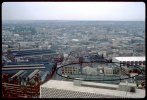
Is the building that was added to St Martins Church (Edgbaston St) the new rectory, and when was it built? (refer to photo)
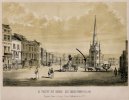
When was the pump nicknamed “Pratchett’s Folly” removed from the Bullring and where is it now? (refer to photo)
There were underground toilets for ladies and gents in the Bullring? Do you know when they were built? (refer to photo)
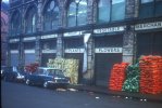
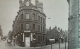
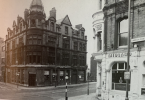
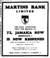
Also Mikejee, if you are reading this post, can I please use some of the photos that you took of Birmingham in the 70s, especially photos of Jamaica Row and Market St for my project? I will obviously give you credits in the video description.
Thank you so much in advance for your help everybody. Have a lovely and sunny week!
Joseline.
I am currently working on a series of Birmingham City Past & Present, street by street that I will upload onto Youtube starting September 2025. It is going to be a huge series.
I am currently working on the Market area (Moat Row, Moat Lane, Jamaica Row, Upper Dean st, Dean St, Gloucester St, Sherlock St, Bradford St, Edgbaston St, Bullring) and I am almost done. But I need your help to finalise it.
I have plenty of photos of the streets mentioned above already, but unfortunately not enough photos to cover the whole streets.
The templates are already done (photos placed in the right order and captions added), I just need to go out and take pictures.
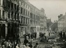
- I am looking for photos of Upper Dean St before the Inner Ring Road was constructed. Photos that show St Martins Toll Market and photos that show the side of Upper Dean st circled in black (refer to photo).
- Photos of St Martins Lane, especially the junction with Moat lane. I am also looking for a photo of the Black boy inn drawing by A. Darlington 1870.
- Edgbaston St and Lease Lane pre 1939.
- Gloucester St: post 1939
Is the building that was added to St Martins Church (Edgbaston St) the new rectory, and when was it built? (refer to photo)
When was the pump nicknamed “Pratchett’s Folly” removed from the Bullring and where is it now? (refer to photo)
There were underground toilets for ladies and gents in the Bullring? Do you know when they were built? (refer to photo)
Also Mikejee, if you are reading this post, can I please use some of the photos that you took of Birmingham in the 70s, especially photos of Jamaica Row and Market St for my project? I will obviously give you credits in the video description.
Thank you so much in advance for your help everybody. Have a lovely and sunny week!
Joseline.

