• Welcome to this forum . We are a worldwide group with a common interest in Birmingham and its history. While here, please follow a few simple rules. We ask that you respect other members, thank those who have helped you and please keep your contributions on-topic with the thread.

    We do hope you enjoy your visit. BHF Admin Team

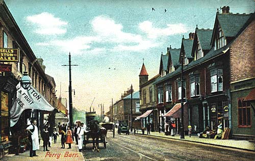
Birchfield Road Perry Barr

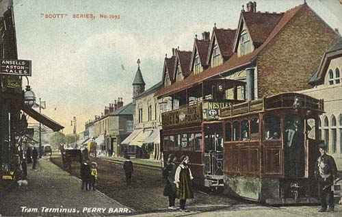
The destination board on the side of the passenger trailer seems to say 'Old Square' and 'Saltley' (which would explain the 'S'). Where do the tracks swinging to our left (under where the girls are standing) go? Is there a depot down there? I don't have my maps of that era handy to check.
 
The 3rd pic below shows that the tower was probably there in 1920
A Tower in Perry Barr.
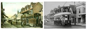
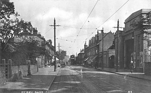
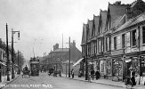
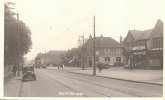
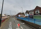
Three pictures of Birchfield Rd Perry Barr, the early pictures show a pointed tower on the building on the corner of Aston Lane. The tower was later removed from the building ? The Birchfield cinema which opened in 1913 can be seen in the lower right picture.

1900-1920
birchfield1.jpg


1905 ca.
PerryBarr1905.jpg


1920 ca.
Perry_Barr__1920.jpg
 
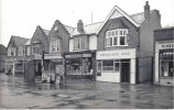
The tower on a corner building in Perry Barr was corbelled but had lost it's pointed roof by the date the photo below was taken. I remember Perry Barr as it looks in the photo and the shop, but with no pointed roof I didn't notice there was a tower.
The only image I know of which shows the shoe shop on the corner in Birchfield Road. I do not know the date but notice the pedestrian crossings are not zebra crossings and the cars would also probably help to date it. The image is not very clear but the name on the shop appears to be 'Englands'.
index.php
 
It was England’s Shoe Shop. I don’t remember the shop itself but I do remember the X-ray machine in the shop when I got my feet measured there.

Now that it’s been mentioned, it looks obvious that at some time in the past there would have been something like a tower as the architecture looks odd/incomplete around the eaves on that corner.

Viv
 
Can anyone remember, 142 Birchfield Road, Perry Bar, where I was born in 1950 at selly oak Hospital. I've got maps but looking for more information on the house. We left about 56 and can remember sitting at the gate with my late sister and have no more information, I would appreciate any help
 
Last edited:
It looks a large house on the maps, I assume it was knocked down for the road widening. There are a couple of mentions in the newspapers - in 1940 a resident Harry Cotton was charged with stealing 3 diamond rings and, in 1942 it and its neighbouring properties appear to be up for sale at a reduced price after being damaged in a blast (war ?).

There are photos of Birchfield Road here but they seem to be further out of the city...

 
Before my time, but I think Viv's picture was taken from near the junction with Trinity Road, looking towards Perry Barr, and near Holy Trinity Church and its vicarage. There are still a couple of very substantial villas on that part of Birchfield Road.
This photo is from long before the flats opposite the Odeon were built. Anyway, that's guess! Nice pic, too.

Big Gee
Big Gee, I think you are correct! I think a little closer to the Trinity Rd end.
 
It looks a large house on the maps, I assume it was knocked down for the road widening. There are a couple of mentions in the newspapers - in 1940 a resident Harry Cotton was charged with stealing 3 diamond rings and, in 1942 it and its neighbouring properties appear to be up for sale at a reduced price after being damaged in a blast (war ?).

There are photos of Birchfield Road here but they seem to be further out of the city...

Thank you so much MWS, I will have to find out more as i was told nothing about what went on.
 
It looks a large house on the maps, I assume it was knocked down for the road widening. There are a couple of mentions in the newspapers - in 1940 a resident Harry Cotton was charged with stealing 3 diamond rings and, in 1942 it and its neighbouring properties appear to be up for sale at a reduced price after being damaged in a blast (war ?).

There are photos of Birchfield Road here but they seem to be further out of the city...

Hello can anyone help me, What newspapers are the best to search for information about birmingham in the 40s and 50s please.
 
here is the link to the newspaper archives...you will need to subscribe but it is not expensive

 
here is the link to the newspaper archives...you will need to subscribe but it is not expensive
I'm afraid I must disagree, Lyn. I was a subscriber, but at the costs (£12.99 a month, £27.99 for 3 months, or £86.04 for a year) I found it to be too expensive to renew.
 
I'm afraid I must disagree, Lyn. I was a subscriber, but at the costs (£12.99 a month, £27.99 for 3 months, or £86.04 for a year) I found it to be too expensive to renew.
Hello every one, I been on Newspaper Archives all day. I found Harry Cotten but nothing else. has anyone got any idea what number 142 Birchfield road looked like or some property that looks the same so i can get a idea please.
 
have you looked at our main birchfield road thread there are loads of old photos on it but you will need to read from post 1 in case you miss any...cant say as any will show no 142 but at least you will get an idea of what the area was like back in the day...click on below link to take you to the thread...lyn

 
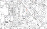
In 1959 I lived 28 Birchfield Road right opposite Mansfield Rd (marked red). It was a big View attachment 99951Georgian type house and must have belonged to someone of note back in the day.
Does anyone remember Harry Bastable's shop? He was a speedway rider in the 40s/50s? and owned the motorcycle shop on Birchfield Rd. I bought a BSA A7 & Sidecar from him in 1963, for £55. Apologies regarding photo position as I can't get the hang of inserting them.
Hello can you tell me if you remember anything about 142 Birchfield Road please.
 
Don't think this first image has been on here but it shows the Birmingham Municipal Bank at the corner of The Broadway with Birchfield Road. Despite all the changes here, many of the buildings are still there, the BMB is still a bank today according to Streetview. The parade of shops coming towards the photographer in the last photo are also still there, a good example of 1930s local retail development.
Viv.

1930s
Screenshot_20230528_091716_Chrome.jpg
Present day
Screenshot_20230528_133244_Maps.jpg

1950s


Screenshot_20230528_091815_Chrome.jpg
 
Last edited:
Don't think this first image has been on here but it shows the Birmingham Municipal Bank at the corner of The Broadway with Birchfield Road. Despite all the changes here, many of the buildings are still there, the BMB is still a bank today according to Streetview. The parade of shops coming towards the photographer in the last photo are also still there, a good example of 1930s local retail development.
Viv.

1930s
View attachment 180468
Present day
View attachment 180470

1950s


View attachment 180467
That was a nice area for shopping, amazing how well it looked in the 1930’s!
 
Agree Richard, a pleasant shopping area. The biggest change must have been when the road was widened. It looks like there were entrances to houses on the left of the 1930s. These must have been swept away with the 1960s road widening development. Viv
 
Back
Top