
-
Welcome to this forum . We are a worldwide group with a common interest in Birmingham and its history. While here, please follow a few simple rules. We ask that you respect other members, thank those who have helped you and please keep your contributions on-topic with the thread.
We do hope you enjoy your visit. BHF Admin Team
You are using an out of date browser. It may not display this or other websites correctly.
You should upgrade or use an alternative browser.
You should upgrade or use an alternative browser.
Birchfield Road Perry Barr
- Thread starter debi
- Start date


oldMohawk
gone but not forgotten
Hi Topsy - It does look a tight squeeze for the cyclist/biker, no chance of going between the bus and car. I cycled in the 1950's and remember if your front wheel went into a tramline then it was very scary.
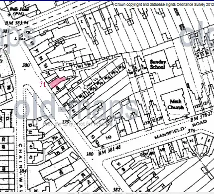
With your pic in #111 I remember driving there and would say it was down from Six Ways near Chain Walk as confirmed on Mike's map. I notice the white car is trying a dodgy 'U turn', and there looks to be a build-up of buses towards Trinity Road.
oldmohawk
With your pic in #111 I remember driving there and would say it was down from Six Ways near Chain Walk as confirmed on Mike's map. I notice the white car is trying a dodgy 'U turn', and there looks to be a build-up of buses towards Trinity Road.
oldmohawk
TT's pic on Post No 111 is with Six Ways behind the camera, looking towards Perry Barr. You can see the Bulls Head pub behind the parked lorry. I went to school with the son of a former manager of the Bulls Head, Mr Williams, and we used to play snooker in the upstairs games-room on Saturdays...a mis-spent youth. This would be in the late 1950's or early 1960's. Also, the father of a good friend of mine had a car-repair business on Chain Walk. If my memory is correct, there was a dance-school on Chain Walk, as I remember (vaguely) being dragged there one evening much against my will.
Regarding the traffic on Birchfield Road, in the few years prior to the building of the underpass and flyover, it was horrendous at peak periods. Some evenings it was solid from the Central Fire Station almost to the Scott Arms.
Big Gee
Regarding the traffic on Birchfield Road, in the few years prior to the building of the underpass and flyover, it was horrendous at peak periods. Some evenings it was solid from the Central Fire Station almost to the Scott Arms.
Big Gee

big gee you are right...i didnt notice the bulls head pub in that pic...i used to play darts against them..it just goes to show how much of birchfield road was demolished..some fine buildings as well...the building of the bulls head is still there but no longer a pub...
lyn
lyn
oldMohawk
gone but not forgotten
Hi Viv - Your mention of a 33 bus reminds me of the type of bus in the pic below which travelled along Birchfield Rd in WWII. It pulled a trailer which burnt coke to produce gas. I remember as a small child getting on a No 33 'gas bus' with my Mum at a bus stop in Perry Barr and the strange engine noise as it struggled up the hill by the Golden Hind pub for it to then 'conk out' on the hill up towards Hawthorne Rd.I'd have been on that # 33 bus
They were not a success and there is an interesting description of them in the last paragraph of post #7 in another thread Here
oldmohawk


Hi Oldmohawk. Never heard of those before. Can't say I'm totally surprised they had a short life! How on earth could they've been regarded as safe? Bus failures must have been a common winter sight on the hill near the Golden Hind. I've been on the # 29 bus, going towards Hawthorn Rd in bad weather and seen the the buses just refusing to go up the hill. It was quicker to walk. Must have been a bit of a nightmare for bus drivers. Viv.

TOPSYTURVEY
brum
Big Gee i also wet to the Dance studio to try and learn old time when i was about 12 " No chance" More into Twist and Shout. The dance studio was Madame Amies, i always remember the powder or chalk on the floor.
Hi TT,
yep, Madame Amies, that was it. I've been racking my brains trying to remember. A bit later I was dragged (by another person) to Goodwin-Harding's Dance Studio on Westminster Road, with the same result - I just hated dancing and still do.
I didn't know that the Bull's Head was now a mosque. Strange, because I drive past it on the flyover quite frequently.
Big Gee
yep, Madame Amies, that was it. I've been racking my brains trying to remember. A bit later I was dragged (by another person) to Goodwin-Harding's Dance Studio on Westminster Road, with the same result - I just hated dancing and still do.
I didn't know that the Bull's Head was now a mosque. Strange, because I drive past it on the flyover quite frequently.
Big Gee
The Bull's head is now a mosque...sign of the times
i would have thought the bulls head too small to be a mosque...will take a look when i pass it tomorrow..
lyn

lynne webb
GONE BUT NOT FORGOTTEN
Lyn, Vicki said she thought the Bulls Head was now flats.
Trying to locate where exactly this is. It's Perry Barr Village in 1900. I'm assuming it's on Birchfield Road. But can anyone be more precise please? Viv
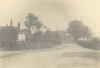
Oh thanks Lyn. I suppose the very old cottages opposite the Perry Park on Aldridge Road must be the early village then. Expected it to be nearer the station and Crown and Cushion. I know St. John's - was christened there, although many, many years ago of course! Viv.
What you've said does make more sense Lyn. The pic looks to be of a winding road, whereas Birchfield is pretty straight. In fact I think Birchfield was supposed to be part of Icknield Street and there's a Roman kiln somewhere around Perry Barr. You've set me off again - going to check it out on a map! Viv.
TOPSYTURVEY
brum
I Think the Roman kiln was found in Wellington Road.
TOPSYTURVEY
brum
[h=1]Birmingham: The Hidden History [Paperback][/h]Michael Hodder (Author This looks a very interesting book on Amazon. It has a good review.
I Think the Roman kiln was found in Wellington Road.
do you know if its still there topsy...
TOPSYTURVEY
brum
This is part of what i had read lynLAND ADJACENT TO THE CROWN AND CUSHION PUBLIC HOUSE,
WELLINGTON ROAD, PERRY BARR, BIRMINGHAM
AN ARCHAEOLOGICAL DESK-BASED ASSESSMENT, 2006
SUMMARY
An archaeological desk-based assessment was carried out in January 2006 on land at
the Crown and Cushion public house, Wellington Road, Perry Barr, Birmingham (NGR
SP 0671 9088
) in advance of residential development. The site is located on the
north side of Wellington Road, adjacent to the Crown and Cushion, and at the
intersection of Walsall Road, Birchfield Road, Wellington Road and Aston Road.
Previous archaeological work to the west along Wellington Road identified
archaeological remains associated with a Roman kiln dating to the second century,
and evidence of settlement from the first and second centuries. The site is also close
to the predicted line of Icknield Street, and spot finds of Romano-British coins, and
the assessment has highlighted the potential for archaeological remains of this
period to survive within the site boundaries. The assessment also highlighted the
potential for archaeological remains of the post-medieval period to be present within
the site boundaries.
WELLINGTON ROAD, PERRY BARR, BIRMINGHAM
AN ARCHAEOLOGICAL DESK-BASED ASSESSMENT, 2006
SUMMARY
An archaeological desk-based assessment was carried out in January 2006 on land at
the Crown and Cushion public house, Wellington Road, Perry Barr, Birmingham (NGR
SP 0671 9088
) in advance of residential development. The site is located on the
north side of Wellington Road, adjacent to the Crown and Cushion, and at the
intersection of Walsall Road, Birchfield Road, Wellington Road and Aston Road.
Previous archaeological work to the west along Wellington Road identified
archaeological remains associated with a Roman kiln dating to the second century,
and evidence of settlement from the first and second centuries. The site is also close
to the predicted line of Icknield Street, and spot finds of Romano-British coins, and
the assessment has highlighted the potential for archaeological remains of this
period to survive within the site boundaries. The assessment also highlighted the
potential for archaeological remains of the post-medieval period to be present within
the site boundaries.

Di.Poppitt
GONE BUT NOT FORGOTTEN
I have just ordered it Lyn, there were 3 left tonight.
Years ago I read somewhere that Roman archaeology had also been found around what's now Holford Drive and the area of the playing-fields. I can also remember reading that there was a Roman road roughly along the line of Kingstanding Road/Wellhead Lane/Stoneleigh Road/Wheeler St/Great Hampton Row. How true this is I don't know. When I was a lad people used to say that the Zig-Zag bridge was on the site of what was originally a Roman crossing of the Tame. Most of the Birmingham history and archaeology books I've read have been concerned only with the Middle Ages and later - there doesn't seem to be much published about the history of the area prior to the Norman Conquest. But obviously there was a Roman presence in the greater Birmingham area - ref: Metchley Fort, Icknield Street, etc. Interesting, and worth finding out more.
Big Gee
Big Gee
Thanks Topsy for the info. And totally agree with you BigGee. Well worth digging deeper - sorry for the pun! What intrigues me is how this area developed from ancient to early 18th century. The area was predominantly rural until relatively modern times, with lots of mills and farms. Much of the history would still have been in the ground, undisturbed for many centuries, except for the work of the farmers plough of course! So good to be able to trace some of it, if only a glimpse. Viv.

Interesting about Holford Drive playing fields, when I was at Birchfield Road Junior we used to use them sometimes - don't remember seeing any Roman remains ;-)
I think the remains were probably pottery and other bits and pieces, rather than the remains of building. There was a water-mill in the vicinity too, but I don't think this was Roman.
HI BIG GEE
That was a very intresting report on the subject regarding holdford rd and the tay ;
many years on holford rd perry barr end there was an allotments and i had a couple of plots on there
and i recall the old barron land many ; many years ago before any think was ever built on that holford rd
so do you think that the allotments down there could have been a roman site ;in its aye day ;?.
do you know if the allotments are still there at perry barr [ holford road ; ]
gra; i will E, MAIL you later later today ; alan ;; astonian
That was a very intresting report on the subject regarding holdford rd and the tay ;
many years on holford rd perry barr end there was an allotments and i had a couple of plots on there
and i recall the old barron land many ; many years ago before any think was ever built on that holford rd
so do you think that the allotments down there could have been a roman site ;in its aye day ;?.
do you know if the allotments are still there at perry barr [ holford road ; ]
gra; i will E, MAIL you later later today ; alan ;; astonian