• Welcome to this forum . We are a worldwide group with a common interest in Birmingham and its history. While here, please follow a few simple rules. We ask that you respect other members, thank those who have helped you and please keep your contributions on-topic with the thread.

    We do hope you enjoy your visit. BHF Admin Team

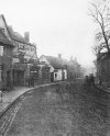
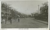
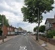
Aston Hall Road (formerly Aston Lane)

Aston Tavern on Aston Lane/Aston Hall Road in 1927. Perhaps a Sunday, quite a few people around the churchyard. Viv.
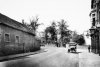

image.jpeg
 
very interesting pedro as looking at the photos i posted of westbrook house i did not think it was 15th century i thought it was georgian:rolleyes: there again i am no expert

lyn
 
very interesting pedro as looking at the photos i posted of westbrook house i did not think it was 15th century i thought it was georgian:rolleyes: there again i am no expert

lyn

Yes, maybe they should have said that there had been a house, in some form, from the 15C ?
 
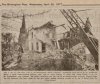
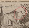
That was my Doctors in the 50's, so sad to see it go, such a lovely old Georgian (?) building, so much for listed status, it would have been nice to see it restored, maybe turned into flats, typical Council action. Same with the old Vicarage opposite, also demolished, spent many happy hours there at various functions, still that was probably the Churches decision and not the Councils Eric
 
i am just wondering if the back of the building with its original brickwork is the part that dates to the 15th century but i still have my doubts...we do know however that the original aston tavern pub which was a tad down to the right of westbrook house dated back that far....my photos on posts 20 and 21 may help
 
Last edited:
lyn, re your#23 pic 4 - it is/was the Vicarage, I remember the Vicar, lovely Wife but I did not like him, he refused to marry my late Wife and I because she was a divorcee, even though she was the innocent party, hardly a Christian act !! Eric
 
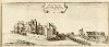
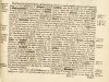
Looking in William Dugdale’s Antiquities of Warwickshire (1656) gives an interesting picture of Aston Hall.

It also gives a history of Aston Parish Church, and mentions a vicarage.

5747091C-8CA9-4CA7-9AB3-54550E4F7747.jpeg 4D41FB00-5521-47E0-BDAF-94CC58BE6164.jpeg
lyn, re your#23 pic 4 - it is/was the Vicarage, I remember the Vicar, lovely Wife but I did not like him, he refused to marry my late Wife and I because she was a divorcee, even though she was the innocent party, hardly a Christian act !! Eric
 
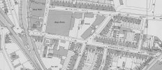
Glad to help Denise. I don't know if you have determined where Coronation Place was, but they weren't what I call back houses. Have taken just a part of the map (to save storage on the forum) and marked which was coronation place. It was between 42 & 44 Aston Hall Road, which makes it the 14 houses in red. They are behing the houses along the road, but not what i call a back house (but then I'm not a Brummie !)
If you click twice on the map to bring it to the biggest size, then you can make sure the arrow is on the picture and click on it using the right hand button on your mouse which brings up a list of options . One of these says "Save picture as" Then click with the left hjand button and you can save the picture wherever you want. Once it is on your computer then you can send it by e-mail to your cousin as an attachment. I only know how to attach using AOL e-mail, which may be different to yours. Sorry if my explanation is not clear, but I tend to do it automatically, and may have missed something out.
If you are having trouble still with sending it, if you or Jean send me a private message with your cousins e-mail address, then I could send it directly.
Mike

map1938astonhallrdcoronationplace.jpg
My dad's Mom or moms mom lived in Coronation Place, Jane Martha Black 1935 as far as I recall
 
Map and aerial shots (Coronation Place clearly visible) here...

 
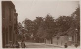
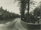
nice one here...aston village 1926..think it says aston lane or witton lane on the sign on the church railings so that must be aston parish church..

View attachment 210701
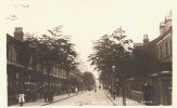
Sure is I lived round the corner to the right of this photo in Holte road with my parents and Aunt Floss. Two others of my dads side of the family lived further down the road. Aunt Nell and Uncle George.
 
A super quality aerial view (1952) of Aston Hall Road and Waterworks Street.
Hi John
Could you provide a link to the original of the aerial image? I'm wondering if there is anything similar
I'm pretty sure the yard to the bottom of the picture by the rail junction is CJ and FW Rudders timber merchants -- which had two entrances, one at 79-81 Aston Hall Rd (that can be seen), and the other on the bend in Sutherland St at no. 38, which is out of shot below the bottom of the image. It certainly looks like timber stacks by the railway line.
 
Hi Lyn
That's brilliant. Thanks very much. I think you've cracked it.

I'm having a bit of a family history binge, and I've found copies of the auction notices for the two properties in the 1960s. They match completely.

No 38 Sutherland St, the two sheds behind it, and the area along the railway embankment went up for auction on Friday 10 November 1961, sold by the estate of my grandfather, Stanley Victor, but originally purchased by his uncle FW (Frederick William) Rudder sometime before 1914, and used as a timber yard. The early 1900s map seems to show the main shed already erected there.

(The auction notice for No 38 says it had outline planning permission for 5 light industrial units, but there's no evidence from the modern image that the buyer took any advantage of that!)

The buildings at and behind 79-81 Aston Hall Rd were auctioned on Wednesday 8 May, 1963, had two workshops and timber storage sheds and were being sold by the company of my great grandfather CJ (Charles John) Rudder, nineteen years after his death but before the firm's final liquidation.

CJ originally started his packing case manufacturing business at a site on Cambridge St, possibly around 1903. But he seems to have acquired the Aston Hall Rd site after his brother FW died in 1925. After that, CJ managed both companies as separate entities. It must have been something of a fluke that the Aston Hall Rd site became available, because, in effect, the overall site now had two entrances, on different streets, and lots of shared storage by the railway embankment.

The early maps show a property set back from the road on the Aston Hall Road site. It seems to align with the front of the main roadside building from the 1940s, and I wonder if it was simply incorporated into the overall site construction when CJ took over.

The family rode the boom and bust of most of the smaller timber traders of Birmingham -- a period of almost exactly a century. CJ's dad William Daniel was the original founder of Rudders and Paynes business on Chester St, and appears in business directories from 1852, first on Bagot St, and then in Chester St.

I remember a single visit as a young boy to the Aston Hall Rd works around 1958, CJ's picture, with an exotic walrus mustache, was still hanging up in the front office.

My father was already clear in his mind that the business was doomed, and even at my young age I was aware of a sense of some relief on his part. By the time it was all wound up, any remaining value was taken up by death duties, overdue tax and solicitors' fees -- a mess that took another 30 years to resolve. But even before the properties went up for auction, the younger Rudders of our branch had already moved to Essex and London, resolved to find a different line of work and a regular salary.

Many thanks for your help and for the introduction to fabulous online mapping gizmos :)
 
Back
Top