Aidan
master brummie
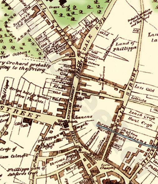
Hi everyone, only just read this thread - back to Aidan's original questions - in my book on Building Birmingham - Cherry St. was one of a small development dating from the mid18th C. In October 1733 William Hay, toymaker, leased part of Guest's Cherry orchard from Moses Guest. he laid out Cannon St. Hay developed the site and built a second road linking with Guest's with Walkers Cherry Orchard - the road became Cherry St. When St. Philips was consecrated in 1715 a row of houses was built known as Temple Row, which consisted of ten houses in a block divided by Cherry St.
Sheri
Thanks Sheri, that's useful info. I assume from this that the Cherry Orchard was originally laid out by the Priory, was grabbed by Gibbons (1543 map), divided into two fields (one owned by Guest with the Dovecote-like structure, one by Walker) that are shown on the 1731 map who then both start to lease out the land for development to Hays and others as you describe.
Does your reference have any pictures or maps perchance, or mention who owned/developed/Designed the Temple Row site - I wonder if it was William Ing & Penelope Philips who had given the land for the Church (hence the name) by the Designer Thomas Archer as it mentions they were built at the same time? I think Ann Colmore's land was to the North and John Pemberton's Square and Priory estate to the East. Moses Guest's land seems to have been in the West. Walker seems to have owned the Rackhams plot Southwards.