-
Welcome to this forum . We are a worldwide group with a common interest in Birmingham and its history. While here, please follow a few simple rules. We ask that you respect other members, thank those who have helped you and please keep your contributions on-topic with the thread.
We do hope you enjoy your visit. BHF Admin Team -
HI folks the server that hosts the site completely died including the Hdd's and backups.
Luckily i create an offsite backup once a week! this has now been restored so we have lost a few days posts.
im still fixing things at the moment so bear with me and im still working on all images 90% are fine the others im working on now
we are now using a backup solution
You are using an out of date browser. It may not display this or other websites correctly.
You should upgrade or use an alternative browser.
You should upgrade or use an alternative browser.
Yardley Wood
- Thread starter enclosed
- Start date

The next photos require a little imagination. The first is Yardley Wood Road c1910. Still a very rural scene even into the 1910s. Viv.

And two more around the same position on Yardley Wood Road near the ford. The second is dated 1929. Viv.


And two more around the same position on Yardley Wood Road near the ford. The second is dated 1929. Viv.
Speedy23
master brummie
If you look at the sign closely, it says "Warstock Post Office"....I come from Warstock but I can't think where it could be...or have been! I'll have a look at my old maps in a bit.And a very quaint Post Office at Yardley Wood. Sorry no date and no indication of exact location. Viv.
View attachment 113440
Speedy23
master brummie
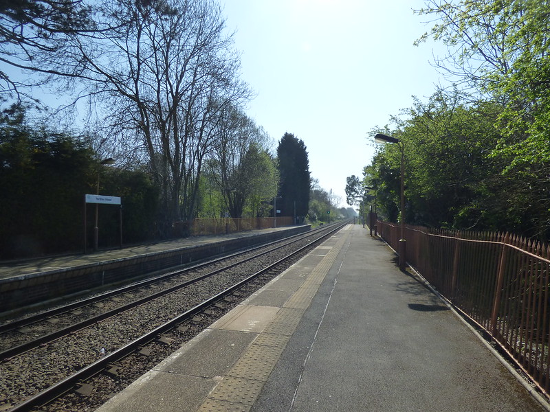
Got an idea that this might be Prince of Wales Lane, opposite where the allotments used to be....in fact, the Warstock Post Office that I remember was next to a shop called "Morgans" on the left hand side towards the top of P.o.W Lane as you went toward the P.o.W pub at the top. I seem to remember this bring discussed on here before....Thanks Ell. Good to see the station's still there and functioning!
I assume there was once a Yardley Wood village where the PO would have been but finding it hard to imagine. Below is another postcard just with the title "Yardley Wood" so presume this was the village centre. Obviously still looks very rural at this time, as does the photo of the PO. In fact at first, I thought the PO was a farm. Maybe Mike could locate the PO on a map for us please?
What's that in the handcart? Looks like a metal band which is fixed onto barrels. Viv.
View attachment 113442
If you look at the sign closely, it says "Warstock Post Office"....I come from Warstock but I can't think where it could be...or have been! I'll have a look at my old maps in a bit.
Hadn't spotted that above the window Speedy, thanks. I've tried to highlight it a bit more, and yes, you can just make out "Warstock PO". Viv.
A few more images of Yardley Wood. The first of Four Arches is 1904.

The second the 'Aqueduct'. This is not quite how I'd describe an aqueduct. The brickwork of the bridge in the background looks new.

A view of Windmill Pool. The windmill stands in the background but looks like it might be out of use as it has no sails.

And finally the Ford, this view is of the Ford in winter or early spring. Very little development around it.

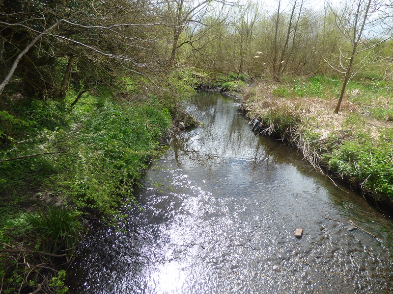
All very watery places in Yardley Wood. Was it a very wet area? Viv.
The second the 'Aqueduct'. This is not quite how I'd describe an aqueduct. The brickwork of the bridge in the background looks new.
A view of Windmill Pool. The windmill stands in the background but looks like it might be out of use as it has no sails.
And finally the Ford, this view is of the Ford in winter or early spring. Very little development around it.
All very watery places in Yardley Wood. Was it a very wet area? Viv.
Radiorails
master brummie
As to be expected here, there are some lovely pictures being posted. There were many fords along the River Cole and Chinn Brook in my youth. I cycled over or through them many times.
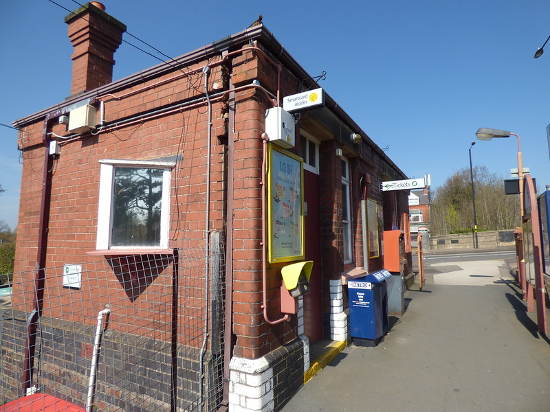
Yardley Wood Road is a long road which stretched from Sparkhill within the city boundary) almost to Druids Heath which was outside the city. It was a good road to cycle back in the late 40's and early 50's: I doubt it is today. The principal places of interest to me along that road were at the southern end, that is to say Yardley Wood railway station and BCT bus depot. Shops rarely interested me (except those which catered for young boys) and being too young pubs meant little either.
Yardley Wood Road is a long road which stretched from Sparkhill within the city boundary) almost to Druids Heath which was outside the city. It was a good road to cycle back in the late 40's and early 50's: I doubt it is today. The principal places of interest to me along that road were at the southern end, that is to say Yardley Wood railway station and BCT bus depot. Shops rarely interested me (except those which catered for young boys) and being too young pubs meant little either.
Last edited:
Radiorails
master brummie
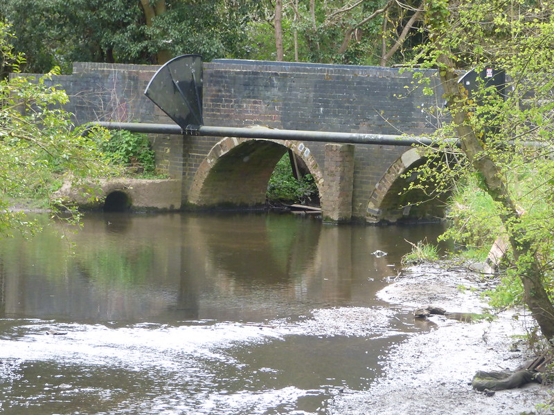
The aqueduct was in Peterbrook Road, Shirley. The Mill pool was also a feeder to the Stratford Canal and was off Priory Road. I don't know when the mill lost its sails, it never had any in the 1940's. It was a great pity that it was not restored but sadly it was demolished in the frantic house building of the late 1950's when so much was destroyed throughout the UK, despite the fact that wartime bombing had done so much damage already. It would have made a nice feature in the landscape today I am sure.
I am reminded of this beautiful mill in York, England which is wonderfully preserved. It sits within a housing estate today but is a great enhancement, I believe, to the area.
https://en.wikipedia.org/wiki/Holgate_Windmill
I am reminded of this beautiful mill in York, England which is wonderfully preserved. It sits within a housing estate today but is a great enhancement, I believe, to the area.
https://en.wikipedia.org/wiki/Holgate_Windmill
Thanks Alan and Janice. Very helpful. Viv.
devonjim
master brummie
I notice on a map of the area a "Quagmire Farm" . Amusingly it is now Glastonbury Rd. Plenty of quagmire at Glastonbury!A few more images of Yardley Wood. The first of Four Arches is 1904.
View attachment 113460
The second the 'Aqueduct'. This is not quite how I'd describe an aqueduct. The brickwork of the bridge in the background looks new.
View attachment 113459
A view of Windmill Pool. The windmill stands in the background but looks like it might be out of use as it has no sails.
View attachment 113458
And finally the Ford, this view is of the Ford in winter or early spring. Very little development around it.
View attachment 113457
All very watery places in Yardley Wood. Was it a very wet area? Viv.
Radiorails
master brummie
Noticing mention of Prince of Wales Lane reminds me that it was believed that to stand in in a certain spot near a side road junction off Prince of Wales Lane, you could move slighly to be in three places simultaneously. Those places were Shirley (Solihull UDC), City of Birmingham and lastly Worcestershire. It was wonderful childish fun. Those were the days when you actually made the effort to visit somewhere rather than look at it on a computer screen or phone. 
Addendum:
Quagmire Farm. The whole area, I feel, was a quite watery place so that name does not surprise me. There was the Chinn Brook and River Cole with its associated mill pools and canal feeders in the area. The area between between Aqueuct Road (Shirley) and Trittiford (Yardley Wood) where the Cole ran was quite a swampy sort of place. Improvements (as recorded elsewhere on this Forum by me) were made by POW's, after the cessation of WW2, who dug a straightensed and wider channel for the small river. Note it was often called Cole Brook in its headwaters.
Last edited:
Now managed to dig out two maps of the area (a major success finding them since we moved house). Quite a difference in the roadway development between 1830s and 1890s albeit still a very rural location.
I notice " Tritterford Farm" was once "Titterford Farm" (no 'r'). Was it once a mill too? Viv.


I notice " Tritterford Farm" was once "Titterford Farm" (no 'r'). Was it once a mill too? Viv.
Two of Trittiford (Tittiford) Mill/Farm. The first is a 1911 image labelled just "Mill" and the second, a 1937 Bimingham Libraries image, is labelled "Mill Farm". Viv.


Radiorails
master brummie
I am certain that that mill pool shown here is the feeder to the canal as it is in an adjacent field to the mill, which is on the western side of Priory Road. I am not sure what, if any use of the pool was made by the mill as it was a wind powered mill rather a water mill. Another mill is shown nearby, on a post 1910 map (that is when the railway was built) on a map on the W, Dargue site but as it is situated on a water course I guess it was possibly a water mill that was served by a leat off the Cole and again maybe belonged to The Priory.The mill pool is there to this day in Trittiford Park
The a pool adjacent to Trittiford Park would have been for the Trittiford Mill which as the old map shows is listed a steel mill. Not sure what 'steel' means in this instance.
Radiorails
master brummie
The pictures are extreemly interesting. I must add, however, that some are not strictly Birmingham as they are of places within the former Solihull UDC.
Radiorails
master brummie
That clears up the steel mill then and its purpose.
A map on the Dargue web site , which shows the railway, so is after 1910, shows three mills. The windmill in Priory Road,(the photo is in an earlier post) and not far away, but east of Priory Road and close to the Cole, is what I think could be a water mill fed by a leat and was part most likely of the Priory. The steel mill is further north and is near Trittiford. I feel the Priory mill might be older than the others.

A map on the Dargue web site , which shows the railway, so is after 1910, shows three mills. The windmill in Priory Road,(the photo is in an earlier post) and not far away, but east of Priory Road and close to the Cole, is what I think could be a water mill fed by a leat and was part most likely of the Priory. The steel mill is further north and is near Trittiford. I feel the Priory mill might be older than the others.
Speedy23
master brummie
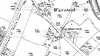
Hi Janice - that looks as if it's the one - I think looking from my other maps, "Warstock" seems to be nucleated around the Prince of Wales lane area where the Warstock pub used to be (oh happy days!). Is there any chance of putting a bit more of that map on - an extended view from about Warstock House to just past the bridge on School Road? It's very interesting - I would love to see more!In 1916 there was a Post Office in Warstock on what was then called Stoney Lane - a continuation of Yardley Wood Road. The street name Prince of Wales Lane is visible.
Thanks
S23
The Mills Archive here
https://millsarchive.org/explore/mills/entry/5221/priory-mill-yardley-wood#.WOc9IbxLOrU
describes Priory Mill as a water-driven corn mill. Viv.
https://millsarchive.org/explore/mills/entry/5221/priory-mill-yardley-wood#.WOc9IbxLOrU
describes Priory Mill as a water-driven corn mill. Viv.
pjmburns
master brummie
Easiest is for you to go to the site. https://www.old-maps.co.uk/#/ If you put in the post code B14 4BJ and then press search you will get a modern map on the right (you might need to press the - to get it to show clearly) and on the left will be lots of old maps. I try to choose one with the best scale so used the 1916-1917 one, if you click on it then you will get the map on the right and you can drag it around to get the area you want. To remove the "blue print area" click on the blue button with the white square on it.Hi Janice - that looks as if it's the one - I think looking from my other maps, "Warstock" seems to be nucleated around the Prince of Wales lane area where the Warstock pub used to be (oh happy days!). Is there any chance of putting a bit more of that map on - an extended view from about Warstock House to just past the bridge on School Road? It's very interesting - I would love to see more!
Thanks
S23
Radiorails
master brummie
Than you Vivienne. That seems to confirm my suppositions regarding the mill by the River Cole. That was a place somewhat secluded from Priory Road, whereas the windmill shown in an earlier post, without its sails, stood out and could be seen quite well being on, probably, the highest ground.The Mills Archive here
https://millsarchive.org/explore/mills/entry/5221/priory-mill-yardley-wood#.WOc9IbxLOrU
describes Priory Mill as a water-driven corn mill. Viv.
I think we now have a good idea what the purpose of the three mills were (from here and the Dargue site).
Of course windmills, water mills - under and overshot - stamp mills and so on were a common feature of our landscape even after the advent of steam powered.
Not far from the area being discussed, adjacent to Shirley railway station, stood a flour mill (probably what made the windmill redundant) known as Wollastons. *
*There is a very small thread about this mill here originated by a family member.
There are tithe maps of 1843 on the Acocks Green History Society site (originally from Birmingham Libraries archives).
I've copied two extracts of the area below. This time Tittiford/Trittiford is labelled Tettiford. I can't see Tettiford farm labelled on these maps. Although I could be missing something. Viv.


I've copied two extracts of the area below. This time Tittiford/Trittiford is labelled Tettiford. I can't see Tettiford farm labelled on these maps. Although I could be missing something. Viv.


Radiorails
master brummie
My suggestions are - bearing in mind it was over sixty years ago when I walked or cycled around these places - is that the sluice allows the Cole to feed the Trittiford Mill pool. There was, and probably still is, an overflow at the western end of Trittiford pool which allowed excess water to overflow from the pool back into the River Cole. It is my belief - and I have vague memories of low old walls being there - that this was the site of the steel mill which was obviously water powered.
The Cole appears to rise west of Wythall and has quite a few small brooks feeding in to it in its headwaters and the area we are discussing.
Birmingham is not blessed with large, well known rivers, such as many other large cities are due to it being situated well above sea level. However it does have the Cole, Rea and Tame plus very many brooks which run into those rivers. The Wiki link I have posted does give a good description of the journey made by the River Cole on its twenty five mile course to the River Blythe. Maybe we could get more reminiscences about the river over its total length and have a 'section by section' account (rather like that done with the Outer Circle bus route). This would make reading about it more coherent.
There are many references, some direct others indirect, on this Forum about the Cole; hopefully some posts could be reviewed by those who made the original post and reposted (or moved) if a new River Cole thread came about.
So far most posts here are of locations outside the city boundary but a dedicated Cole thread would bring it a certain legitimacy.
https://en.wikipedia.org/wiki/River_Cole,_West_Midlands
PS: There is a possibility that should you drop a pooh stick in the headwaters of the River Cole it could end up in the North Sea.
Last edited: