-
Welcome to this forum . We are a worldwide group with a common interest in Birmingham and its history. While here, please follow a few simple rules. We ask that you respect other members, thank those who have helped you and please keep your contributions on-topic with the thread.
We do hope you enjoy your visit. BHF Admin Team -
HI folks the server that hosts the site completely died including the Hdd's and backups.
Luckily i create an offsite backup once a week! this has now been restored so we have lost a few days posts.
im still fixing things at the moment so bear with me and im still working on all images 90% are fine the others im working on now
we are now using a backup solution
You are using an out of date browser. It may not display this or other websites correctly.
You should upgrade or use an alternative browser.
You should upgrade or use an alternative browser.
The Moat - Moat Row & Moat Lane
- Thread starter brumgum
- Start date

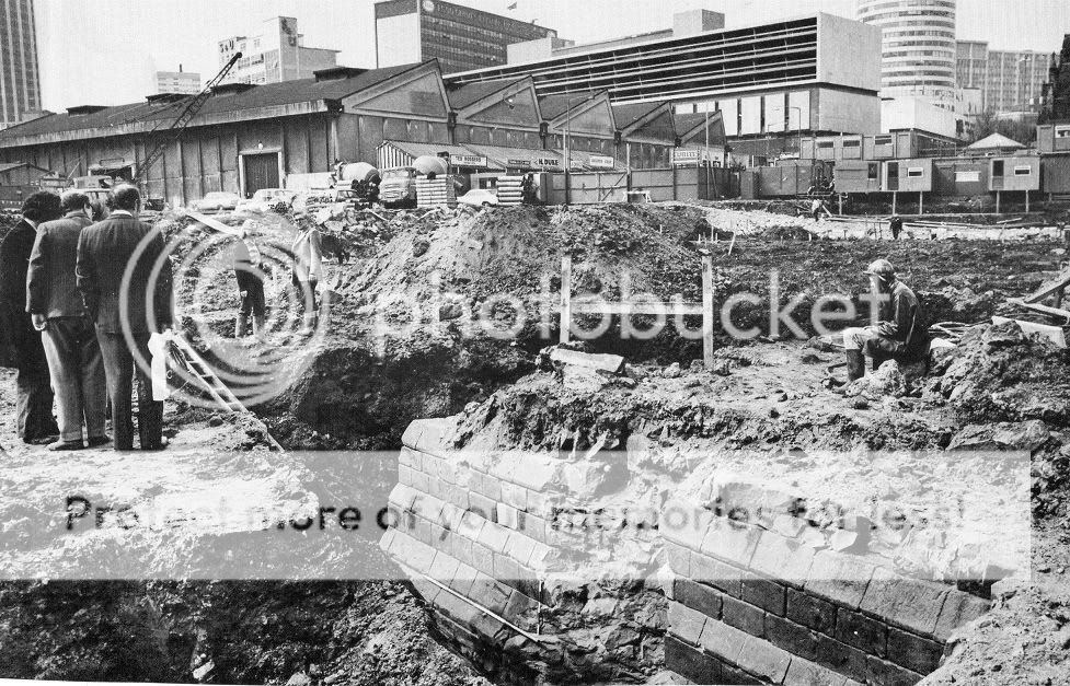
the moat was infilled in 1816 and the site then turned into smithfield wholesale market until rebuilding in 1974..during archaeological brief this remarkably well preserved section of moat revetment wall was uncovered along with the remains of substantial sandstone buildings within the island..
i beleive that if the markets get the go ahead for demolision the moat will be once again escavated in more detail...i am keeping my ears and eyes open on this one...
i beleive that if the markets get the go ahead for demolision the moat will be once again escavated in more detail...i am keeping my ears and eyes open on this one...
I have seen this picture before and great to have it posted again. I wonder what it is that can be seen and never thought that the moat would have been lined with brick around. Anyway, if you go on GE and draw a line from the corner of New Street and High Street and down by the side of St Martins steeple...both can be seen in the above picture... then compare with the orientation of the brickwork in the picture and it might be that this is the bridge across the moat that was at about the end of Bradford Street.
A 1968 Phyllis Nicklin view of the site of the moat. Moat Row to the left and Moat Lane to the right, Drovers Arms on the corner to the right. Photo taken from Bradford Street. Viv.

Rupert
I think the bricks were fairly near the surface and were probably the bricks at the base of the old smithfield market the angle of view would be something like below
PS/ Coppermine seems to be working for me nowView attachment 72967
I think the bricks were fairly near the surface and were probably the bricks at the base of the old smithfield market the angle of view would be something like below
PS/ Coppermine seems to be working for me nowView attachment 72967
It's hard to imagine the scale of the moat now that it's all been developed around the area, but it surrounded a circular island 70 metres across, the moat varying in width from 8m to 30m. The moat and the parsonage were also connected by a watercourse. This drawing from 1814 gives a partial impression of the house and moat. 
I get a bit of a different result using GE Mike. I started from the other side of the Rotunda and skimmed the Steeple and arrived at a point close to the end of Bradford Street. Which is where the bridge must have been. I took it that the structure was in fact remains of the moat but I suppose this could be wrong. It seemed that the angle of the run of brickwork was about right for the bridge but who knows. Ignore the other siteline...I do this all the time and leave the lines on. You have the bridge on that view Viv and the view would be from Moat Row.
You know what though...those bricks do look familiar and the Nicklin picture street level Smithfield bricks might be right.
You know what though...those bricks do look familiar and the Nicklin picture street level Smithfield bricks might be right.
Attachments

sistersue61
master brummie
I didn't realise the moat was that wide - or hadn't thought about it I guess. Would be good to see it if the planned excavations go ahead.
Sue
Sue
Sue much wider than deep by all acocounts. When it was excavated in 2000 they claimed it was only 2.5 metres deep! Seems very shallow considereing how wide it was in parts. But maybe that was enough of an obstacle. Viv.
horsencart
master brummie
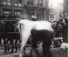
This is a view from the old Bull Ring and before the new markets were built, https://www.flickr.com/photos/transport_photos/5930069116/in/set-72157627177309848/lightbox/ this area has now changed a little bit
A fantastic record Horsencart! Plenty there to chew over! Viv.
Morning Lyn. you might need to give it a bit of time to load. I got that too. But it's well worth the wait! Viv.
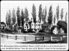
Two photos from the Historic England archives of Moat Lane. They look around the early 1900s. Viv.


Added to the thread title Lyn as a search doesn't seem to pick this up very well. Pity as there's so much of interest around the moat area. Viv.
Hope so Lyn.
Apparently there were two moats: the Lord of the Manor's Moat (or Birmingham Moat) and the smaller Parsonage Moat. They're both shown on Westley's 1731 map, the first moat going back to the days of Peter de Birmingham's castle. It's also thought a moat probably existed at the Parsonage Moat position at that time too. Viv
Apparently there were two moats: the Lord of the Manor's Moat (or Birmingham Moat) and the smaller Parsonage Moat. They're both shown on Westley's 1731 map, the first moat going back to the days of Peter de Birmingham's castle. It's also thought a moat probably existed at the Parsonage Moat position at that time too. Viv
Lady Penelope
master brummie
Post #14 - Does anyone know what the interesting looking black and white building in the background is?
Jonob
master brummie
Both pictures are of Moat Lane, John.Two photos from the Historic England archives of Moat Row. They look around the early 1900s. Viv.
View attachment 114909 View attachment 114910
Thanks John, have corrected my post. Viv.
Phil
Gone, but not forgotten.
Viv
This is what looks like a painting of the Manor House and moat, I've also included a section of Joseph Hill's 1553 map showing both the Manor House moat and the Rectory moat included the extensive water management needed to feed these moats and millponds.
This is what looks like a painting of the Manor House and moat, I've also included a section of Joseph Hill's 1553 map showing both the Manor House moat and the Rectory moat included the extensive water management needed to feed these moats and millponds.
Attachments

Dugdale's Antiquities of Warwickshire (1656) shows Holme Park in the foreground in the image below. Don't think there are any references in the modern streets/places although did wonder if Park Street refers back to it. (But think Park Street might be more north-east of Holme Park and might have been named after Little/Over Park - another of the Lord of the Manor's hunting grounds).
Holme Park remained open countryside until the 18th century. Viv.

Holme Park remained open countryside until the 18th century. Viv.