• Welcome to this forum . We are a worldwide group with a common interest in Birmingham and its history. While here, please follow a few simple rules. We ask that you respect other members, thank those who have helped you and please keep your contributions on-topic with the thread.

    We do hope you enjoy your visit. BHF Admin Team

Old street pics..

thanks topsy i do the same but yet to spot someone i know...if this weather keeps up there will be more pics going on tomorrow...


lyn
 
These pics get better every day. I went to see the last tram that day, although it was a sad day i remeber the crowd was very buoyant and me and my mates had a good time.
 
aa6.jpeg
I have a feeling this one has been posted before but I can't find it so here goes.
Aston Road opposite Prtchett Street. 1914.
 
Hi, Not sure how to start a new thread so hope this is ok tagging on here. I have an old photo taken about 1961 of Corporation Street, looking up from the bottom, with C&A on the right hand side. There is a hotel just past C&A and I cant read the name of it. Can anyone help please. Thanks.
Wendy
 
Hello, lovely to see old photos they're fantastic. I wonder if anyone would have one of 'Midland Grove' Balsall Heath, Kingsnorton? It was quite along time ago but you never know - or maybe an old street map. Thank you
Susan Wheeler. S Wales
 
Lovely to find the photo of Hingeston Street, my grandfather was born here in 1893 at number 152. thank you. Mary Wheeler S Wales
 
Hi John,
I have just checked the photo and I think you are right. I can make out the letters ICT which would be Victoria, so thank you very much for that.
Wendy
 
Hi Susan

I realise your request is from a few months ago, but it's the first time I have seen it. Hopefully you will see this reply, if you are talking about Balsall Heath when it was still part of Kings Norton then you must be talking about prior to the end of the last century as I understand that Balsall Heath became part of Birmingham in 1891.

Nevertheless Midland Grove sounded familiar so I had a search about and yes I did know it, even today it is still there but I don't think there is any housing along it and I think it is only used as a service rd for Moseley Rd Baths & Library.

I am uploading a map showing it's location, a photo showing how it looks today, and a third photo of a row of shops that once stood at the bottom of the grove. On the extreme left of the photo would have been the entrance of the Grove.

Phil
 

Attachments

  • Midland Grove Edward Rd.JPG
    Midland Grove Edward Rd.JPG
    93.8 KB · Views: 139
  • Midland Grove.JPG
    Midland Grove.JPG
    99.7 KB · Views: 136
  • Balsall Heath Edward Rd Nr Moseley Rd.JPG
    Balsall Heath Edward Rd Nr Moseley Rd.JPG
    143.3 KB · Views: 197
Hello Phil,
I'm very pleased with what you've found for me. Yes it did come under Kings Norton at the time, according to the census. My request was quite recent not some months ago, that may have been for something else? The people on here - like you, are very generous and helpful, especially with people like me who are not from the area. I did have some info from someone on the Forum that it may have been near the junction of Edward St and Moseley Road - a lane/cartway behind the baths* which was used to take the coal there*. So I googled Moseley Road not expected to still see the baths but they were there and worked it back from there. I 'snipped' a photo exactly like the second one you sent me - so I now know it's the right place.
Looks like a Health Centre on the right and of course many new houses behind now. As for the map and the photo of the shops I'm very very pleased, a huge thank you! The year I'm talking about was 1881, my great great grandparents lived at No 12. I went through all the census for that particular area and found about 15 streets/lane/buildings etc; and 'Cobden Place' was one of them, which I can see on the map you sent me!! My connection with Birmingham is through my paternal grandparents, who came down to Wales, seperately - then met and married here!
What lool like two tower shaped buldings on the map I suppose must be the Baths?
Anyway I'm babbling on a bit now, again many thanks for your help
Mary (susan) Wheeler
S Wales
 
Susan

You will have to forgive me for getting my dates mixed, I was looking at the date you joined the forum and not the date you posted your enquiry.

I don't think anything from the map I posted can be part of the baths as they didn't open until 1907 and the map I posted was from the 1880's. So at that time there were still large houses where the baths are now. In keeping within the spirit of the thread here is a photo of the baths not long after they opened. Midland Grove would have been directly behind them. It must have changed the outlook from the houses that were there quite a bit. Just the sort of thing you would get a rate reduction for today.

Phil
 

Attachments

  • Balsall Heath Moseley Rd Baths.JPG
    Balsall Heath Moseley Rd Baths.JPG
    199.7 KB · Views: 158
Hi Phil,
no worries about the dates it's not important. Well thanks again for another photo - they're lovely buildings I was pleased to see they were still there when I googled. So many buildings have been taken down haven't they, especially here in the welsh coal mining valleys - every village seemed to have a 'Workman's Hall' which were huge, but sadly not many existing now. Also the hotel/pubs were very big too and also disappearing - very sad
Mary (susan)
 
My parents always reffered to the bin as the "Miskin" and the drain was the "suff". The miskin men used to have to walk to where each miskin was located and empty it into a tin baby bath type of thing. They then lifted the tin bath up onto there own shoulder and walked back to the miskin lorry and emptied the tin bath into the lorry. Then they went onto the next miskin, they never left any mess and were always on time.
If our ball went into the drain and was resting on the grill (lid) of the drain, as we retrieved it our mom or dad used to shout "come out of that suff, youll catch the fever".
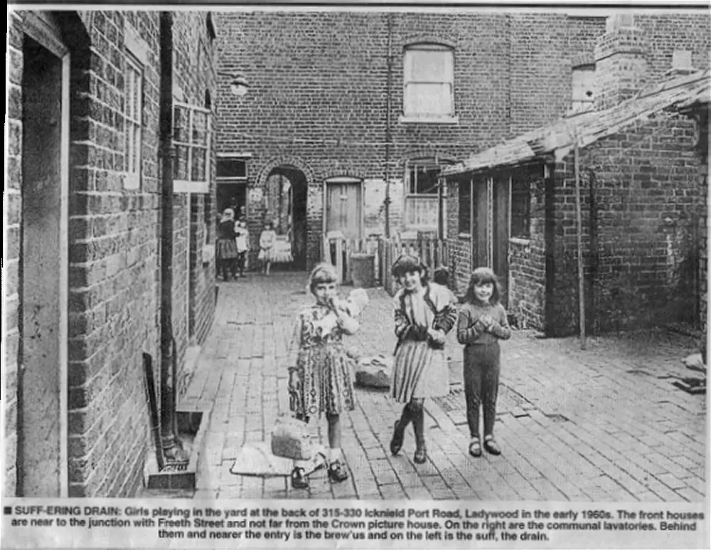
I had never heard a drain referred to as a 'suff' but looking through the 'old evening mail' pics, I noticed the word 'suff' in the caption underneath the 1960's Ladywood picture below.
Icknield_Port_Road_early_1960s.jpg
 
Lovely photo! My Great Grandmother lived in Icknield Port Road in the 1800's. There are a few vilages here in S Wales called 'Miskin'
 
Last edited:
This again is a lovely photo, My great grandmother lived at Icknield Port Road in the 1800's. We have here in S Wales some villages called 'Miskin'. What a good site this is with many helpful people, many thanks to you
Mary (susan) Wheeler
 
That looks like the area my Step-Sister lived in. She and her family lived in St Martins Street of the top of Broad Street. There was a Post Office on the corner that became a strip club in later life. I can always remember visiting them it as a one down two up with a tiny kitchen. Toilets across the courtyard as was the wash house. Their name was Hancock, they move to Warstock in the 60's
 
then +now.JPG
Hello Phil, can't seem to make these any smaller but just to say that I'm 100% sure it's the right place, thank you again - Mary (susan) Wheeler
 
That looks like the area my Step-Sister lived in. She and her family lived in St Martins Street of the top of Broad Street.
I notice there is a St Martins St shown in the second photo in the post here, and St Martins Place in the first photo in the post here, both of them near Broad St.
 
Bristol Street..jpg
I am reliably informed that this is a photo of the tram tracks being removed on Bristol Street.
 
I don't know Stitcher but it looks a bit later to me.
paul

I think its a later photo too. The JCB is too modern. With the Cinephone on the right the digger is off-road anyway, preparing the way for the "new" Bristol Street Motors later become Monaco House and the Volvo dealership. Would put it early 1970s?
 
I thought so too Paul but then some else said that at times the old tracks were left in situ and maybe they were being removed some time after. I am hoping someone will/can link the background to an aproximate date.
 
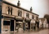
I think the Rothmans sign over the shop on the corner of Corporation Street was still there in the 1960's. We used to go into town on Sunday nights and buy roast chestnuts from the man on the corner of Stephenson Place.

His name was Dennis :)
 
I think its a later photo too. The JCB is too modern. With the Cinephone on the right the digger is off-road anyway, preparing the way for the "new" Bristol Street Motors later become Monaco House and the Volvo dealership. Would put it early 1970s?
I agree the JCB is to new
 
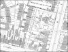
View attachment 74364
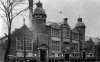
I assume this is a public service vehicle rather than family transport. All I have with it is Stratford Road, 1912.
I get the feeling that it is travelling away from the city and has just gone past Main Street.

That would have been either a City Transport horse drawn bus or a local company. I was told some years ago that when those used to run up the Hagley Road past a house where someone was sick then straw was thrown under the wheels to deaden the noise.
 
Does anyone remember Saint Paul's Square?st pauls sq.jpg
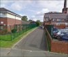
These are old office units. The corner towards the car is the top of Ludgate Hill, Saint Pauls Church would be to the right of the picture. The offices on the end where the scaffolding lies, were at the time of this picture architects. This project was meant to be rather new offices or a club.
 
Back
Top