Dennis Williams
Gone but not forgotten
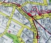
An interesting shot of..LITTLE BOW STREET....also captioned Nat Pro Bank...? Shown on this map dated 1904, but it doesn't look much like a Bank to me....


Dennis
They have this wrong. Richard Charles Marsh, watchmaker: Edward Butler, clothier, Charles Butler, bookseller were at respectively 76, 77 & 78 High St in the city Centre from at least 1880 to 1895 . Have not seen exact period, but at least this


Dennis
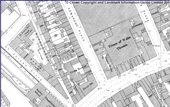
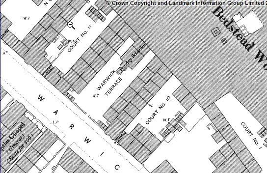
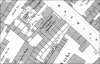
The solution is on the 1889 map, but a bit over from Phil's scan. Warwick Terrace, with sunday school at end, is opposite the church in Warwick St


Dennis, would you mind if I took a copy of your photographs of Moor Street. I would be 'over the moon' as my great grandfather was Thomas Jehu and the family lived at 102. Thank you - S


![Chapel%20terrace,%20Warwick%20St%20%201-6%20%20copy[1].jpg](/forum/data/attachments/18/18598-aad538baad45311a771da3f10c575257.jpg)