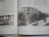
Using Mike’s 1939 plan in post #26 it looks like “P” probably became part of Block C - see my yellow dot. Or it might have been a little bit lower than the dot.
So whatever it was it’s quite likely it would have been incorporated into that block (and so in a covered in area by that time ?). I notice there’s a very small oblong feature marked next to my yellow dot. Was this the “P” ? Or was it lower ?
The earlier map with “P” marked seems to have been maked with a black dot alongside a small building, and so at that time “P” was possibly outside. Be interesting to know what the small building to the left of “P” was. Might give a clue as to what “P” was.
Viv.
Last edited: