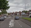
I don't know, GE shows reasonable flatness in that immediate area and the terrain seems to rise a bit around the bend in the left of the photo. In the distance you can see what are possibly the row houses on Church Ln. with housing development in progress towards the camera where the farm was. Could that have been a graveyard on the left with the railings around. Houses there now. Darned interesting photo that and mucho kudos for getting the location and map ref. The current photo seems to show a slight rise which may result from the camera pointing down.
-
Welcome to this forum . We are a worldwide group with a common interest in Birmingham and its history. While here, please follow a few simple rules. We ask that you respect other members, thank those who have helped you and please keep your contributions on-topic with the thread.
We do hope you enjoy your visit. BHF Admin Team
Where is This #209?
- Thread starter Phil
- Start date