-
Welcome to this forum . We are a worldwide group with a common interest in Birmingham and its history. While here, please follow a few simple rules. We ask that you respect other members, thank those who have helped you and please keep your contributions on-topic with the thread.
We do hope you enjoy your visit. BHF Admin Team
You are using an out of date browser. It may not display this or other websites correctly.
You should upgrade or use an alternative browser.
You should upgrade or use an alternative browser.
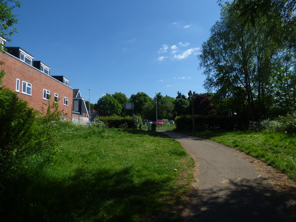
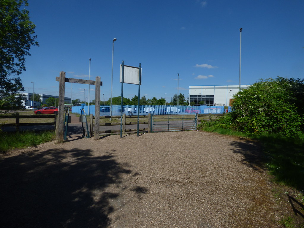
Stratford Road
- Thread starter history_fan
- Start date
pjmburns
master brummie
The church became an Asian (sorry to be vague but I am not sure exactly what cuisine they served) restaurant. Then the owners changed it to a banqueting venue for weddings and celebrations. I gather it was going back to a restaurant after requests from former customers. I will try to find the newspaper article.
pjmburns
master brummie
This was the report I first read:
https://www.birminghammail.co.uk/news/midlands-news/live-updates-stratford-road-closed-18062378
https://www.birminghammail.co.uk/news/midlands-news/live-updates-stratford-road-closed-18062378
pjmburns
master brummie
I have checked and all it puts on maps and in Kelly's is "Church of Christ".Will check but it was definitely opposite English Martyrs School.
Up the road from Hall Green Parade and after Sparkhill Park and Baths.
My brain wants to say "Presbyterian" but that could be wrong.
Last edited:
RobT
Acemeccanoman
Map 1950I have checked and all it puts on maps and in Kelly's is "Church of Christ"

sospiri
GONE BUT NOT FORGOTTEN
Janice,
Fire in a restaurant? Hmmm. Listed or not listed, I guess that seals its fate.
RobT,
Thanks for the map, it even shows my old house, 215 Knowle Road, alongside the bombsite, five new houses now replace those destroyed by the Luftwaffe.
Mods: Can you please move posts #330 to #336 of this thread to the end of the following thread. It would make more sense there.:- https://birminghamhistory.co.uk/forum/index.php?threads/sparkhill-congregational-church.45064/page-2
Maurice
Last edited:
pjmburns
master brummie
Thanks - too many churches. My comment was about the church in post #322. The one knocked down for the Guru Nanak Gurdwara.Map 1950
RobT
Acemeccanoman
Church of ChristThanks for all your help. First photo was definitely on the Stratford Road and it looks as if the second one was as well. I left Birmingham in 1967 but have been back fairly frequently. Found these photos when I was clearing out a cupboard. They were taken in 1987. I lived near the Stratford Road in Sarehole Road. Nearest points would have been Hall Green Parade or the College Arms. Do we know the original name of the church in photo 1? Dave

ellbrown
ell brown on Flickr
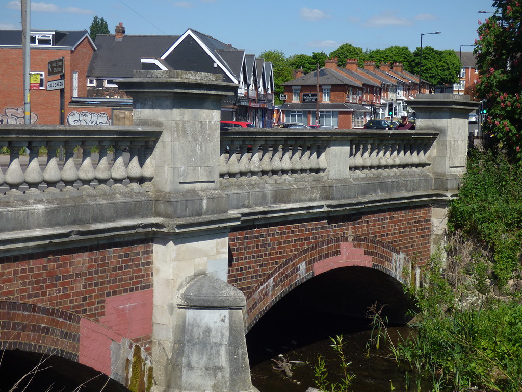
Another view of the bridge over the River Cole on the Stratford Road, opened in 1914 it is still known by the name " the New Bridge" because I suppose it is the latest of several.
View attachment 127240
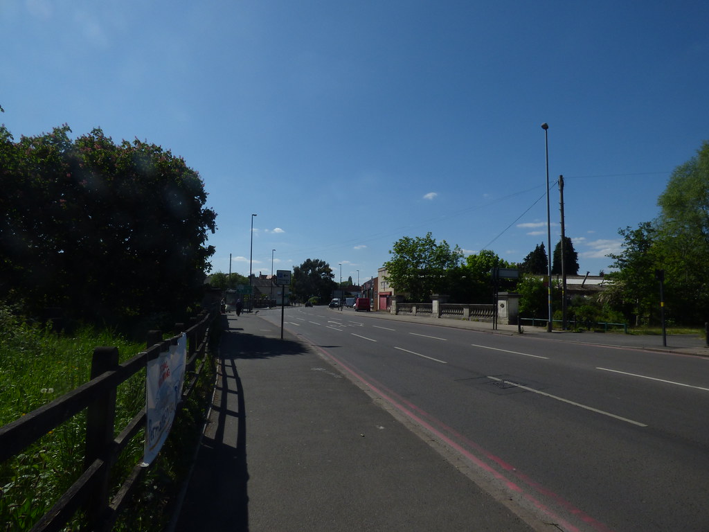
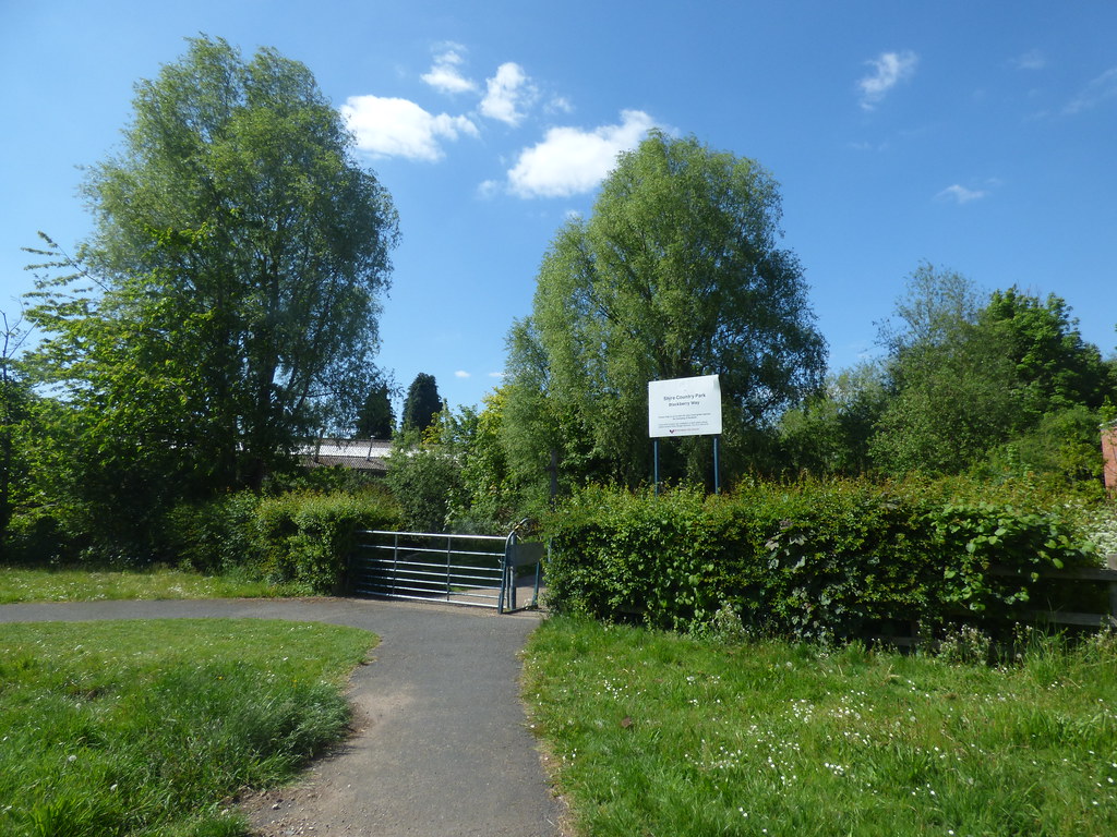
I took some new photos of the Stratford Road Bridge from the Greet Mill Meadow while on my daily walk on lockdown. This was before going into the Blackberry Way.

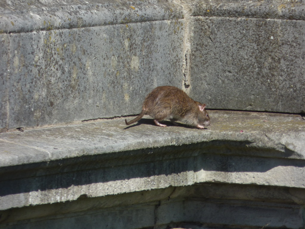
Saw a rat.
No bill posting.

Plaque

Took these after coming back from the Blackberry Way.


Stephen hopkins
New Member
Regarding Stratford Road I was wondering if anyone remembers/knows about the cottages near to police station which are now long gone(flats are there now) thanks
sospiri
GONE BUT NOT FORGOTTEN
Thanks for the pics, Ell, it was 1950 when I last stood on that bridge. All around there was part of my playground as a kid, though it does look a bit overgrown. Blackberry Way presumably refers to the part that goes from the bridge towards Formans Road? That was not open in my day and that bit was too deep to paddle, but you could pick up the Cole again via the allotments in Knowle Road.
Maurice
Maurice
farmerdave
master brummie
Hi Ell. I'm assuming that the third photo (second one of the bridge) was taken on the opposite side compared to the first photo and is looking towards Shaftmoor Lane. It seems to show that we are entering Hall Green. I had never heard of Greet Mill meadow but must have gone past there, walking or by bus, very frequently. Dave
ellbrown
ell brown on Flickr
The first three photos were taken from what is now called the Greet Mill Meadow. Part of the Shire Country Park.
Near the Stratford Road is this large grassy area.

The Blackberry Way is on the other side of the Stratford Road.
There are paths that goes all the way from Yardley Wood towards Small Heath.
I saw a business park at the end of the Burbury Brickworks Nature Reserve (which leads to the Warwick Road). I didn't go behind here before turning back.
Near the Stratford Road is this large grassy area.
The Blackberry Way is on the other side of the Stratford Road.
There are paths that goes all the way from Yardley Wood towards Small Heath.
I saw a business park at the end of the Burbury Brickworks Nature Reserve (which leads to the Warwick Road). I didn't go behind here before turning back.
sospiri
GONE BUT NOT FORGOTTEN
Thanks for those, Ell, I'm going to have another look at the maps & Streetview to try and get my bearings here. I'm trying hard to remember what was on Stratford Road between the bridge and Bromyard Road - it's such a long time ago! ")
EDIT: Ah, they must have either knocked some properties down here or else removed some fencing or hoardings as you could never walk up either side of the Cole in this direction.

Maurice
EDIT: Ah, they must have either knocked some properties down here or else removed some fencing or hoardings as you could never walk up either side of the Cole in this direction.
Maurice
Last edited:
JudiM
master brummie
I know this is an old post, but I do remember this burning down. I was on a bus between Solihull & Birmingham when it was happening . I thought it was a little earlier than 88 though, as My recollection is of still living at home in Solihull, but I had moved out by 88. Could be my memory playing tricks on me though. I would have still travelled that way anyway once I'd moved out as I had grandparents in both Sparkhill & Shirley whom I visited regularly.Found a reference in this book (bottom of page 275) saying it burnt down in 1988. https://books.google.co.uk/books?id=P3ZkU7V6N0MC&pg=PA276&lpg=PA276&dq=stratford+road+baptist++church+spire+removal&source=bl&ots=NX9VFfMzVr&sig=yQ-WkyUDUQ-kehnseosaxvsB_6Y&hl=en&sa=X&ved=0ahUKEwjj9qvO2-zTAhWhDsAKHc2MB1EQ6AEIJjAD#v=onepage&q=stratford road baptist church spire removal&f=false
This is how it originally looked. Seems to have lost quite a lot of the original structure joining the tower on the Palmeston Road side. Viv.
View attachment 114479
farmerdave
master brummie
Hi Maurice. There were definitely 3 or 4 shops before you reached Bromyard Road. I could see them when I joined the Stratford Road from Sarehole Road. Can't remember what kind of shops they were. They can be seen in the distance in photo 3 of #340 where we are looking towards Bromyard Road and Shaftmoor Lane. Can Ell confirm that Greet Mill meadow is on the left of the bridge going to town and that Blackberry Way is on the right. They didn't have these names in my day. Dave.Ell, I'm going to have another look at the maps & Streetview to try and get my bearings here. I'm trying hard to remember what was on Stratford Road between the bridge and Bromyard Road - it's such a long time ago!
ellbrown
ell brown on Flickr
If you are on the bus going down the hill on the Stratford Road between Hall Green and Sparkhill (Springfield), the Greet Mill Meadow would be on the left. Then the Blackberry Way is on the right. They were probably renamed by the Council in the last 20 or so years when they developed the Country Park.

 en.wikipedia.org
Shire Country Park - Wikipedia
The Shire Country Park (grid reference SP099818) is a country park in the south of Birmingham, England, taking its name from Tolkien's The Shire.
It consists of the Millstream Way following the course of the River Cole from Yardley Wood to Small Heath and includes the following sites: Scribers Lane SINC, Trittiford Mill Pool, The Dingles, Chinn Brook Recreation Ground, Sarehole Mill Recreation Ground, Moseley Bog LNR, Burbury Brickworks, The John Morris Jones Walkway and Cocksmoor BMX.
History
River Cole´s race to Sarehole Mill formerly went under Brook Lane in a culvert, but this has been blocked and the line of the race is lost to northward. The spillway from race to river is seen to be still there, and the slots for the removable plank weir can be seen. The riverside walk continues as the John Morris Jones Walkway past the site of Robin Hood Lane ford, across Cotterills Meadow which has been Colebank Playing Field for the last ninety years until it reaches the Grade II Listed water mill, Sarehole Mill at Hall Green. The Coldbath Brook, a tributary of the Cole, drives the mill which is now a museum and one of the inspirations for J. R. R. Tolkien's The Lord of the Rings. The Shire Country Park ranger office is located at Sarehole Mill.
Tolkien and his brother spent their childhood in Birmingham with their widowed mother. They first lived in the hamlet of Sarehole, which Tolkien said were the happiest years of his youth. Sarehole is said to have been the model for The Shire, home to the hobbits. Every year the Tolkien Weekend is held at Sarehole Recreation Ground and Moseley Bog Local Nature Reserve part of the Shire Country Park. 2005 commemorated the 50th anniversary of the release of The Lord of the Rings. Ronald and his brother spent many hours playing around Sarehole Mill and being chased away by the miller's son. The Mill features in The Hobbit when Bilbo Baggins runs "as fast as his furry feet could carry him down the lane, past the great Mill, across The Water and then on for a mile or more." In the 1960s Tolkien contributed to a public appeal to restore the mill which had become dilapidated. It is now a museum and is the only surviving water mill in the City's ownership.
Continuing to Green Lane ford which, like those at Slade and Scribbers Lane, has been concreted and the wooden footbridge is the latest of many, earlier ones have been swept away by sudden torrents. When the meadow below Green Road was opened as part of the riverside walk in the 1960s, the Cole was re-coursed and two weirs topped by step-stones were installed. Next, the river crosses the A3400, Stratford Road, the site of the former 13th-century Greet Mill, whose pool was the ponded river. In 1914 two brick bridges, over the river channel and a flood-race, were replaced by a two-arched brick bridge with a stone balustrade which allowed tramcars to cross the river and go on to Hall Green. The mill went out of use about 1843, was demolished and forgotten.
Between Stratford Road and Formans Road, known in the 14th century as Foulemoreslone and which used the Fole- or Fullford (foul ford) the stretch is known as Blackberry Way, being named after consultation with local residents and highly suitable, as this is one of the best blackberry picking sections of The Shire Country Park.
The river is bridged by the A41, Warwick Road at Greet, there is no documentary evidence for a ford here, and then continues north, passing under the Grand Union Canal and the Chiltern Main Line railway at Hay Mills close to the Ackers trust outdoor pursuits centre.
sospiri
GONE BUT NOT FORGOTTEN
Dave,
In the 1940s Blackberry Way or any way was not open from Stratford Road toward Formans Road. There were either buildings in the way or big hoardings. If you tried to paddle under the bridge from the direction of the weir, the water suddenly got very deep and was impassable. In those days your only option was to go down Knowle Road and through the allotments on the other side of the river. That's not now an option because the access to the allotments is by key only issued to allotment holders. Thank vandalism for that.
Maurice

farmerdave
master brummie
My confusion was that Greet Mill meadows were on the left of the Stratford Road bridge, going to town. I assumed they were on the right and therefore nearer to Greet. Do we know anything about Greet Mill?
Pedrocut
Master Barmmie
There is a bit of info on Greet Mill in post 342...
 birminghamhistory.co.uk
Stratford Road
I thought it looked a bit empty last time I saw it. Traffic moves quite quickly there so didnt look much. The church/restaurant opposite badly burnt in a fire a couple of weeks ago. It was being refurbished ready to re-open.
sospiri
GONE BUT NOT FORGOTTEN
Lots about Greet Mill here:-
https://aghs.jimdofree.com/watermills-of-the-cole-valley/greet-mill/
Maurice
https://aghs.jimdofree.com/watermills-of-the-cole-valley/greet-mill/
Maurice
barry hopwood
Brummie babby
i worked in a furniture store called daveys on stratford rd rsparkhill opposite the maypole grocery store next was wimbushes cake shop .also next to the cake was a cooked meat shop that carved the ham straight off the bone
I was born in 1988 and lived on knowle road off formans road and Stratford road my dad still lives there . I remember the antelope that is now a curry house . I use to go to st Johns primary school Mr long was the head teacher then and left and Mrs rocky was our headteacher I left for secondary school in 2000. Couple years before that I chose to be a Catholic cause of my nan and got baptised in English martyrs church it is still there . The swimming baths are now modern they got knocked down and rebuilt the library is still there looks the same with the clock and the police station is still there . The bear closed down a few years ago it hasn't turned into anything yet the collage arms is still in the same place open apart from the lockdown.My journey starts at The Antelope on the corner of Baker Street where we lived in the late thirties. We lived in a yard where the front of the house was in Baker Street and and the entry from the yard was in St.Johns Road. Further along the Stratford Road was Evelyn Road and my Dad and I went to Mass at English Martyrs Church. On the opposite side of Stratford Road was Court Road and the Fire Station and next to it was Sparkhill Police Station and then the Library and Swimming Baths then St.Johns Church of England School where Mr.Baker was Headmaster and then there was Sparkhill Park with its ornate flower beds and beautiful lawns and pools and a bandstand. On the opposite corner was Thornhill Road and the Bear Public House which was very popular. At the end of a block of shops was Formans Road and on that corner was the Doctors House which was. Beautiful Victorian house which was covered in Ivy. Just a little further along Stratford Road during the war was The British Restaurant where you could get a very decent meal for a few pence - I think it was a shilling. After the large array of shops already mentioned previously we came to Springfield School Clinic where Mr Cliff Baker ( son of the headmaster of St.Johns School) was the Dentist there. Further along and over the bridge was The College Arms Public House and the road forked there to Shaftsmoor Lane and off that was Allcroft Road where we moved to the day before war was declared.
I remember a grocery shop I was only young under 10 but the lady who worked there was so nice behind the till I'm sure her name was Val or something I'm guessing though . And I remember the meat shop he had a big silver cutter to cut the ham I don't remember Davey's but I remember Kwik save lol the supermarketi worked in a furniture store called daveys on stratford rd rsparkhill opposite the maypole grocery store next was wimbushes cake shop .also next to the cake was a cooked meat shop that carved the ham straight off the bone