• Welcome to this forum . We are a worldwide group with a common interest in Birmingham and its history. While here, please follow a few simple rules. We ask that you respect other members, thank those who have helped you and please keep your contributions on-topic with the thread.

    We do hope you enjoy your visit. BHF Admin Team

Springfield Area

BrummieGeoff

Sparkhill Lad
Springfield is a small area that overlaps the boundaries of Sparkhill and Moseley where they meet the River Cole. I don't know if it was ever used in formal postal addresses, but it has had its own Post Office, SPR Telephone Exchange (located in Hall Green), Birmingham Municipal Bank, and cinema.
It seems confusing now, but in the 1921 Census a house in Springfield Road had the following classification ....
Address: Springfield Road, Smethwick, Worcestershire
Ward: Sparkhill
Parliamentary Division: Moseley
Registration District: Kings Norton
Sub Registration District: Acocks Green
Enumeration District: Birmingham
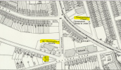
Here's a 1903 map of Springfield, and a few photos.
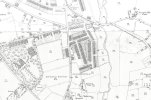
1903 Springfield.jpg

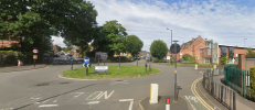
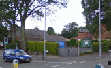
Junction of Springfield Road, College Road and Woodlands Road
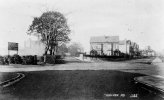
Springfield College Road 1.jpg

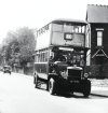
1A Bus on College Road
Springfield College Road 2.jpg

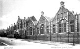
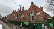
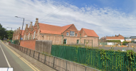
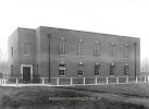
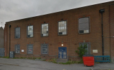
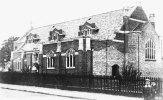
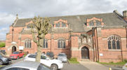
College Road School
Springfield College Road School 1.jpg

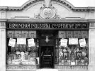
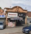
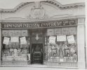
Stratford Road Coop shop
Springfield Stratford Road Coop 1.jpg

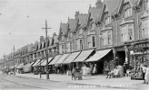
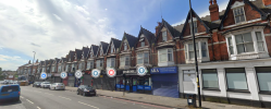
Stratford Road shops c1908
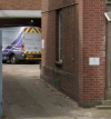
Springfield Stratford Road c1908.jpg
 
many thanks for the info and photos geoff...love the first photo and i must go and see if i can find todays view...bet its changed a lot

lyn
 
Our postcode is B13 and our address is therefore classed as Moseley.
However, if I go to the Birmingham council site for any reason (last week to report some flytipping for instance) our address comes up as Springfield.

College Road school is still in use - Springfield Primary
 
Last edited:
Our postcode is B13 and our address is therefore classed as Moseley.
However, if I go to the Birmingham council site for any reason (last week to report some flytipping for instance) our address comes up as Springfield.

College Road school is still in use - Springfield Primary
thanks jan i am struggling to find today view :rolleyes:
 
The late Bill Dargues take on the name/place

This self-explanatory name derives from a medieval holy well or spring which emerged from the ground somewhere on the slope between Springfield Road and the River Cole. The water was believed to be a cure for eye ailments.

The district of Springfield lies at the southern end of Springfield Road. It is a name that currently has limited use, the area being considered part of Sparkhill.

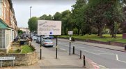
Recently the name has been revived by the City Council and the run of shops on the Stratford Road between Hillfield Road and Knowle Road has been designated Springfield Shopping Parade.


Screenshot_20250919_164908_Chrome.jpg
 
I was very surprised to see that sign installed at the top of Hillfield Road. I don't think many of the past or current locals would think Springfield spreads that far .... but I guess it's a nice name for marketing purposes.
 
I see the notorious small roundabout, as shown in the modern view of post 7, has now been altered. That old roundabout must have tasked the drivers of older buses that did not possess power steering.
 
Yes, the Acocks Green bound 1A used to go straight down College Road to meet the Stratford Road .... but they changed the route in the 1970s to turn left at the roundabout down Springfield Road.
 
Back
Top