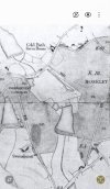
• Welcome to this forum . We are a worldwide group with a common interest in Birmingham and its history. While here, please follow a few simple rules. We ask that you respect other members, thank those who have helped you and please keep your contributions on-topic with the thread.

    We do hope you enjoy your visit. BHF Admin Team

Sarehole Mill

  • Thread starter Thread starter Rod
  • Start date Start date
Visited Sarehole Mill last Friday for the first time in decades. Very disappointed - paths in poor condition and "garden allotment" very overgrown. Cafe closed permanently but building just empty. Shop non existant and a general air of neglect about the whole site. And entrance fee too high - gave it a miss. One highlight was seeing a heron watching the pond patiently.

I know BCC is bankrupt but this is very disappointing and didn't happen overnight. Particularly disappointing in view of the renewed national interest in Tolkien.
Truly so disappointing not protecting such a vital piece of the cities heritage! Considering all the apparent waste.
 
An interesting old plan of the Sarehole area dated 1807. Sarehole Mill is indicated in red, and Sarehole Farm in green. It shows the River Cole flowing south to north, and the mill streams created for the mill. Sarehole Farm has now disappeared, but it was located adjacent to the current route of Wake Green Road. On the right it lists all the land associated with each property at that date.
Credit: Birmingham Library

View attachment 209343
Pity it doesn't go a tiny bit further north and my road would be on it :(
 
What a gem of a map! Wake Green & Sarehole are two of my interests and this is a brilliant addition to my notes - also the oldest detailed map I have seen of the area. Many thanks BrummieGeoff for posting it.

It shows Wake Green Common stretching at that time down to what is now Wake Green Road - very useful info. Confirms my thoughts on early and original boundaries of Wake Green. It also shows the old "reservoir" situated in what is now Moseley Bog and the leat leading from it to Sarehole Mill pond.
 
yes its a great map...shows gt gospel meadow and mr dolphins land so would dolphin lane and gospel lane have been named after those..

lyn
 
What a gem of a map! Wake Green & Sarehole are two of my interests and this is a brilliant addition to my notes - also the oldest detailed map I have seen of the area. Many thanks BrummieGeoff for posting it.

It shows Wake Green Common stretching at that time down to what is now Wake Green Road - very useful info. Confirms my thoughts on early and original boundaries of Wake Green. It also shows the old "reservoir" situated in what is now Moseley Bog and the leat leading from it to Sarehole Mill pond.
The Enclosure map below clarifies the boundary of Wake Green, which did not wrap around Old Pool, as might be guessed from the mis-naming of Swanshurst Common as Wake Green Common on the 1807 map. There are clearly two commons here separated by a wide piece of private land. Sarehole Mill goes back to the 16th century, and it was using Coldbath Brook water, and Lady Mill was using part of the brook water too via the golf course pool. Water rights could not be on common land for obvious reasons. The other map defines the boundary of Wake Green on a modern street map.
 

Attachments

  • Screenshot_20250922_085115_Gallery.jpg
    Screenshot_20250922_085115_Gallery.jpg
    201.8 KB · Views: 15
  • Screenshot_20250922_092739_Samsung Internet.jpg
    Screenshot_20250922_092739_Samsung Internet.jpg
    238.4 KB · Views: 11
Last edited:
The Enclosure map below clarifies the boundary of Wake Green, which did not wrap around Old Pool, as might be guessed from the mis-naming of Swanshurst Common as Wake Green Common on the 1807 map. There are clearly two commons here separated by a wide piece of private land. Sarehole Mill goes back to the 16th century, and it was using Coldbath Brook water, and Lady Mill was using part of the brook water too via the golf course pool. Water rights could not be on common land for obvious reasons. The other map defines the boundary of Wake Green on a modern street map.
Interesting post. Yes, Sarehole Mill was operating in the 16thC and possibly even earlier. Sarehole and Wake Green were both owned by Maxstoke Priory [nr Coleshill], along with Swanshurst and much more in Yardley in the medieval period. They were later owned by John Taylor, of banking fame. before the "Wake Green Estate" part was purchased by Joseph Dyott [hence Dyott Road].

It is interesting that Moseley Wake Green, as shown on the enclosue map of 1843 is mainly to the south of what is now Yardley Wood Road confirming the use of Moseley Wake Green in what was obviously Yardley at the time. As the map only shows common land not yet enclosed it is probable that Moseley Wake Green was originally larger but that piecemeal enclosure over the years had nibbled away at it. Not too much of a stretch to suggest that the land on which Gracewell Cottages/Tolkien's home was originally part of Wake Green [Common]?

One thing is certain, that what is meant by Wake Green has varied over the last century or so. The area around St Agnes Church was called the Wake Green Estate when owned by Joseph Dyott [as confirmed by my house deeds.] and I have seen other locations for it And then there is Moseley {!] Wake Green Common as shown on the enclosure map of 1847. And now we have a BCC map showing it somewhere completely differently - actually this has no historical relevance - not sure what it was purports to show - perhaps you can clarify?

All very interesting. Keep up the good work.
I am afraid it is too much to say Gracewell Cottages were in Wake Green. They were built in one of the Sarehole Estate fields. I seem to remember mentioning this in another thread, which I have now managed to find:

"On the Tithe Map is a small field number 2138, where Gracewell Cottages were later built. This is entirely surrounded by fields tenanted by the miller at Sarehole. A sliver of Moseley Wake Green, field 164, came down to the junction of Wake Green Road and Gracewell Road, but no further. So it is apparent that the Cottages were not strictly speaking part of Wake Green, in reality being part of Sarehole, whether it was a hamlet or not. The map evidence is clear." August 4th 2025

Comparing the 1916 OS map below with the 1807 Sarehole estate map it is clear that Gracewell Cottages are in Sarehole. There can be no doubt about this.
 

Attachments

  • Screenshot_20250924_040803_Samsung Internet.jpg
    Screenshot_20250924_040803_Samsung Internet.jpg
    280.2 KB · Views: 0
  • Screenshot_20250924_040554_Gallery.jpg
    Screenshot_20250924_040554_Gallery.jpg
    223.2 KB · Views: 0
Last edited:
I am afraid it is too much to say Gracewell Cottages were in Wake Green. They were built in one of the Sarehole Estate fields. I seem to remember demonstrating this in another thread.
Also the BCC map is very much relevant because it traces the outline of the area of Wake Green that was enclosed as a result of the 1833 Act. The outlines of that and Swanshurst Common show the wedge of private land completely separating them. Another map view has the actual georeferenced Enclosure map, which you can switch on and off to compare with today, but the view I showed is clearer, which is why I posted it. It is all found on the Historic Landscape Characterization map:

 
Last edited:
Back
Top