• Welcome to this forum . We are a worldwide group with a common interest in Birmingham and its history. While here, please follow a few simple rules. We ask that you respect other members, thank those who have helped you and please keep your contributions on-topic with the thread.

    We do hope you enjoy your visit. BHF Admin Team

Phillips Street Aston

What an interesting thread. My Great grandparents and 8 of their children lived at 110a Phillips Street from 1903 and are recorded there in the 1911 census. Does anyone know why it was 110a and not just 110? Also is anyone able to locate it on a map? I can place the Talford in at 48 and count from there but would like a second opinion if possible.

Many thanks.

it could be that 110a was behind no 110..if any of our map experts spot this post they should be able to post you a map

lyn
 
It is rather strange . I cannot answer your question as to why, merely state that the c1950 map shows numbering as just going 108, 110a,112 and this is confirmed by the electoral roll for 1920

map c1950 Phillips st showing 110a.jpgphillips st.1920.112.jpg
 
Super - thank you both. William and Caroline Webb were my great grandparents. Caroline died in 1922 and I have a photo of her in a back garden. This might help me confirm where it was taken by looking at the background.

Also by looking at an earlier map and the electoral roll there weren’t any houses numbered 124, 126, 128, 130 which added to the difficulty in locating 110a.
 
Last edited:
Hi
I am re-posting these photo's Which were on before the hacking.


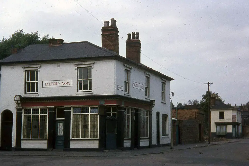
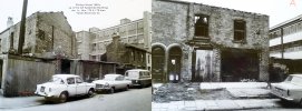
Philips Street 1
Phillips_St_Talford_Arms_1970.jpg


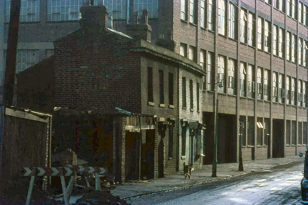
Philips Street 2

Phillips_St_28329_1968.jpg


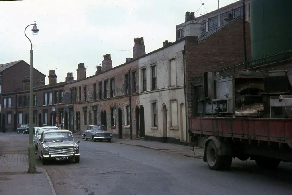
Philips Street 3
Phillips_St28329_1968.jpg


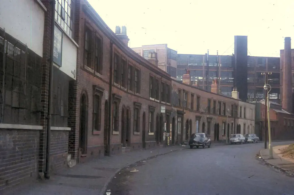
Philips Street 4

Phillips2520Street25201967.jpg


The above photo's above are taken in 1967 and 1968. Thanks to Astoness.


Regards Stars
thats strange mike the last house befor Rt shelley was 107 i live at 89 were the anglia is parked
 
It is rather strange . I cannot answer your question as to why, merely state that the c1950 map shows numbering as just going 108, 110a,112 and this is confirmed by the electoral roll for 1920

View attachment 152205View attachment 152206
Mike, you are more of an expert on this than me but could it be that the houses were renumbered. Comparing the 1950s and 1890 map and transposing the house numbers then they wont all fit in. I came across a similar thing to this on Aston Road North.
The 1881 census for Phillips St. lists it as #110 not 110a. I'm confused by the 1871 census, did the enumerators use the schedule number in 1871 as the house number? If this was the case then in 1881 there was a Bullock family at #13 but in 1871 they were at #141.
 

Attachments

  • mapsphillipsst.jpg
    mapsphillipsst.jpg
    472.1 KB · Views: 19
  • 1881phillipsst.jpg
    1881phillipsst.jpg
    472.5 KB · Views: 18
  • 1871phillipsst.jpg
    1871phillipsst.jpg
    555 KB · Views: 19
This photo was taken in 1938, I think that number 110a is hidden by Millers.....Houses from 124 to 168 were bombed during the war, It was my and the local kids adventure ( bomb peck ) playground until around 1969, when they started to build Aston Manor secondary school ...119646346_10221826882088531_4246895678439147142_o.jpg
 
This photo was taken in 1938, I think that number 110a is hidden by Millers.....Houses from 124 to 168 were bombed during the war, It was my and the local kids adventure ( bomb peck ) playground until around 1969, when they started to build Aston Manor secondary school ...View attachment 152237
thanks astonlad
loverly pic i can see my back garden. do you remember the scrap yard next to the peck. i played on there still have the scar from sliding down the hill on a cooker lid:grinning:
 
it is indeed pete..can clearly see burlington st school which was used as an annexe for lozells girls..we took..pottery..needlework and cookery there...cookery teacher was miss orton..

lyn
 
it is indeed pete..can clearly see burlington st school which was used as an annexe for lozells girls..we took..pottery..needlework and cookery there...cookery teacher was miss orton..

lyn
i always wonderd what the old bomb peck was like for it was bombed. now i know:)
 
Mike, you are more of an expert on this than me but could it be that the houses were renumbered. Comparing the 1950s and 1890 map and transposing the house numbers then they wont all fit in. I came across a similar thing to this on Aston Road North.
The 1881 census for Phillips St. lists it as #110 not 110a. I'm confused by the 1871 census, did the enumerators use the schedule number in 1871 as the house number? If this was the case then in 1881 there was a Bullock family at #13 but in 1871 they were at #141.
That might be the explanation, but frankly seems peculiar and am at a bit of a loss
 
This photo was taken in 1938, I think that number 110a is hidden by Millers.....Houses from 124 to 168 were bombed during the war, It was my and the local kids adventure ( bomb peck ) playground until around 1969, when they started to build Aston Manor secondary school ...View attachment 152237

Wow! Using an 1888 map (I think) I can now identify my great grandparents house. The isolated pair of houses at the end of the gardens are Court 2 which was accessed through an entry between 114 and 116. 114/116 are the two storey property in the middle of the three storey ones. The layout of all houses/entries between there and the right hand side correlates with the map. The furthest right house is no 162. The houses Behind with the large gardens match the phot I have of my great grandmother standing in her garden. The left hand one is Vine Cottage located on Wilkinson Street.
 
That might be the explanation, but frankly seems peculiar and am at a bit of a loss
Mike,

Looking at the old map I have which I think is 1888, there is a row of four houses behind no’s 80-86. If the Miller building is the tall modern looking building just left of centre in the foreground of the aerial photo, on the site of the old malt house, the upper storeys can be seen immediately above it. The map shows the entry between nos 84 and 86, but in the electoral rolls they are listed as Back of 78. They do not show as a Court, the first evenly numbered court being number 2 with entry between houses 114 and 116. Wild guess but perhaps these are the ‘missing’ four houses in the sequence. As far as I can tell they do not fit my understanding of a ‘back’ house I.e. one sharing a wall with the ‘front’ house. Certainly an interesting conundrum.
 
Back house did not necessarily mean a back to back, it meant it was one accessed behind the house of that number or accessed by a passage by an adjacent house. Thus, if there was a yard with 4 frontaged houses (say 23,24,25,26) which was accessed by a passage next to 24, all the houses in the yard would USUALLY be called back 24 .Should add though that occasionally this was not adhered to and , if they were back to backs occasionally the houses at the back might be back 23, back 24, back 25 and back 26
 
I'm just compiling the Phillips Street images for inclusion on the interactive map, I have about 20 in total (mainly off BHF) and have identified the location of all but one of them. Can anybody confirm that the 2 houses shown are Nos. 125/125½? Looking at the factory in the background it appears to be the building at the Wincaster Factory Estate in which case I think my assumption would be correct. Your help would be appreciated.

EDIT: SORRY Just realised that they are 2 properties on Sydenham Buildings (looking towards Phillips Street) Nos. 1 & 2
 

Attachments

  • phillipsstreetpart.jpg
    phillipsstreetpart.jpg
    608.7 KB · Views: 41
  • phillipsstreet-unknown.jpg
    phillipsstreet-unknown.jpg
    963.2 KB · Views: 42
Last edited:
I'm just compiling the Phillips Street images for inclusion on the interactive map, I have about 20 in total (mainly off BHF) and have identified the location of all but one of them. Can anybody confirm that the 2 houses shown are Nos. 125/125½? Looking at the factory in the background it appears to be the building at the Wincaster Factory Estate in which case I think my assumption would be correct. Your help would be appreciated.

EDIT: SORRY Just realised that they are 2 properties on Sydenham Buildings (looking towards Phillips Street) Nos. 1 & 2
i love the pic of my old house.
 
They were showing on another image
you would not think a bloke worked in that tin shed upolstering chairs would you.
I'm just compiling the Phillips Street images for inclusion on the interactive map, I have about 20 in total (mainly off BHF) and have identified the location of all but one of them. Can anybody confirm that the 2 houses shown are Nos. 125/125½? Looking at the factory in the background it appears to be the building at the Wincaster Factory Estate in which case I think my assumption would be correct. Your help would be appreciated.

EDIT: SORRY Just realised that they are 2 properties on Sydenham Buildings (looking towards Phillips Street) Nos. 1 & 2
telson Building was ansells maintainance. dept were they kept the vans and tools etc
 
I'm just compiling the Phillips Street images for inclusion on the interactive map, I have about 20 in total (mainly off BHF) and have identified the location of all but one of them. Can anybody confirm that the 2 houses shown are Nos. 125/125½? Looking at the factory in the background it appears to be the building at the Wincaster Factory Estate in which case I think my assumption would be correct. Your help would be appreciated.

EDIT: SORRY Just realised that they are 2 properties on Sydenham Buildings (looking towards Phillips Street) Nos. 1 & 2
before winchester factory was Rt shelley.part of norton m/bikes
phillips st e rolls 1965 2.jpg
How lovely that you have that Pete. Bet it brings back a lot of memories! :)
yes very happy ones
 
Last edited:
I'm just compiling the Phillips Street images for inclusion on the interactive map, I have about 20 in total (mainly off BHF) and have identified the location of all but one of them. Can anybody confirm that the 2 houses shown are Nos. 125/125½? Looking at the factory in the background it appears to be the building at the Wincaster Factory Estate in which case I think my assumption would be correct. Your help would be appreciated.

EDIT: SORRY Just realised that they are 2 properties on Sydenham Buildings (looking towards Phillips Street) Nos. 1 & 2
the two white houses 87 were the night watchmans house,for millers Lamps,you just about see the goods entrance
 
the two white houses 87 were the night watchmans house,for millers Lamps,you just about see the goods entrance
Thanks for all the info Pete, it's invaluable having somebody with with so much knowledge of the street. I only ever used Phillips Street when my uncle (Keights bicycle shop, Park Lane) used to ask me to collect parts from a warehouse in town, I can't remember the place now but it was like a giant Halfords, I would have been about 9 years old.
Strangely one thing I do remember is the houses with a front garden, they looked so 'posh' in the 50s especially as I lived in a back2back.
 
Hi Pete, I have now added all of the Phillips Street images (that I have) to the Aston interactive map, could you let me know if there are any I have missed or indeed if there are any errors on the ones I have added. Thanks.

www.leroux.co.uk/aston
 
Back
Top