• Welcome to this forum . We are a worldwide group with a common interest in Birmingham and its history. While here, please follow a few simple rules. We ask that you respect other members, thank those who have helped you and please keep your contributions on-topic with the thread.

    We do hope you enjoy your visit. BHF Admin Team

Panorama – the first Rotunda

The picture I am speaking about is not a painting, but some kind of drawing, whatever it may be called in 'proper' terms. The Town Hall can be seen, however that is because the picture is from he 1850's. I do understand from what I have read before, that the Panorama was somewhere at the end of New Street, near Christ Church. This picture is a bit odd, too, because it appears to show the front of Christ Church from St Phillips. which would be totally impossible. The wharf cannot be seen either. This picture is on Page 79 of Chris Upton's book. Shortie
 
Shortie - I am with you there, as I cannot see the building either and some of the representations are odd - I think Upton made a mistake there. However, I upload it here with a zoom in case one of the eagle-eyed viewers can see anymore and also because it is an interesting sketch in that it is roughly the same view as the painting but some 30 years later and the unattributed artist at least represents the increased urbanisation and smog over that period. (Still hope someone can get a modern view too)
 
Well, Aidan, I shall make enquiries about this. Chris Upton, before he went to teach at Newman College was Head of Local Studies at the Library, so he knows his stuff, and has had it all to hand. I think he means the building that without magnification appears to have a domed top - in front of the Town Hall. To me it looks square with a funny dome. I have been looking at it through a jeweller's loupe. I still think it is a total work of fiction - however, none of us alive today would know how large St Phillip's burial ground was before it was taken away, so perhaps I should not say that. I am due to go to the library within the next month (busy on projects or I would go sooner) so I will ask the question. Shortie
 
Have taken a section of the 1839 map and twisted it approximately as if you were looking from the St Phillips tower.The position of Christchurch and the town hall fit reasonably well down Waterloo St, but some of the other things look very wrong
mike

1839_view_from_St_phillips_tower.JPG
 
Looking at the drawing panorama and working around St Phillips perimeter from the right. The first road is Waterloo Street and the building that is being thought of as the Town Hall can not be so. It must be another building. The Town Hall has a portico and that building does not seem to In any case the Town Hall was not in Waterloo St. The next street around Temple Row is Temple Street and the next is Needlers Alley, which we would not have seen. At the bottom of Temple Street you can see New Street Station roofing.
Next street around is Cherry Street which I know well and looking down beyond this street I think the church may be St Peters in Dale End. There was an RC Chapel in that area too though, New Meeting Street I think.
The draughtsmanship is not the greatest but it is still a valuable drawing. There is no Rotunda to be seen there...perhaps it is a mistake.
 
Just been taking another look at the oil by Samuel Lines Senior. On the magnification here it shows an elongated protrusion seemingly at the rear of the Panorama - I wonder what that was?

I think it most likely another example of the artist reversing the actual view to show the detail he wanted (the protrusion actually being the entrance at the front of the building onto New Street that would not be seen from the viewpoint of St Philips but reversed to show it in the painting). This "artistic licence" being quite acceptable (even desirable) in a painting which appears strange in a photographic world

The colouring would suggest red-brick construction (though not definite)
 
There was no other building that was the same as the Town Hall - at least if you look at photographs before and after the Council House was built, so I think this has to be accepted. The drawing is too small to see if there is a portico - and from St Phillip's, it would not be that clear, either, one would surely just see the columns. I think Chris Upton is right in his assumption, although the building looks nothing like that on Samuel Lines' painting, which I have never seen before. Lines' painting is out of proportion, too. The Georgian Houses in Temple Row would be much larger that he shows, and also the fields look huge, yet the distance between St Phillip's and Christ Church is not far, insufficient, I feel, for there to have been three fields of that size. The graveyard used to be much larger, so where Temple Row is in this picture would have probably been nearer to Christ Church. I used to work overlooking St Phillip's, so I know the distance rather well. I think we have to accept certain artistic licence, also the fact that we will never know exactly the distances as they were then. The Church in the drawing to the left is St Martin's - St Peter's did not have a spire. St Martin's was remodelled in the 1800's, from a Georgian Church which was rather elegant to the Victorian design we see today. I think this is meant to be the Georgian design, although that is hard to tell, too. The roof of the station is rather smaller than it was when finishes, so perhaps this was during construction? All down to perception of the artist and a little licence thrown in.
 
I think we have established that it does not appear in the 1850s picture referenced by Upton (though undoubtedly an interesting picture) as either he couldn't see it (the Portico would have been hidden anyway as was facing away from St Philip's onto New St, plus would probably have been built around by this stage) or chose not to represent it.

I would be interested in what the Central Library has to say about that and what info they do hold on the Panorama. Sadly I can't get there myself but if anyone of the Forum members happens to be visiting and has a bit of spare time then I am sure they must hold something on it.
 
The drawing of the rotunda in the opening post shows extensions on both sides of the round building and surely there must have been a need for a storage room around back...or mechanism room or something. I think that it is shown faithfully in the painting and although it looks longer than the original extension...things advance and maybe the earlier constructions in other places were short of storage space so they made it bigger.
The later drawing is too much wrong to be of much value at all and if St Peters never had a spire and that church was ment to be St Martins then not only is it in the wrong location ...it is also facing the wrong way. Funny, I seem to remember reading that St Peters burned down and when it was rebuilt the spire was omitted...can't find that passage now and maybe I am thinking of something else. There is always the RC Chapel in New Meeting Street also...in the same direction approx.
Incidentally, if you go to Google E. and draw a line between the known location of the Holoway Head windmill and St Phillips you will find that the line cuts New Street at precisely the same location as shown on the painting ie. just by the Theatre Royal. Not too shabby. Lines was good with his sight lines.
 
That's very clever, Rupert, using the lines through known locations - I like it!

I can only see one extension on the painting (see zoom repro below) but I also like the idea of the storage space at the back and in fact the schematic I showed in post-#21 certainly indicates symmetrical protrusion at front and back up to the base of the conical roofline with triangular (Toblerone shaped) roof.

The length of the extention is certainly a surprise - it could be as you say added to, but could also be a reversed view (ie the entrance) as it is more indicative of the keyhole/igloo footprint outline shown on the 1845 map of Mike's post-#6 - jury still out until we can get some other info and pictures

The magnification also shows a number of skylights in the roof also as well as at the top which is an unexpected suprise. The light was carefully managed through a central skylight that was hidden from those in the room but just lit up the walls. Can't yet get my head around how that would be managed with perhaps 5 additional "side" skylights, if that is indeed what they are.
 
On google E. draw a line from the Granville Street canal bridge to St Phillips and then look at the Lines painting above the rotunda ...zoom in and you have an early version of the bridge and the sight line is pretty darned good where it cuts New Street by Christchurch Passage. Beyond the bridge the canal bends to the left which is exactly correct on Google E.

I guess what I am saying is that this painting is remarkably accurate and suggest that what we see is faithfull to the scene then. I think that the foreground fields seeming large is possibly because there are no large hedges and we may visually be assuming that what are shown are large when they are not. Place a pin mark at each spot and use the ruler symbol to draw a line between the two.

I have an older version of GE and the windmill site is scraped earth and I think that the base construction can be seen. I was told that the UK versions of GE can switch back to previous years overhead pictures.
 
And now we have satellites....bit harder in them days!

I haven't used Google Earth for anything very meaningful so far (except for the usual zooming in on me house & plotting me holidays [although part of that was trying to find hidden Pyramids in the Mexican jungle!]) so this "real" use is interesting. Well there goes my evening....:rolleyes:. I will try both of the line-ups you suggest, thanks Rupert
 
Well tried the line-ups on Google Earth and they definitely show that the alignments are realistic on Samuel Line Snr's 1821 painting, another proof of the Panorma's location as already incontrovertibly established.

I noticed on the notes to the Oil "This view, by Samuel Lines Senior, looks in a south-westerly direction from Temple Row in the foreground over a block of land bounded by Upper Temple Street, New Street, and Colmore Row. Although buildings lined these streets, much of the backland was still undeveloped and gives the impression of a country town. This open land was attached to Bennett's Hill House. When this ground was let in 1698 on a 120 year lease, a clause was included which forbade the erection of permanent buildings on it. Lines's painting was produced only a short time after the expiry of the lease and before the land was developed. The buildings on the corner of Upper Temple Street as far as the bend in Temple Row were demolished in 1823 for the opening up of Waterloo Street, which was driven through the middle of this open land towards Christ Church. Waterloo Street was crossed slightly later by Bennett's Hill, a street linking New Street with Colmore Row. By 1830, a Birmingham directory could describe these new streets as 'both rapidly filling up with handsome buildings, having stuccoed or plastered fronts'.

So this was really the last look at "Pastoral" Brum. Also made me think that although the Panorama was probably not affected by the 120year lease of the fields (as it is one of the buildings lining New Street), there may be somewhere the documents surrounding the plot of land (Land Registry, Sale agreement, Mortgage, Company registration, tax forms, Insurance, etc) - does anyone know if such documents are likely to exist and if so where (I assume the Central Library if anywhere)?
 
Aidan
Of the documents you mention, I think only the Sale agreement would have existed at that time, and that may well be in the archives somewhere.
m ike
 
I was hoping a basic genealogical search would throw up some clues. Robert's (1739-1806) son Henry Aston Barker (1774-1856) is known to have worked with him on the London Panorama and I have found the following:

Born: 23 Mar 1774 in Glasgow to Robert & Catherine (nee Aston I believe, where Henry gets his middle name)

Married: poss 03 Jan 1802 to Harriet Maria Bligh (poss from Isle of Man) unknown location

Died: poss 19 Jul 1856

Children:
1. Robert - Born maybe 28 Jul 1809 Died maybe 13 AUg 1809 - unknown location
2. Mary - Born 22 Feb 1811, Baptised 21 MAR 1811 in St George The Martyr, Southwark, London
others unkown

Census (both in Bitton near Bristol):
1841 Census shows his mother Catherine was still around and originated from Ireland (as did Robert) and living on independent income with Henry and family

1851 Census shows Henry as a "Fund Holder"

So no immediate clues apart from they seemed well off (at 3/- a pop I should think so) and retired to the countryside.

If we can find out where Henry & Harriet married, where their son was baptised & died and if they had any other children we may yet prove that at least some of their funds originated from Birmingham.
 
Last edited:
IGI search for other children of Robert’s son Henry Aston Barker and Harriet Maria Bligh gives:
• Henry Barker, Born maybe 21 APR 1804, location unknown
Elizabeth Catherine Barker, Baptized 25 Feb 1806 in St Mary Lambeth
WILLIAM BLIGH BARKER, Baptized 19 Aug 1807 in St Mary Lambeth

So no evidence from this that Robert’s son Henry was involved in the Birmingham Panorama. Not conclusive of course (family could have remained in London) and still need to find details on the marriage plus birth of children Robert & Henry
 
Another tack. Bernard Comment's book shows that another son of Robert's called Thomas Edward Barker set up a rival Panorama in The Strand, with the artist Reinagle, to that started by his father in Leicester Square (and subsequently inherited by Henry Aston Barker on his fathers death in 1806). Thomas sold up to Henry in 1817 who then monopolised Panoramas in London until he retired off the incredible profits of his "The Battle Of Waterloo" Panorama in 1826

However (and this is where I need some lookups or any other help please!) I cannot find any certain trace of Thomas Edward census or BMD apart from his marriage to the wonderfully names Sarah Brace Thwaites Adston in 1795 (attached). I therefore can't be sure of their children but intriguingly there are a number of children baptized in St Mary Handsworth that may provide a link if proved (though they are later date than expected, probably wishful thinking). Maybe if someone has access to the registers it may give more detail than IGI? Or is there another way of proving which children belong to which parents? I have hit the wall of my genealogical ignorance!:
* Sarah Barker: 31 JUL 1814 Saint Marys, Handsworth, Stafford
* Sarah Barker: 27 OCT 1816 Saint Marys, Handsworth, Stafford
* Sarah Barker: 27 JUL 1817 Saint Marys, Handsworth, Stafford
* Phebe Barker: 12 JAN 1812 Saint Marys, Handsworth, Stafford - seems to marry Richard Wilson, a Puddler in 1851C in 1833 in All Saints West Brom - unlikely
* Mary Barker: 03 JUN 1810 Saint Marys, Handsworth, Stafford
 
Last edited:
There seems to be quite a few pictures of the building at various dates from a top of New Street perspective, but here are a couple from a different viewpoint.

The dates I have for them are 1829 & 1838 and although they don't advance the investigation on this thread much, I hope you find them of interest (& thanks to a kind member of the Forum for sending them to me).

There appears to be nothing to the right of the building and St Philip's apart from the buildings surrounding the church in the earlier picture which makes me think that it may be of an earlier date than that attributed.
 
I did a sweep of online newspapers and came up with the two clips around the turn of the last century. One gives an alternative view of its invention. The second is about the moving-image Panoramas that travelled from town to town including Birmingham (also dis's Birmingham Gas!).
From Birmingham Daily Post 1891 & 1889
 
https://birminghamhistory.co.uk/forum/images2/userpics/10015/heptinstall_file_makers_engraving.png

Is the attached view through the window of a factory on Ann St a stylised representation of the Panorama? Here is my thinking: the discussion on the Ann Street Thread indicates that the factory was located at 27 Ann Street which puts it about in the centre of the current Council House. The picture is from Bisset's Magnificent Guide or Grand Copper Plate Directory for the Town of Birmingham, 1808. The inscription states:

"Hepinstall and Parker’s File Manufactory, Ann Street, Birmingham and Walsall, Staffordshire - This engraving shows two images of file makers and grinders at work. The top compartment shows a workman using a water-powered grinding wheel. Through an open door, Birmingham Canal Navigation Offices and canal wharves can be seen. The second picture shows a seated row of file makers at work and a man manually operating a grinding wheel."

However the view includes a spire and two elevated and oddly shaped buildings just above the parchment.

Proposition 1 is that the spire is Christchurch and the first odd shaped building to the right is the Panorama. The second cone being some building decoration to the assumed garret-room depicted.

Proposition 2 is that the spire is St Philips and that the conical kiln shaped object is a representation of the roof of the Panorama, which would have been a noted feature of the landscape in 1808. There is also a hint of the circular rotunda underneath the cone which I think is conclusive of it not being a kiln or chimney.

I have posed this question over on the Ann Street Thread which I thought I would also set out here - I would welcome comments on this. Calling all map and topological experts on the forum! I do not know where the Canal Offices were at this time or what they looked like to identify them as per inscription and am struggling with the visualisation. Also please let me know if you cannot see the zoom as it may need to be converted to jpg
 
Last edited by a moderator:
Don't know of any water power in Ann Street...maybe this was in Walsall. Have seen this picture before and wondered what the motive force was. The canal offices were at the end of Paradise Street and are on the Lines painting. When Ann Street was demolished the council house was built further back up Congreve Street leaving a wide opening between it and the church. I can't find a set of windows similar to the ones in the picture but perhaps they were overlooking Christ Church to the south and that is the roof that can be seen.
 
Thanks Rupert. I am wondering if the engraving was done earlier than 1808 publication - say 1804ish when the Panorama would be there but Christchurch wouldn't, maybe for an advertising flyer (the company dates from 1789) .

I attach two pics that were on the Ann Street thread. It shows the nearness of the buildings to Christchurch and the relative size. So I think my Proposition 2 is my leading favourite. Especially as Ann St is at the top of the ridge, Panorama is down New St hill so from an upper room (indicated by the hoist) one could imagine seeing the Panorama roof to the right and St Philips and surrounding houses a way to the left.

IF the manufactury was on a corner position, such as the building that would become the Curiosity shop, then I guess they would have a view of Paradise Street also and maybe the inscriptionist got it wrong. Lot of "maybes" there I grant
 
I think that water power is the indicator if that is reliably stated somewhere. I don't know of any stream that ran down by there but maybe someone else has an old map indicating one. Other than that we have only steam and horses. Watt and Soho were local and I think James Watt had a house close to there. Maybe there is a registry somewhere of locations of early beam engines with sun and planetary motion or crank patent. There is another possibility and that is an early method of producing rotary motion involved the pumping of water, by a steam engine, over a water wheel. Although we do not associate heavy prime movers and smoke stacks and the noise of industry with Ann Street/Colmore Row...who knows in the early days?... and that row of windows may only have been seen by later eyes in this picture.
We don't know that the roof seen through the windows is Christchurch and maybe this building might have been higher and maybe set back from Ann Street so that it may have looked out over the top of the corner buildings.
 
Thanks Rupert - it is intriguing though isn't it? I am sure you are right about the water-wheel being the key (it would have to be pumped and if so why not use the engine in the first place rather than some Heath-Robinson messy affair?).

Perhaps I am just seeing Panoramas where there are none, but the close up of the spire looks like a dome supported by spandrals/pilasters that do hold up St Philips Dome (attachment), The row of houses seem to accord with Lines representation in 1821 from the opposing angle (I think the large one at the end may be the rectors house but not sure) and if Christchurch (1805) had not been fully built by the time of the engraving then the view from the area of the Ann Street Manufactury must surely have incorporated the Panorama
 
Rupert
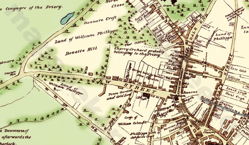
There was a stream just south of where Christchurch would be (at least I think that is where it is) . which seems to come out of the ground just south of New st Admittedly this was 1553 but it can be seen on the map
Mike

new_st_1553.jpg
 
Could that stream be the Bourne Brook? That made the pool at Water Street (near bottom of Constitution Hill), but probably went a little further.
 
When you look at different areas you lose track of the whole some times and this is possibly such a case. The map is super...way back before anything almost. If it is real then that pool seems to be a mill pool that may have fed the wheel. The thing is where did the water come from...everything seems downhill from there...but if you meander across towards Edgebaston Reservoir from there you will see from the elevations, registered on the bottom of GE as you go, that a stream could flow from that area and it is not far away from Ann Street. I seem to remember from a thread...'the mills of Birmingham'...as I recall, that the Manor House moat had some feed from a 'clearwater stream' that came from Edgebaston. So maybe it fed this pool and the manufactury wheel also and then on down to the hill at the top of New Street to the bottom of the Bull Ring and The Rea. If This is the case an interesting find Mike.
I am not familiar with the origins of Edgebaston Reservoir but there are a couple of brooks that originate from that area...Bourne Brook I think.

I had to go away from the computer whilst I was composing this note and Shotie posted the same idea.

Anyway, if that is a mill pool adjacent to what would become Colmore Row...well a new find perhaps. And it drove the Grind Stone in the picture.
 
...and hence I think we have found another representation of The Panorama. The map is really great, thanks Mike - so much has changed but the framework is all there 400 years ago.

Now need to find more information and any more pictures of The Panorama. Is anyone going to the Library soon that could do a look up? It would be good if an advertisement or flyer could be found for when it was in business.

The initial charges for the London Panoramas was 3/- which later came down to 1/- and I think this was a relatively very high amount for the average wages of the day. I am wondering if this is why The Panorama went under so quickly. I am sure they could have counted on the patronage of the residents of The Square and Temple Row areas as well as the surrounding great houses but would that have been enough?

Having said that not sure my assumption of the value stands up - https://www.nationalarchives.gov.uk/currency suggests 3/- in 1810 is equivalent to £5 today and would have been about 1/2 days work from a craftsman in the building trade. Seems cheap then in monetary terms but maybe still a bit steep for the average working man.
 
Personally I think that what you are looking at is more likely to be a view of a building on Waterloo Street with St Phillips dome/spire in the distance and the backs of a Row of buildings in between on Temple Row West. The mill pool indicated on Mikes map seems to be further along towards Newhall Street and located just north of Colmore Row. I wonder where Colmore Row ended and Ann Street began. Since there was not a row of anything along there at the time of the map maybe these names had not been alocated at that time and Phillips had not been sainted yet seemingly.

Anyway as a side issue to this thread I wonder what the pool was originally for...mill pond...water supply for the locals...drinking water for cattle. It would seem that the water came from the Edgebaston area and since there are other downhill routes from there some efforts must have been made...leats...to maintain the elevation to the pool location. I don't think a spring water supply would be there since this is the highest elevation around that location. Although the map that Mike posted has been on here prviously in the Mills Of Birmingham thread; I don't think that there has been any mention of a pool at Colmore Row before. The view through the doorway and the mention of water driven grindstone and the rudimentary spur gearing shown and indication of tailrace run off from the top of New Street all open up something new. There is more in these old drawings/paintings than just the subject matter.

If you read Pye's Travels...accounts of tourism in the early 1800s he mentions about the wonderfull white Theater Royal viewed from a distance...presumably from Phillips Square but I wonder how he could have seen this view without climbing up to the top of St Phillips....there are buildings in the way. I wonder if he was looking at the Lines painting to get the information to write this report.
 
Back
Top