• Welcome to this forum . We are a worldwide group with a common interest in Birmingham and its history. While here, please follow a few simple rules. We ask that you respect other members, thank those who have helped you and please keep your contributions on-topic with the thread.

    We do hope you enjoy your visit. BHF Admin Team

Kingston Row

Dennis Williams

Gone but not forgotten
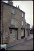
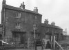
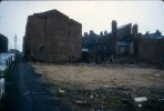
One more that I should imagine has been on before, but I can't find it. Kingston Row. Again Phyllis Nicklin was there first, and her colour shot shows the depredation effect quite starkly. No idea where it was, apart from the big clue in the photo legend, but I first dated my Mrs in the Kingston Cinema in 1958. What was on? Love Me Tender. The Plot? No idea...I was 17 for heaven's sake. Sounded OK though...when I came up for air. That will be snipped I know...but you get my drift dek?

Coordinates please someone? Mike? Put me out of my misery with a nice map? Big or small, suit yourself...


View attachment 81238 View attachment 81237
 

Attachments
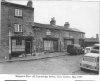
  • Kingston Row 1967.jpg
    Kingston Row 1967.jpg
    563.3 KB · Views: 1
  • Kingston Row P Nicklin.jpg
    Kingston Row P Nicklin.jpg
    225.1 KB · Views: 1
Last edited by a moderator:
Denis
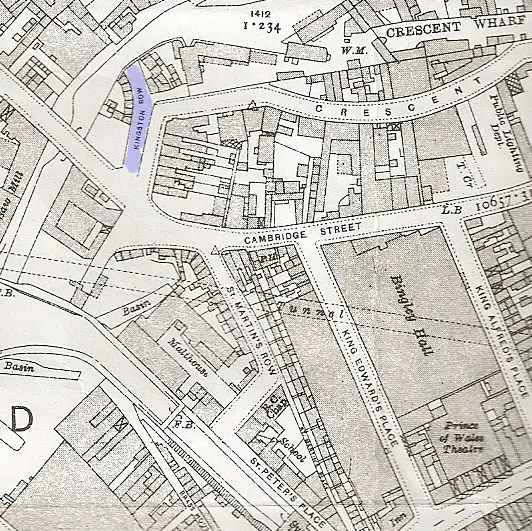
Below is a map showing kingston row behind Bingley Hall c 1914
Mike

map_c_1914_kingston_row.jpg
 
Mike isn't this Kingston Row that runs across the top of what is now called James Brindley Place but used to be the entrance to Falks Warehouses on the canal where the pub is now.

Phil

City Cambridge St Falk's Warehouses off Cambridge St 1958 (Flapper & Firkin).JPG
 
It seems to correspond to the road that runs off King Edwards Road parallel to the canal . It isn't named on the overheads google earth, but if you go to streetview at https://maps.google.co.uk/maps?f=q&...&spn=0.001336,0.003852&z=18&cbp=12,14.08,,0,5 then it is named as kingston row. Streetview doesn't go right down th eroad, but if you go to as far as you can towards the end, the road you are talking about is off to the right, but not clear if that part is called kingston row.
Mike
 
Mike

Yes its the same place, Kingston Row would have continued on past where the barrier is now and the downhill part of the road would have led to Falks's warehouses are in the photo in post #3. The area that is now the Flapper & Firkin public house.

Phil
 
Last edited by a moderator:
aa1.jpegaa2.jpegView attachment 79793 1959.-----View attachment 79794
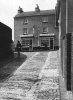
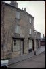
These old geogian cottages are/were close to Falk's Warehouse and these tow photo's show them as they were and how they were renovated with a cobbled road/pathway leading to the Longboat.
 
Last edited by a moderator:
Truly wonderful to see the restoration that has gone on Stitcher, it makes you wonder how many more old buildings could have survived had the will been there.
paul
 
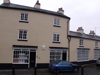
Curly / Sticher - I took a modern shot of the first building back in 2010

1-4 Kingston Row
 
Last edited by a moderator:
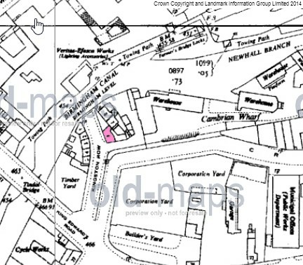
1-4 are and are listed buildings map c1955

map_c_1955_showing_6_Kingston_row.jpg
 
Last edited by a moderator:
The Birmingham Canal Navigations established canal carriers wharves alongside the Newhall Branch of their waterway in Birmingham. They started near junction with the Birmingham & Fazeley Canal and where until the 1840's Farmer's Bridge crossed the canal. They extended along the Newhall Branch on the offside to the towpath as far as the junction with the private Gibsons Arm. Whilst all traces of these warehouses were removed in the late 1960's, save a couple of cranes, left as a feature, the cobbled path down from Kingston Row remains. It is a rare survivor from the 1790's when these wharves were first established.Crescent1.jpg
 
Edited ...... even though it's hard to believe this photo only dates to 1958. The other thing I thought I should mention is that I have an idea that Kingston Row, (top of photo - edit) originally led down to Cambrian Wharf that was next to the Crescent Wharf.
City Cambridge St Falk's Warehouses off Cambridge St 1958 (Flapper & Firkin).JPG
 
Last edited by a moderator:
The 1889 map is a bit vague but almost seems to imply than Cambrian wharf was part of Crescent wharf. Tthe cobbled area is shown in red.
map c 1889 showing Kingston row.jpg
 
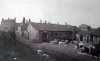
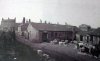
Post 13 shows a photo by Phyllis Nicklin of Kingston Row. Apparently she also took this one of the Row, though have not seen it before, perhaps because it is not a very informative photo .


Kingston row 1957. nicklinA.jpg
 
hi mike i have that photo labelled as kingston row edward st off king edwards road and its dated 1967 as opposed to the one you posted dated 1957...looking at the cars i would say 1967 is correct..

lyn
 
Back
Top