• Welcome to this forum . We are a worldwide group with a common interest in Birmingham and its history. While here, please follow a few simple rules. We ask that you respect other members, thank those who have helped you and please keep your contributions on-topic with the thread.

    We do hope you enjoy your visit. BHF Admin Team

Help With Map Please

Lady Penelope

master brummie
I have searched through all my maps but as usual I need the next one to the ones I have. Very frustrating!

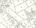
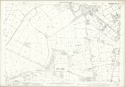
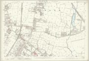
I have an 1883 map showing part of St Michael's Church in the top left hand side and would like to see the next section please showing the vicarage and glebe land. I searched through many faculties yesterday at The Library of Birmingham archives and thought I had the maps. Wrong again...

The other map I would like to see, if at all possible, is the 1889 one showing what is now Boldmere shopping centre. It shows the school at the bottom of the section I have and it's the next one showing the church that I need.

I'd be very grateful for any help anyone can give me.

Penny
 
I have searched through all my maps but as usual I need the next one to the ones I have. Very frustrating!

I have an 1883 map showing part of St Michael's Church in the top left hand side and would like to see the next section please showing the vicarage and glebe land. I searched through many faculties yesterday at The Library of Birmingham archives and thought I had the maps. Wrong again...

The other map I would like to see, if at all possible, is the 1889 one showing what is now Boldmere shopping centre. It shows the school at the bottom of the section I have and it's the next one showing the church that I need.

I'd be very grateful for any help anyone can give me.

Penny
hi pen hopefully someone can help and i have moved the thread to our maps section

lyn
 
Thank you very much Janice, very helpful. I always seem to want something on the crease when I'm looking at road maps too!

To mark the centenary of the church a booklet was produced and in it there is a paragraph on the lovely avenue of limes leading from Boldmere Road. It reads:

"When the churchyard was extended for the second time some seventy or so young trees were planted as a memorial avenue. After 20 years they are making good progress and in due course may be expected to rival the original avenue".

It's the original 'avenue' that I'm looking for but can't see it on the maps as yet, just a footpath.

Very confusing but I'll keep searching the maps.

Again, thank you.

Penny
 
It's always on the crease - or so it seems.
Glad to help.
Your comment refers to the church being extended a second time - when was that?
 
Back
Top