• Welcome to this forum . We are a worldwide group with a common interest in Birmingham and its history. While here, please follow a few simple rules. We ask that you respect other members, thank those who have helped you and please keep your contributions on-topic with the thread.

    We do hope you enjoy your visit. BHF Admin Team

Help with location please

Vhenn

proper brummie kid
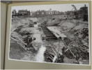
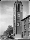
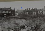
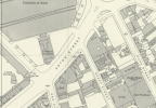
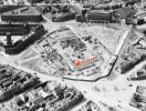
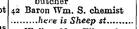
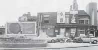
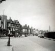
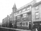
This is a photo that I found which is a view from Aston University when they were constructing the main building circa 1953. I think that Bishop Ryder church is in the background as it was still there until at least 1960. So I think that we are looking at Sheep Street next to the Tudor style Building and then Gem street further along. Does anyone know what the Tudor style building was and does it look as if I have the right location.

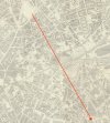
1793869906953.png1793869978328.png
 
Hi everyone

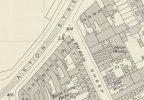
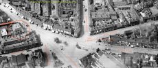
Thanks for all of your help today with all of the great maps and aerial views. It has really helped me to get a feeling of where Gem Street was in relation to the University. I agree that the Gas Holder is confusing and it is good to see the line of view on the map. I guess they were huge at the time. After over 20 years of my uncle doing research into Gem Street it was a great feeling yesterday to take him to Aston University and to walk over what had been the street of our relatives for over 60 years. Like many people we do not have photos. It was also lovely to see the Sack of Potatoes and he said that his dad may have had a drink there when he was living in Gem Street. We went to the archive department at the University which is where I saw the photos. They also showed me a Birmingham shield that had been on display on one of the Lawrence Street council houses. I will keep digging as I really want to keep the memory of the streets of Gosta Green alive for future generations.

Belinda
 
Hi Lyn

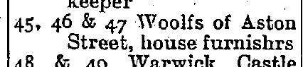
My Great, Great Grandad John Hyland appears to have started at 13 Gem Street in 1871. John died in 1913. They then moved to 26 and by 1921 they were at number 22 when Thomas his son was head of the house. I have a lovely oral history which explained that they moved up the road to newer council houses and ended up at 48 with other members of the family at 77 Ryder Street which was next door.They were the first family to have an indoor bathroom as Thomas converted part of a bedroom. Thomas ran a locksmith's business and had a separate workshop at that time at 25 Vauxhall Street which I think is on the corner. I think he also bought his sister Kate a shop at number 55 which she seems to have run until circa 1933. Thomas and his family then moved to Harborne but his sisters Kate Hyland and Mary Hare lived at 77 Ryder Street. I am not sure when they moved out but Kate died in 1955.

Thanks for your help.

Belinda

 
thanks for the info belinda..this map was posted on your other thread so i dont know if you have seen it yet...but if you move the blue dot to the left and keep your eye on the numbers you are interested in the map will fade out to show you what is on the ground now...i can see numbers 22.26 and 48 but no number 13 so maybe it was demolished...you can also move the map around the area i find it very useful

lyn

 
Back
Top