• Welcome to this forum . We are a worldwide group with a common interest in Birmingham and its history. While here, please follow a few simple rules. We ask that you respect other members, thank those who have helped you and please keep your contributions on-topic with the thread.

    We do hope you enjoy your visit. BHF Admin Team

Cole Bank Road (formerly Lane)

Vivienne14

Kentish Brummie Moderator
Staff member
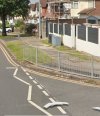
This view seems to be looking down Cole Bank Road across to Sarehole Mill. It was taken from the junction with Southam Road. An earlier Streetview shows the original wall on the right, which in the B&W photo, was topped with a privit hedge, recently it's had a fence erected on top. Also the tall pillars to the tall gate on the right are still there.


Screenshot_20250601_081650_Chrome.jpg
Screenshot_20250606_085420_Maps.jpg
 

Attachments

  • Screenshot_20250606_085628_Maps.jpg
    Screenshot_20250606_085628_Maps.jpg
    139.3 KB · Views: 10
Last edited:
At the bottom of Cole Bank Road, on the left, was a number 11 bus stop where I waited many times between 1956 and 1961 to go to the new Camp Hill Grammar School at King's Heath. Tony Hancock lived for a very short time in Southam Road before the family moved to Bournemouth.
 
Post 3, before the Outer Circle bus route 11 started in 1926, which shows what was probably a recently widened road.
 
Ref Post #3 : The same section of Cole Bank Lane/Road before it was widened .... showing the old bridge over the River Cole, and Sarehole Mill in the background.

Hall Green Cole Bank Road Sarehole Mill 1.jpg
 
Back
Top