• Welcome to this forum . We are a worldwide group with a common interest in Birmingham and its history. While here, please follow a few simple rules. We ask that you respect other members, thank those who have helped you and please keep your contributions on-topic with the thread.

    We do hope you enjoy your visit. BHF Admin Team

Canals of Birmingham

  • Thread starter Thread starter O.C.
  • Start date Start date
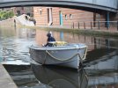
I have yet to see a Go Boat at Brindley Place and wonder how many of the craft exist and where they are kept.

There are certain rules for navigating the canals and I also wonder what instructions are given to those that spend £95 for the hour trip.

Being electric there is the advantage of an environmentally friendly form of power, but what happens if they collide with another craft and mooring up to get on or get off may be more complicated than the website suggests
One would assume that they are meant to be a stay aboard for the hour experience' do not go through locks and we will moor you when you return. Remember when going on a narrow boat holiday, for the first time. The induction is at least half an hour and even on your second or third visit the induction is quite lengthy as the user has to sign to say that an usage induction and canal etiquette and h & s has been covered'
Bob
If you delve into the website they state there is a fine of £30 for anyone leaving the boat during a trip (though not clear if this is legally enforcable).
With regard to alcohol:
We allow alcohol on our boats, but in order to ensure a safe experience we limit the amount of alcohol taken onto the boat. Our limits are:
Either; two bottles/cans per person of standard strength beer, lager, or pre-mixed spirits
Or, one 750 ml bottle of wine/champagne/prosecco between every two people
Strictly no straight spirits allowed
The Captain (driver) shall not consume alcohol during the journey

To be honest. I wonder if they have actually yet provided any trips. Sounds a bit expensive for a short trip.
 
I have yet to see a Go Boat at Brindley Place and wonder how many of the craft exist and where they are kept.

There are certain rules for navigating the canals and I also wonder what instructions are given to those that spend £95 for the hour trip.

Being electric there is the advantage of an environmentally friendly form of power, but what happens if they collide with another craft and mooring up to get on or get off may be more complicated than the website suggests
good point Hearland. the owner of the craft must have insurance to put the craft on the water,wonder if that covers any driver/sailor.
 
I remember the oil tankers coming up the Severn. They had old Galleons sunk into the banks around Kempsey to stop the bank eroding with the wash caused by these tankers.
I can vividly remember going fishing on the Severn for the first time and hearing the throbbing of a large engine and seeing everyone grabbing their gear and scrambling up the bank. Those tankers were really low in the water and the wash came several feet up the bank leaving a soggy mess.
 
One would assume that they are meant to be a stay aboard for the hour experience' do not go through locks and we will moor you when you return. Remember when going on a narrow boat holiday, for the first time. The induction is at least half an hour and even on your second or third visit the induction is quite lengthy as the user has to sign to say that an usage induction and canal etiquette and h & s has been covered'
Bob
I spent a week on the Norfolk Broads and the induction was quite lengthy!
 
Is it Tunstall or Dunstall, a puzzle close to the Birmingham Canal Network and on the Staffs and Worcs Canal.

Over the years I have passed under what I believe to be the Dunstall Water Bridge on a number of occasions. It carries Smestow Brook over the canal and is close to Aldersley Junction, where the Birmingham Main Line Canal meets the Staffs and Worcs Canal.

I was watching a video of a walk along the Staffs and Worcs that passed under this Bridge and it was given the title Tunstall Water Bridge. After rewinding you could see a plaque on the northern side of the Bridge indicating Tunstall, but nothing on the southern side. I have a picture of both sides of the Bridge from 2010 but the plaque is not readable, but on the southern side it is marked Dunstall on the left hand side. Searching the net for pictures there are several with Dunstall on the southern side.

I believe Tunstall is a mistake perpetuated by the makers of the plague. My reasons are as follows. In 1880 the Council were discussing the closure of the Dunstall Lane footpath, and there is a mention…"The bridle road, which led through the Dunstall Estate to the Water Bridge, was a very dirty and uncomfortable road for either walking or driving…” On the OS Map of the 1880s the bridge is marked as Dunstall Water Bridge, and is also named as such in the Bradshaw Guide of 1904. Even the more modern Nicholson Guide names it as Dunstall. It is also a Grade II listed structure under Dunstall.

Taken up with the Canal and River Trust.

C05354D6-54EE-4788-9CB1-7290B333DBCF.jpeg
 
Last edited:
Is it Tunstall or Dunstall, a puzzle close to the Birmingham Canal Network and on the Staffs and Worcs Canal.

Over the years I have passed under what I believe to be the Dunstall Water Bridge on a number of occasions. It carries Smestow Brook over the canal and is close to Aldersley Junction, where the Birmingham Main Line Canal meets the Staffs and Worcs Canal.

I was watching a video of a walk along the Staffs and Worcs that passed under this Bridge and it was given the title Tunstall Water Bridge. After rewinding you could see a plaque on the northern side of the Bridge indicating Tunstall, but nothing on the southern side. I have a picture of both sides of the Bridge from 2010 but the plaque is not readable, but on the southern side it is marked Dunstall on the left hand side. Searching the net for pictures there are several with Dunstall on the southern side.

I believe Tunstall is a mistake perpetuated by the makers of the plague. My reasons are as follows. In 1880 the Council were discussing the closure of the Dunstall Lane footpath, and there is a mention…"The bridle road, which led through the Dunstall Estate to the Water Bridge, was a very dirty and uncomfortable road for either walking or driving…” On the OS Map of the 1880s the bridge is marked as Dunstall Water Bridge, and is also named as such in the Bradshaw Guide of 1904. Even the more modern Nicholson Guide names it as Dunstall. It is also a Grade II listed structure under Dunstall.

Taken up with the Canal and River Trust.

View attachment 172143
I‘ve had a reply from the Canal and River Trust saying that they realize there has been a name change, and they are looking into the archives to check when and who changed it !
 
Even the late Ian Langford had difficulty in deciding whether it was Dunstall or Tunstall. In his book on the Staffordshire & Worcestershire Canal he calls the bridge 63 as Dunstall as the area is known as Dunstall, but admits even the First Ordnance survey records the bridge as Tunstall and the sign on the bridge was spelt as Tunstall and so as the name has persisted for some time as Tunstall that seems now to be the better spelling.

Now with Steward Aqueduct at Spon Lane on the Birmingham Canal, the name has become Stewart in some texts and publications. It was named after a committee member Samuel Steward.
 
“the sign on the bridge was spelt as Tunstall.”

The plaque says Tunstall, but the sign on the southern side has for many years read Dunstall Water Bridge. There are numerous references to Dunstall, so it would be better for the Canal and River Trust to decide which is better.
 
“…but admits even the First Ordnance survey records the bridge as Tunstall…”

The OS 6in Map published in 1886 says Aquaduct and the 1903, 1920 and 1945 say Dunstall Water Bridge.

The OS 25in for 1902 and 1919 both say Dunstall Water Bridge.

The Smestow crossed the Canal on the way to Dunstall Mill and Dunstall Hall. In 1932 the Wolverhampton Borough Council had a scheme to prevent flooding of Smestow Brook at Dunstall.
 
Interestingly there is a parish in Kent called Tunstall. In 1798 it was said that it was called Dunstall by the common people..... indeed this seems to have been its original name... a mistake of the Norman scribes who frequently mistook the pronunciation of their Saxon informers.
 
Even the late Ian Langford had difficulty in deciding whether it was Dunstall or Tunstall. In his book on the Staffordshire & Worcestershire Canal he calls the bridge 63 as Dunstall as the area is known as Dunstall, but admits even the First Ordnance survey records the bridge as Tunstall and the sign on the bridge was spelt as Tunstall and so as the name has persisted for some time as Tunstall that seems now to be the better spelling.

Now with Steward Aqueduct at Spon Lane on the Birmingham Canal, the name has become Stewart in some texts and publications. It was named after a committee member Samuel Steward.


Although the area is Dunstall, the plate on [Bridge] No.63 is inscribed ‘Tunstall Water Bridge’. It is tempting to blame the error on an apprentice pattern maker, but ‘Tunstall’ appears on the 1st edition Ordnance Survey of 1834’ (1974, J. Ian Langford, Towing Path Guide No.1: Staffordshire and Worcestershire Canal).
 
The Canal and River Trust are of the opion that either Tunstall or Dunstall would be correct. They suspect that the ‘T’ spelling has not been changed from the plate to plate. The reference by Ian Langford from his book of 1974 is highlighted, and they presume the 1834 OS Map used an old spelling. They add that in Medieval English, ‘Tun’ means a settlement or farm, and ‘stall’ means much the same thing but possibly refers to an even earlier settlement (Roman?). Tunstall, or Tunsteall often became Dunstall.

Sheet 62 of the 1834 OS Map does not name the aqueduct, but it does name Tunstall (Dunstall) Hall and Tunstall (Dunstall) Mill. They acknowledge that in the late Victorian times the old spelling (Tunstall) had been overridden, but the bridge may have retained the old name. The name is unlikely to be changed, but if some Georgian Deed or Brindley 1760 plan was unearthed then…

The question now is whether Dunstall was ever called Tunstall.

It is interesting to note that the British History Online, when referring to Tunstall in Kent, highlight a quote from 1798 which is just the opposite…

“It is usually called by the common people Dunstall, a name by which it is not unfrequently described in antient deeds and writings, and which seems very expressive of its situation, dun, or dune, in the Saxon language signifying a hill, and Stealle, a place. Indeed this seems to have been its original name, and the former, by which it is described in Domesday, a mistake of the Norman scribes, who frequently, and perhaps for the purpose, mistook the pronunciation of their Saxon informers…

The 1834 map also refers to Authersley Junction, which seems for many years was the junction of the BCN and the Staffs and Worcs Canals. From 1805 Autherley Junction was being referred to as the starting point of the new Birmingham to Liverpool Canal. By 1845 the junction is referred to as Autherley otherwise Aldersley, and by 1855 had become Aldersley Junction.

A few other points to note. If you wish to consult the tithe map of 1839 it refers to Dunstall in the parish of Tettenhall. There is also reference Dunstall in connection with Tettenhall inclosures in 1814. Henry Hordern was residing at Dunstall Hall in 1828.
 
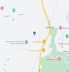
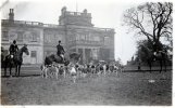
Dunstall was by tunstall near burton on Trent. The picture are the old house which is now a golf club.
 

Attachments

  • 53BEA129-55F2-4398-A410-5B7FDE196C21.jpeg
    53BEA129-55F2-4398-A410-5B7FDE196C21.jpeg
    105.5 KB · Views: 10
  • 400C6A6D-E7C1-4CC2-A1ED-90A9B39793EF.jpeg
    400C6A6D-E7C1-4CC2-A1ED-90A9B39793EF.jpeg
    12.4 KB · Views: 10
  • E6A33392-5023-4239-B931-619EAF3BCB75.jpeg
    E6A33392-5023-4239-B931-619EAF3BCB75.jpeg
    20.9 KB · Views: 10
The Dunstall Hall indicated on the 1834 OS Map had a moat around the Hall.
 

Attachments

  • D9061596-621A-4E42-A4F1-614D3149CFFF.jpeg
    D9061596-621A-4E42-A4F1-614D3149CFFF.jpeg
    633.9 KB · Views: 3
This was the dunstall hall you are talking . I just found it strange to have 2 dunstall halls in staffordshire. And 2 tunstalls and dunstall show wired.
 

Attachments

  • 5191ACD6-4A60-4358-B901-9AC0B55FDF89.jpeg
    5191ACD6-4A60-4358-B901-9AC0B55FDF89.jpeg
    66.1 KB · Views: 4
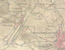
It is also labeled Tunstall in the original Ordnance survey drawings in the British Library from 1816

View attachment 172345
If this map is 1816 then it seems in advance of the 1834 Map quoted by Ian Langford in his 1974 book. But anyway it gives better definition around Tettenhall.

As Dunstall is mentioned in the 1814 inclosures of Tettenhall I decided an approach from the Tettenhall angle and came across the William Salt Library who have documents they have transcribed from the reign of Henry III.

Page 144….In a certain Hamlet of the said Manor, which is called Tunstall (Dunstall ?), is a certain free man who holds half a virgate of land, and 24 acres of meadow at 5^. for all services except suit of Court and tallage.

Later there is what I believe to be a reference to the other Tunstall near Branson and Burton on Trent. This is also marked Tunstall (Dunstall?).

It appears that the transcribers from 1911 had difficulty differentiating D and T !

[Details sent to Canal and River Trust.]
 
Last edited:
Back
Top